Road Stream Crossing Site CRW_029
Cedar River Watershed, Middle Branch Cedar River
Cranberry Lake Rd
Hamilton Twp,
Clare County
Information collected by:
Site Location
GPS Coordinates: 44.046483
, -84.635883
T19N
R3W
Sec 11
Owned by Private
Fish Passability 0.5
Structure is NOT Perched
Total Erosion: 3.7382 tons/year
Severity: Severe
Year Inventoried: 2018
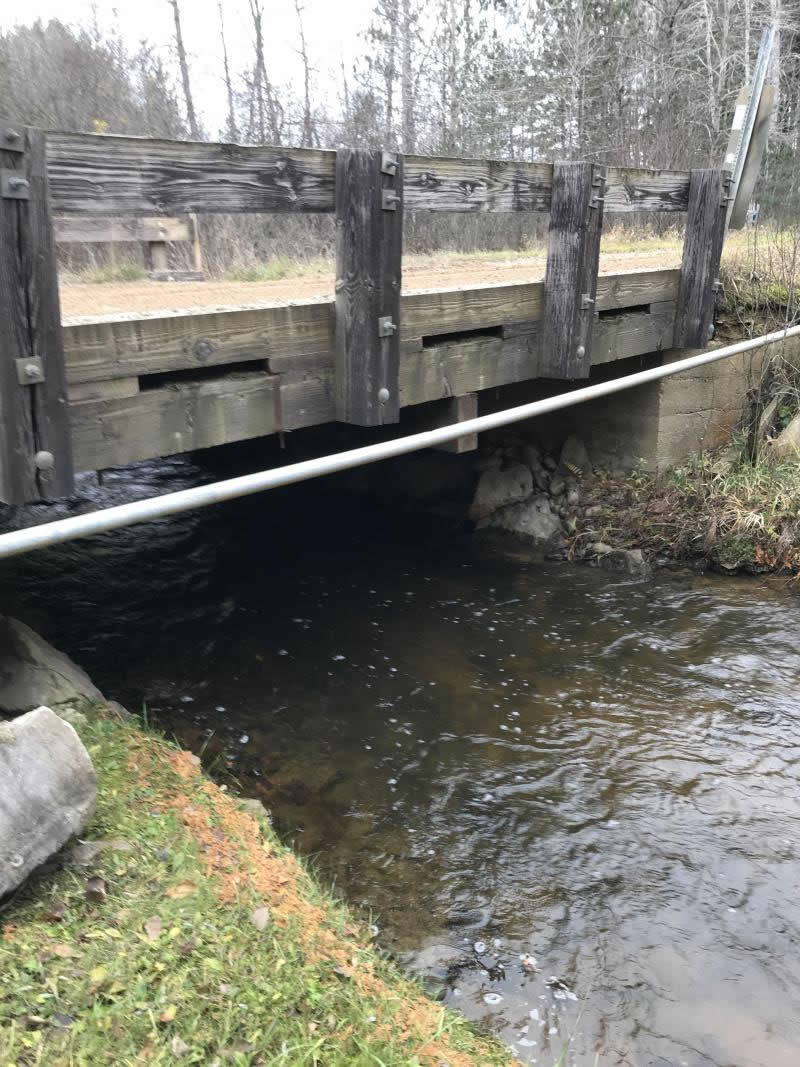
Inlet
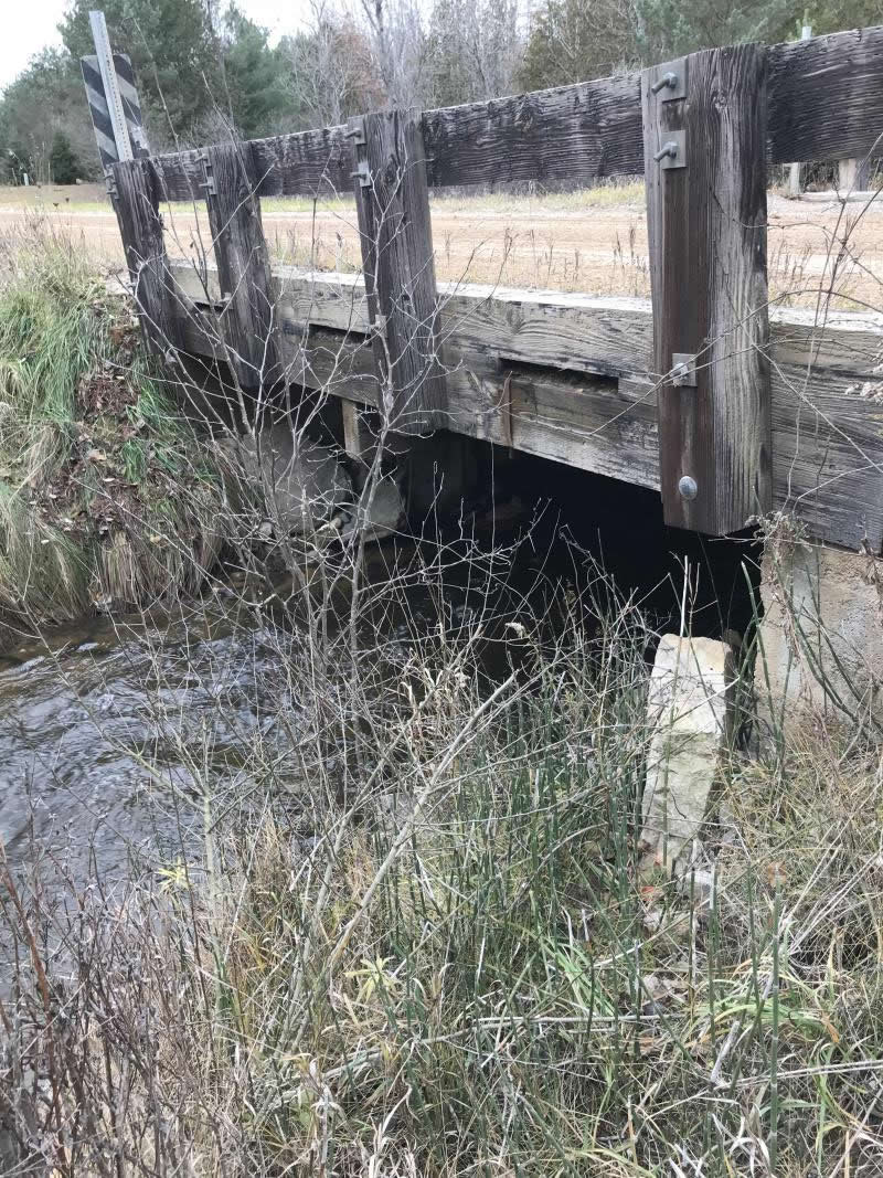
Outlet
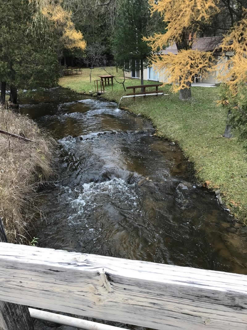
Upstream Conditions
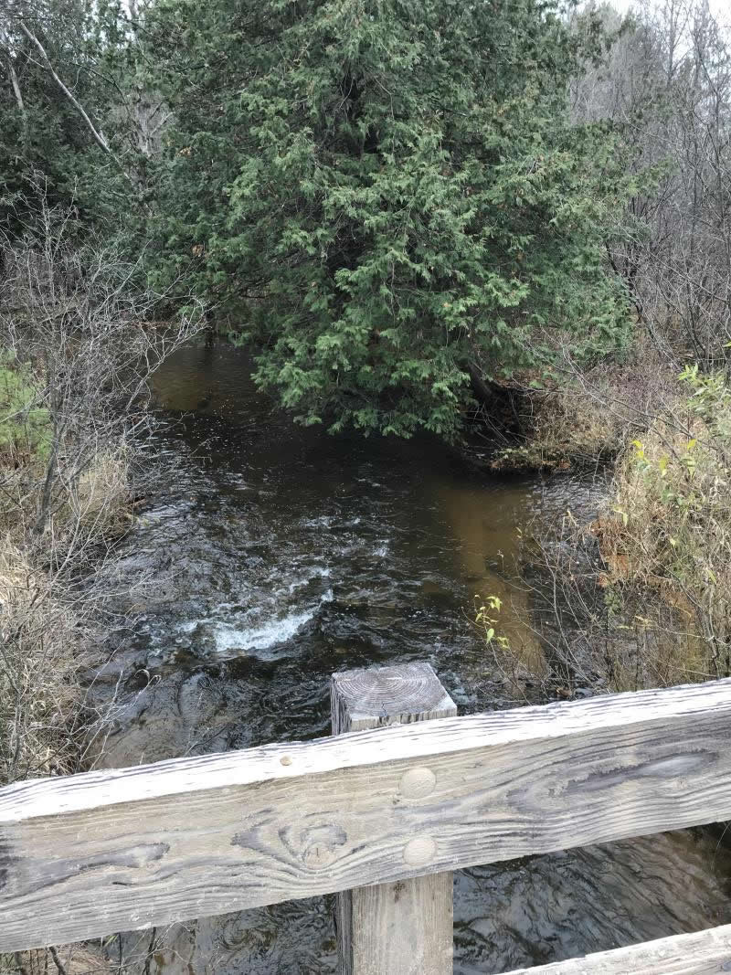
Downstream Conditions
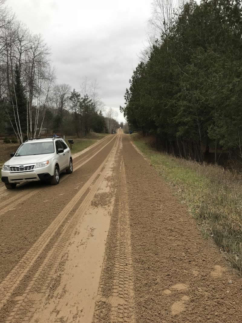
Road Approach - Left
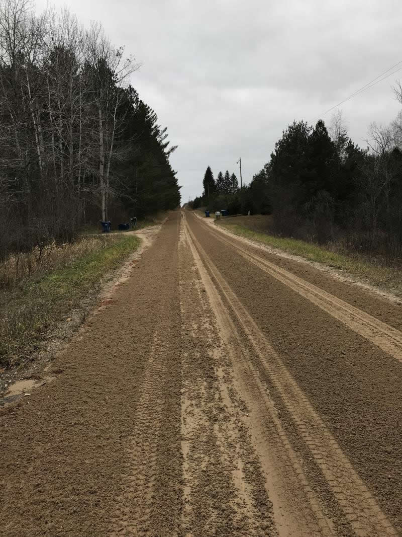
Road Approach - Right
Crossing Information
Type of Crossing: Bridge
Structure Shape: Open Bottom Square/Rectangle
Inlet Type: Wingwall 10-30 Degree
Outlet Type: At Stream Grade
Structure Material: Wood
Structure Substrate: Gravel
General Conditions: Good
Structure Interior: smooth
Dimensions of Structure: Length 22 ft.
, Width 10 ft.
, Height 5 ft.
Percentage Plugged:
Inlet: 0%
Outlet: 0%
In Pipe: 0%
Percentage Crushed:
Inlet: 0%
Outlet: 0%
In Pipe: 0%
Structure is NOT Perched
Structure Inlet
Water Depth: 1.3 ft.
Embedded Depth of Structure: 0 ft.
Water Velocity*: 1.3 ft./sec.
Structure Outlet
Water Depth: 1 ft.
Embedded Depth of Structure: 0 ft.
Water Velocity*: 3 ft./sec.
*Water Velocities were measured 0.5 ft. below Surface
(with Meter)
Additional Comments
Lat:44-02.789' Long: 84-38.153' Landowner: Henry Reimer
Stream Information
Stream Flow: Less than 1/2 Bankfull
Scour Pool: Length 0 ft.
, Width 0 ft.
, Depth 0 ft.
Upstream Pond: Length 0 ft.
, Width 0 ft.
, Depth 0 ft.
Riffle Information
Water Depth: 1 ft.
Bankfull Width: 12 ft.
Wetted Width: 7 ft.
Water Velocity: 3 ft./sec.
(Measured with Meter)
Dominant Substrate: Gravel
Road Information
Gravel
County Road
Road Condition: Good
Road Width at Culvert: 22 ft.
Location of Low Point: At Stream
Runoff Path: Roadway
Embankments
Upstream
Fill Depth: 1.5 ft.
Slope: 1:2
Downstream
Fill Depth: 1.5 ft.
Slope: 1:2
Approaches
Left Approach
Length: 360 ft.
Slope: 1% to 5%
Vegetation: Partial
LS Factor: 0.58
Erosion: 1.2655 tons/year
Right Approach
Length: 600 ft.
Slope: 1% to 5%
Vegetation: Partial
LS Factor: 0.68
Erosion: 2.4727 tons/year
Erosion Information
Total Erosion at Crossing: 3.7382 tons/year
Extent of Erosion: Minor
Notes: Photo #7 Runoff is being filtered before reaching River
Location of Erosion | Erosion Dimensions | Eroded Material | Material Eroded | Total Erosion | ||
facing downstream | Length | Width | Depth | Reaching Stream? | (tons/year) | |
Right Downtream Ditch |
50 ft. |
2 ft. |
0.1 ft. |
yes |
Gravel |
0.005 |
Left Downstream Ditch |
50 ft. |
2 ft. |
2 ft. |
no |
||
Right Upstream Ditch |
50 ft. |
2 ft. |
2 ft. |
no |
||
Left Upstream Ditch |
50 ft. |
2 ft. |
2 ft. |
no |
||
Summary Information
Fish Passability 0.5
Fish Passage is an area of concern for this site.
Possible Fish Passage River narrows from 13' to 7' as it goes through bridge
�