Road Stream Crossing Site LMN001
Frontal Lake Michigan Watershed, Little Sucker Creek
Sturgeon Bay Road
Bliss Twp,
Emmet County
Information collected by:
Site Location
GPS Coordinates: 45.74295
, -84.95302
T39N
R5W
Sec 29
Owned by State
Structure is NOT Perched
Total Erosion: 0.3649 tons/year
Severity: Minor
Year Inventoried: 2018
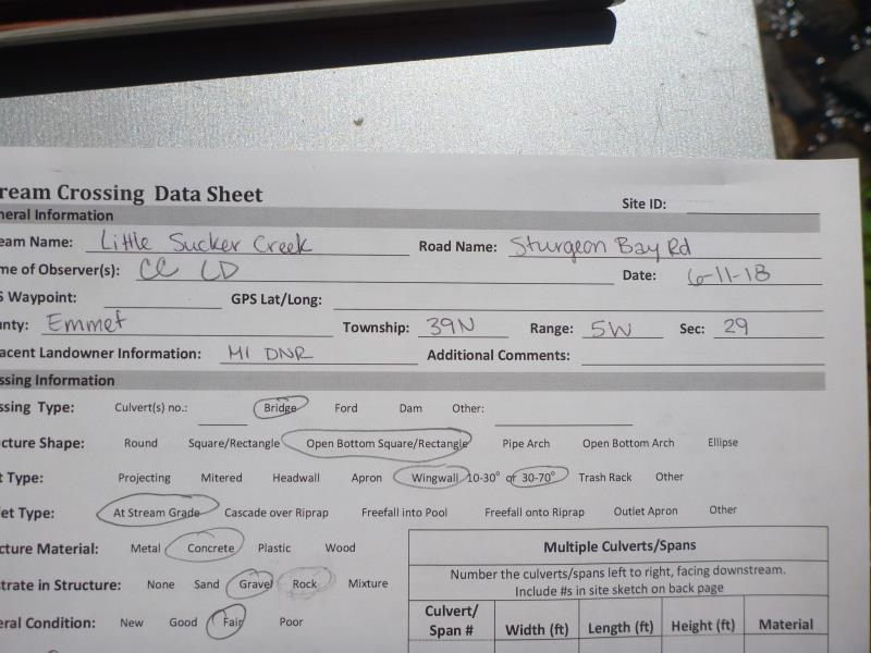
Site ID
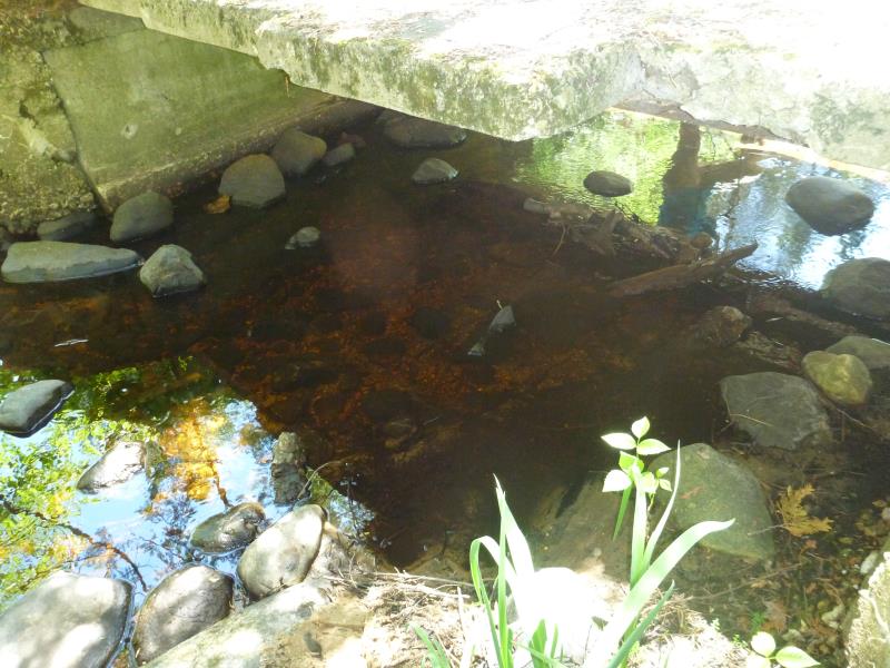
Inlet
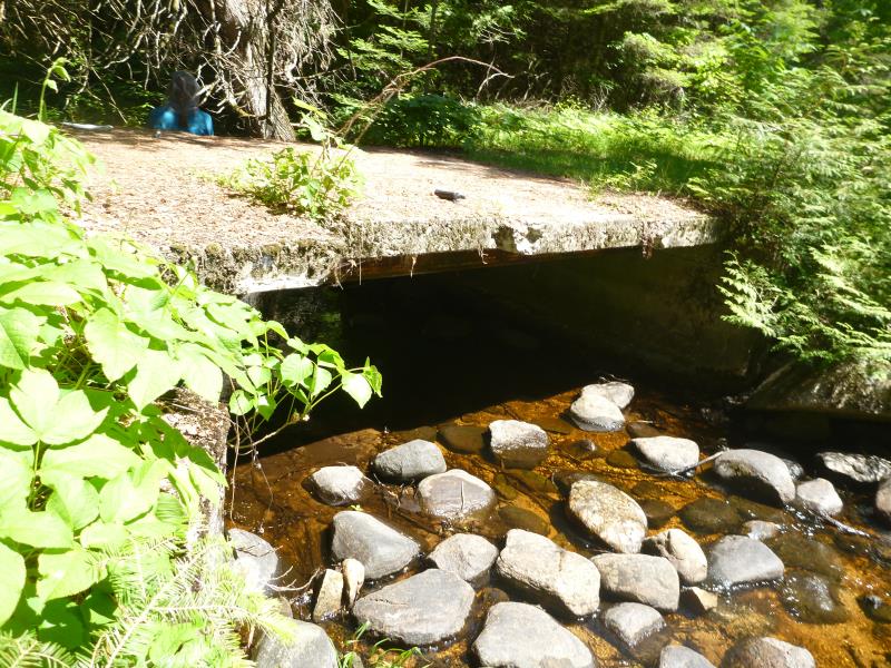
Outlet
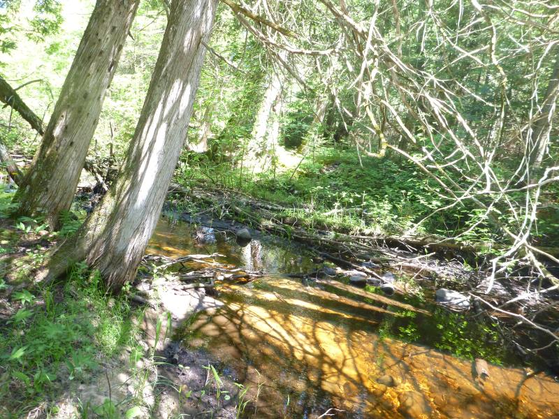
Upstream Conditions
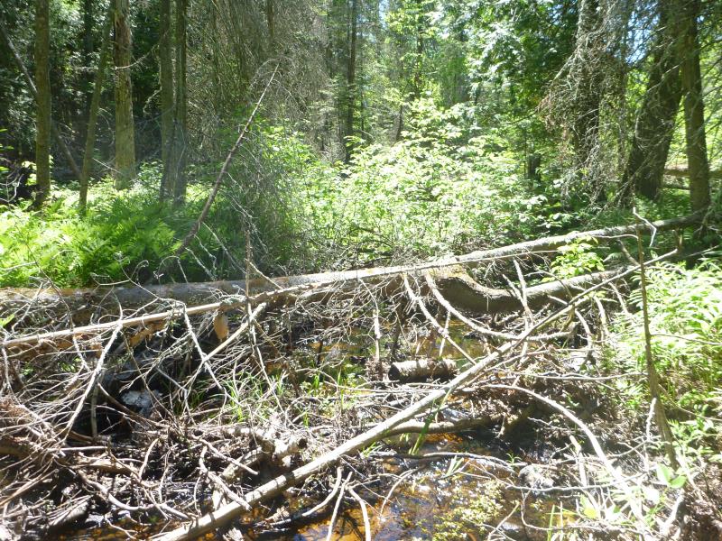
Downstream Conditions
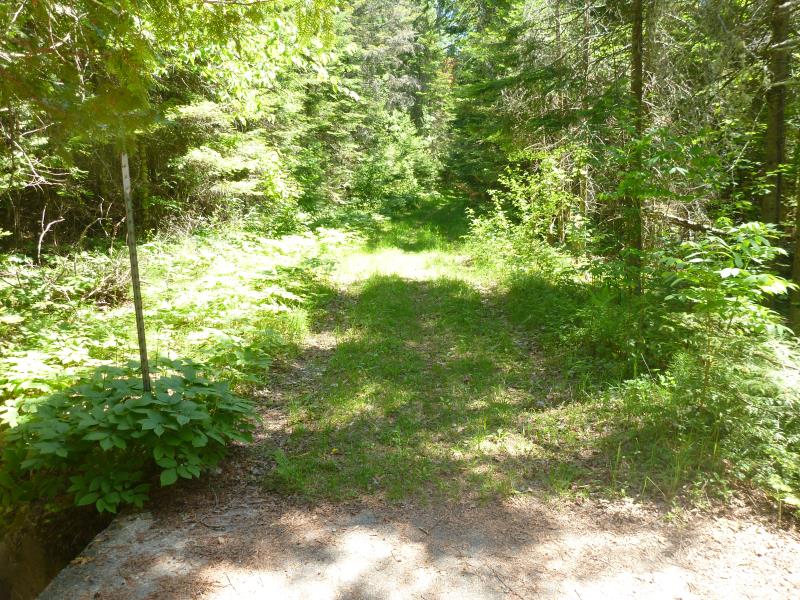
Road Approach - Left
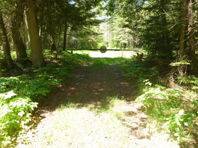
Road Approach - Right
Crossing Information
Type of Crossing: Bridge
Structure Shape: Open Bottom Square/Rectangle
Inlet Type: Wingwall 30-70 Degree
Outlet Type: At Stream Grade
Structure Material: Concrete
Structure Substrate: Gravel
General Conditions: Fair
Structure Interior: smooth
Dimensions of Structure: Length 12.25 ft.
, Width 10.33 ft.
, Height 3.6 ft.
Structure is NOT Perched
Structure Inlet
Water Depth: 0.5 ft.
Water Velocity*: 0.4609 ft./sec.
Structure Outlet
Water Depth: 0.5 ft.
Water Velocity*: 0.1238 ft./sec.
*Water Velocities were measured 0.25 ft. below Surface
(with Meter)
Stream Information
Stream Flow: Bankfull
Road Information
Native Surface
State Road
(Seasonal)
Road Condition: Good
Road Width at Culvert: 10.33 ft.
Location of Low Point: At Stream
Runoff Path: Roadway
Approaches
Left Approach
Length: 110 ft.
Slope: 1% to 5%
Vegetation: Heavy
LS Factor: 0.384
Erosion: 0.1202 tons/year
Right Approach
Length: 200 ft.
Slope: 1% to 5%
Vegetation: Heavy
LS Factor: 0.43
Erosion: 0.2447 tons/year
Erosion Information
Total Erosion at Crossing: 0.3649 tons/year
Summary Information
�