Road Stream Crossing Site LMN004
Frontal Lake Michigan Watershed, Wycamp Creek
Lake Shore Drive
Cross Village Twp,
Emmet County
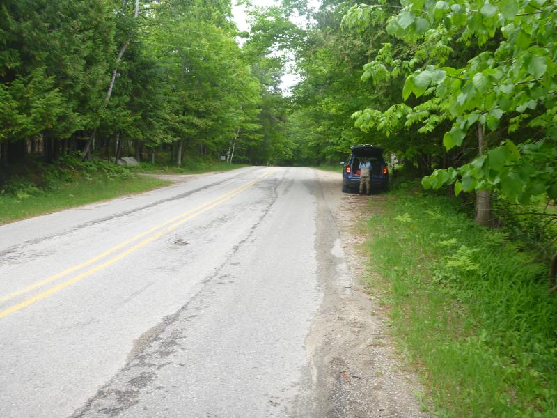
Information collected by:
Site Location
GPS Coordinates: 45.65102
, -85.01353
T38N
R6W
Sec 35
Owned by Private
Structure is NOT Perched
Total Erosion: 10.6758 tons/year
Severity: Severe
Year Inventoried: 2018
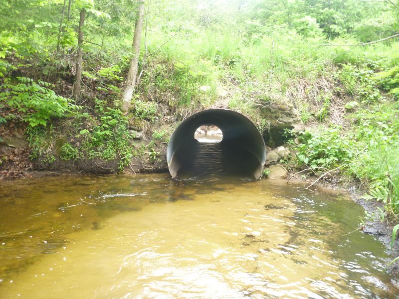
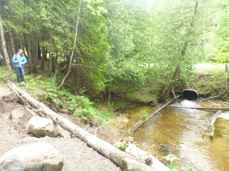
Inlet
Inlet
Inlet
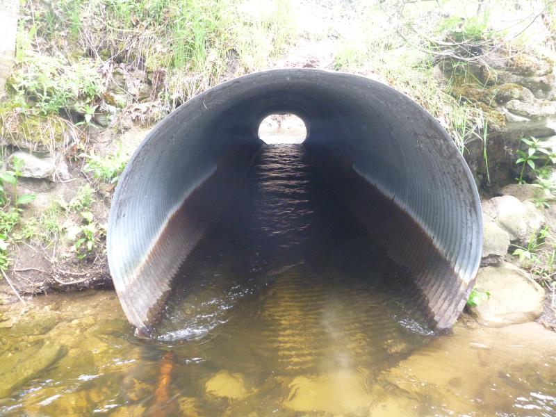
Outlet
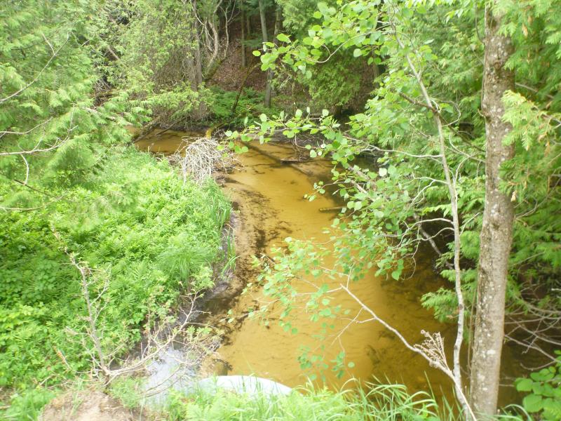
Upstream Conditions
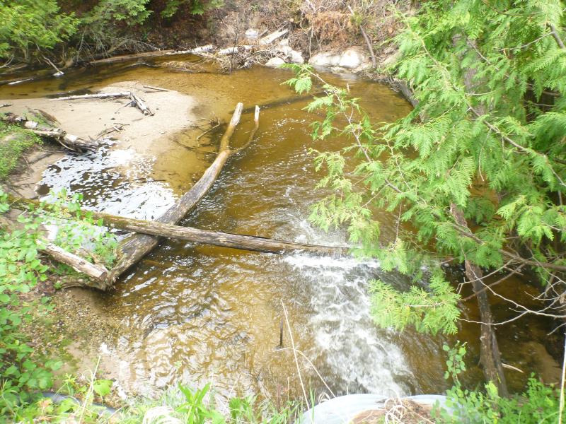
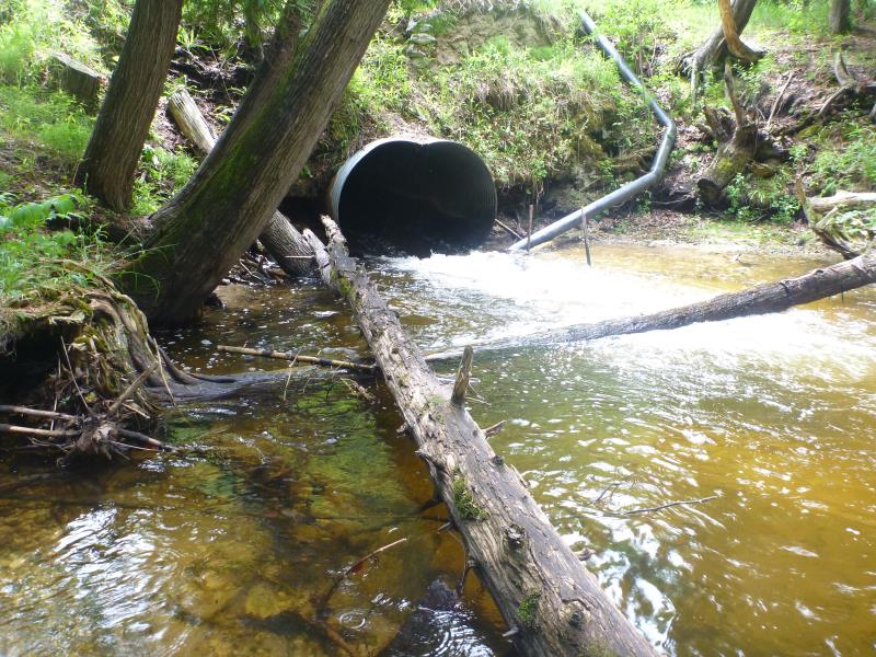
Downstream Conditions
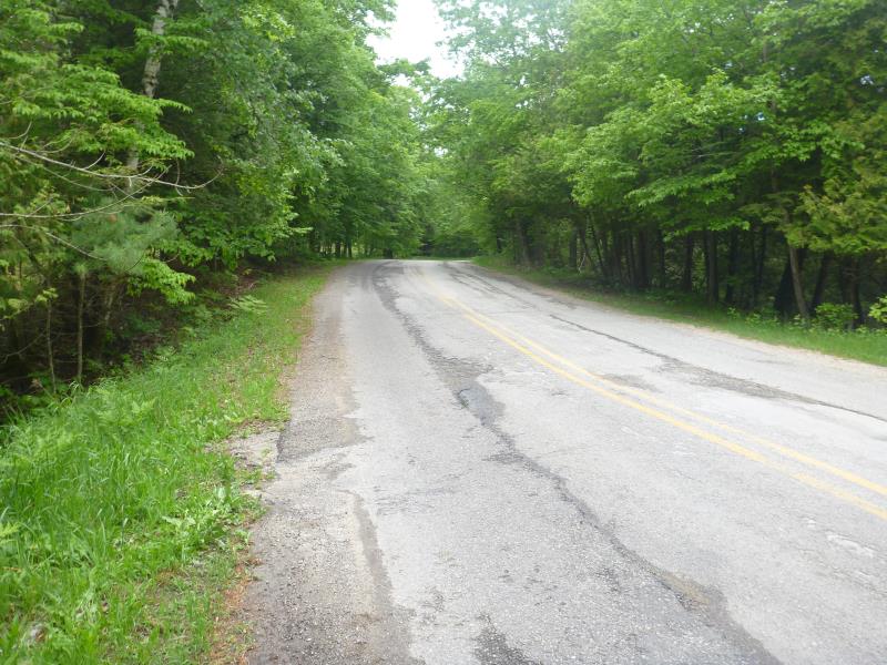
Road Approach - Left
Road Approach - Right
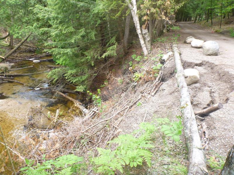
Erosion
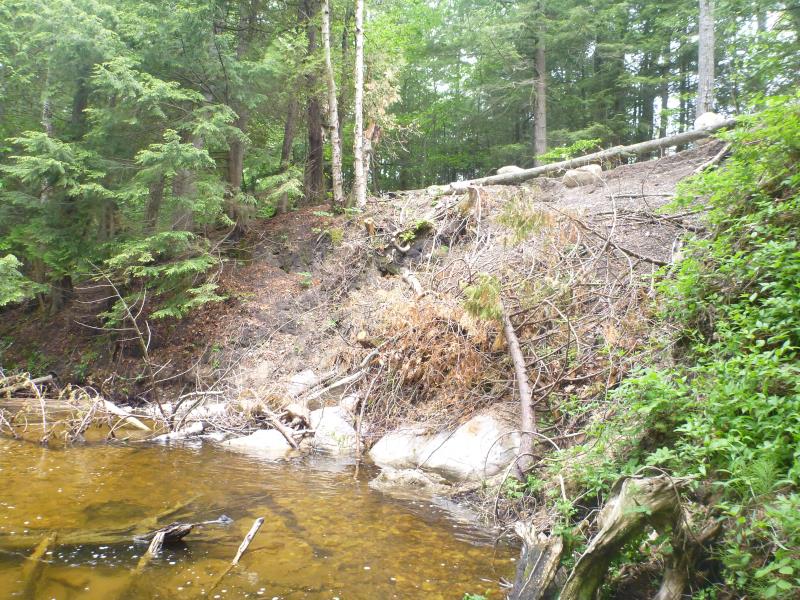
Erosion
Erosion
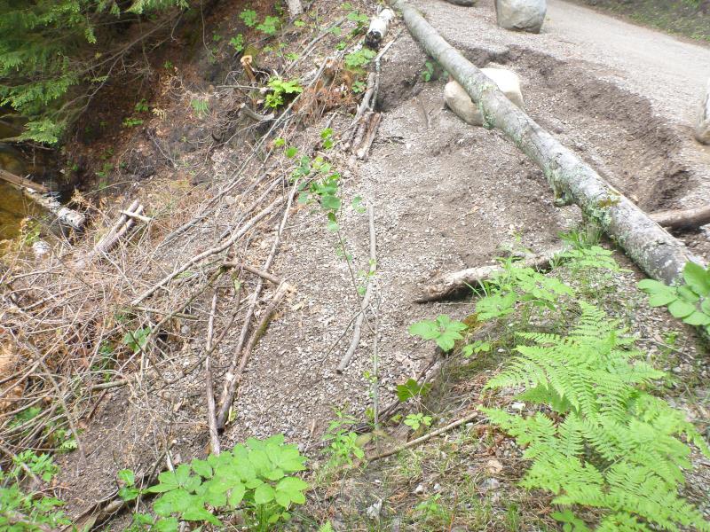
Erosion
Crossing Information
Type of Crossing: culvert(s)
Number of Structures: 1
Structure Shape: Round
Inlet Type: Projecting
Outlet Type: At Stream Grade
Structure Material: Metal
Structure Substrate: None
General Conditions: Fair
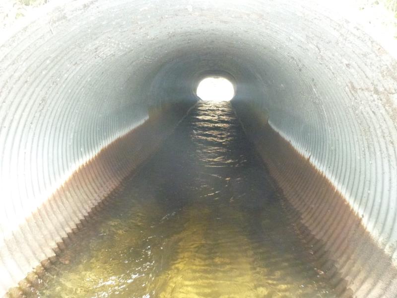
Structure Interior: corrugated
Dimensions of Structure: Length 60 ft.
, Width 5 ft.
, Height 5 ft.
Percentage Crushed:
Outlet: 1% to 25%
Structure is NOT Perched
Structure Inlet
Water Depth: 2.4 ft.
Embedded Depth of Structure: 0 ft.
Water Velocity*: 1.344 ft./sec.
Structure Outlet
Water Depth: 0.4 ft.
Embedded Depth of Structure: 0 ft.
Water Velocity*: 6.5729 ft./sec.
*Water Velocities were measured 0.7 ft. below Surface
(with Meter)
Additional Comments
Perched 0.5 ft but not technically perched at high flow, culvert tips down at outlet, Perched at low flow
Stream Information
Stream Flow: Less than Bankfull
Scour Pool: Length 35 ft.
, Width 19 ft.
, Depth 3.8 ft.
Road Information
Paved
County Road
Road Condition: Good
Road Width at Culvert: 24 ft.
Location of Low Point: At Stream
Runoff Path: Roadway
Embankments
Upstream
Fill Depth: 7 ft.
Slope: 1:2
Downstream
Fill Depth: 10 ft.
Slope: Vertical
Approaches
Left Approach
Length: 150 ft.
Slope: 1% to 5%
Vegetation: Heavy
LS Factor: 0.4
Erosion: 0.0476 tons/year
Right Approach
Length: 200 ft.
Slope: 1% to 5%
Vegetation: Heavy
LS Factor: 0.43
Erosion: 0.0682 tons/year
Erosion Information
Total Erosion at Crossing: 10.6758 tons/year
Extent of Erosion: Severe
Notes: Eroding at culvert
Location of Erosion | Erosion Dimensions | Eroded Material | Material Eroded | Total Erosion | ||
facing downstream | Length | Width | Depth | Reaching Stream? | (tons/year) | |
Right Downstream Streambank |
32 ft. |
34 ft. |
15 ft. |
yes |
Sand |
10.56 |
Summary Information
Erosion is an area of concern for this site.
Yes, major erosion that is eroding away the stream bank and a driveway.
A future visit to this site is recommended. Eroding out the road on the outlet
�