Road Stream Crossing Site LM006
Manistee River Watershed, Little Manistee River Tributary
Hawkins Rd
Ellsworth Twp,
Lake County
Information collected by:
Site Location
GPS Coordinates: 44.024992
, -85.602634
T19N
R11W
Sec 22
Owned by Private
Fish Passability 0.5
Structure is NOT Perched
Total Erosion: 2.4938 tons/year
Severity: Moderate
Year Inventoried: 2019
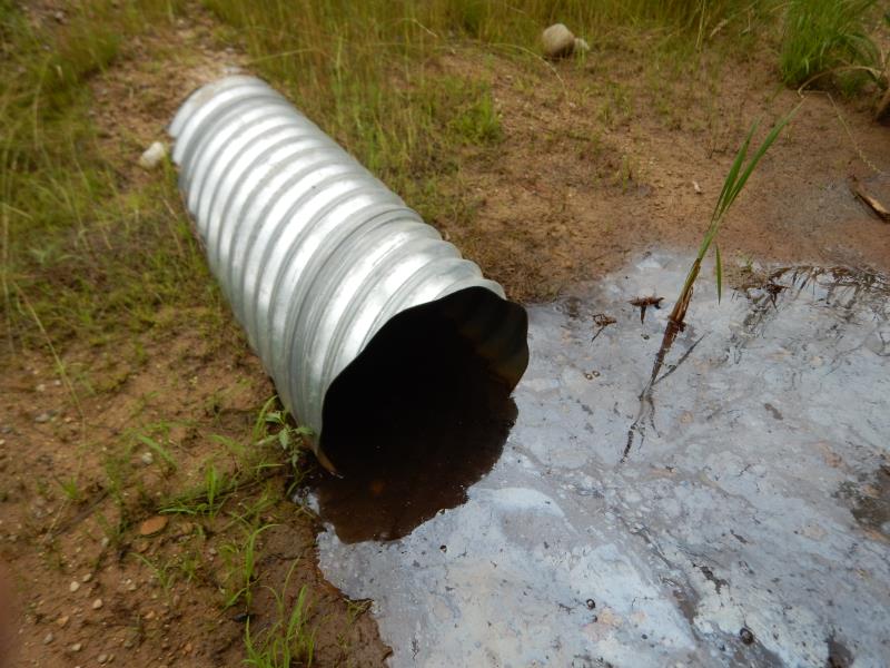
Inlet
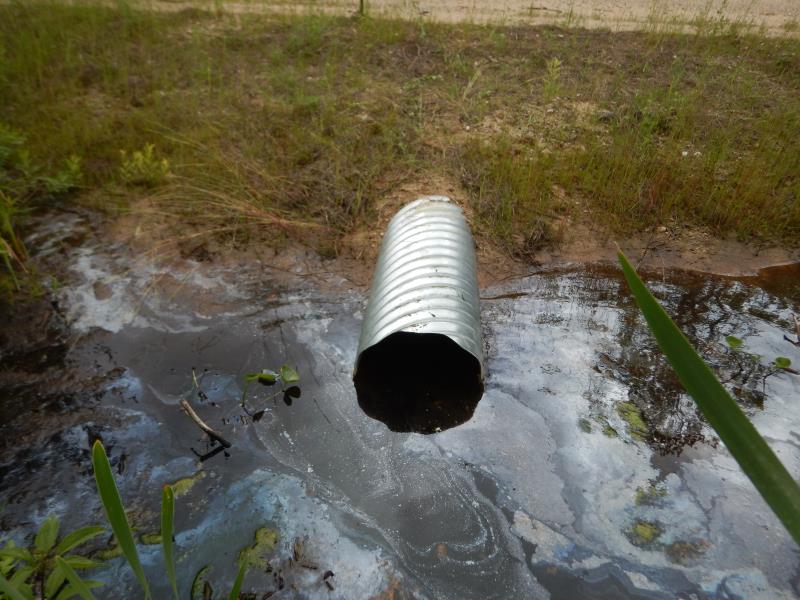
Outlet
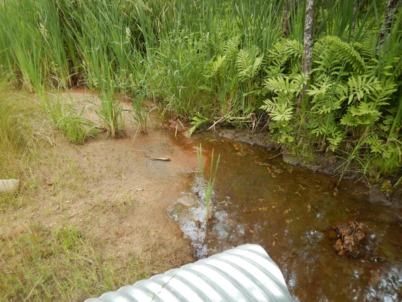
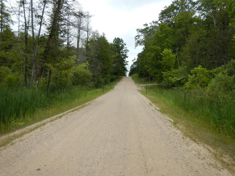
Upstream Conditions
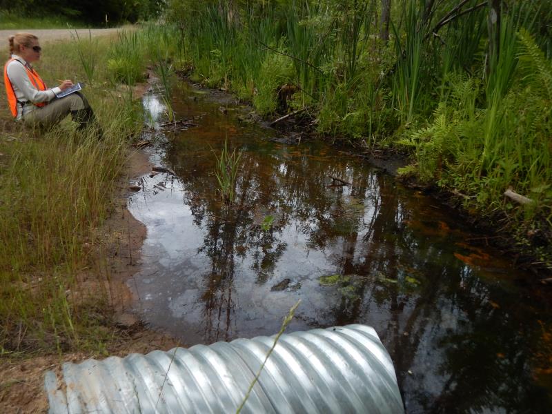
Downstream Conditions
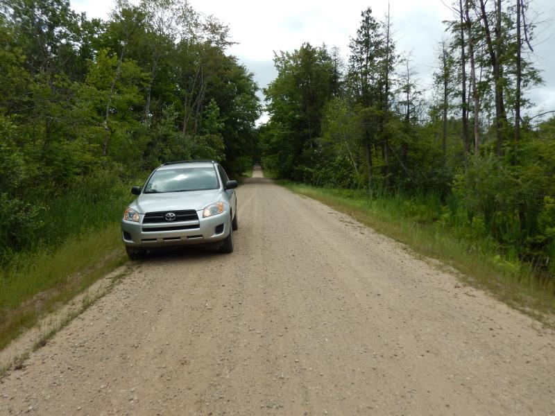
Road Approach - Left
Road Approach - Right
Crossing Information
Type of Crossing: culvert(s)
Number of Structures: 1
Structure Shape: Round
Inlet Type: Projecting
Outlet Type: At Stream Grade
Structure Material: Metal
Structure Substrate: None
General Conditions: New
Structure Interior: corrugated
Dimensions of Structure: Length 40 ft.
, Width 1.5 ft.
, Height 1.5 ft.
Structure is NOT Perched
Structure Inlet
Water Depth: 0.3 ft.
Embedded Depth of Structure: 0 ft.
Water Velocity*: 0.1 ft./sec.
Structure Outlet
Water Depth: 0.6 ft.
Embedded Depth of Structure: 0.1 ft.
Water Velocity*: 0.1 ft./sec.
*Water Velocities were measured at the Surface
(with Float Test)
Stream Information
Stream Flow: Less than 1/2 Bankfull
Riffle Information
Water Depth: 0.1 ft.
Bankfull Width: 5.2 ft.
Wetted Width: 2 ft.
Water Velocity: 0.1 ft./sec.
(Measured with Float Test)
Dominant Substrate: Sand
Road Information
Gravel
County Road
Road Condition: Fair
Road Width at Culvert: 30 ft.
Location of Low Point: At Stream
Runoff Path: Roadway
Embankments
Upstream
Fill Depth: 1 ft.
Slope: More than 1:2
Downstream
Slope: More than 1:2
Approaches
Left Approach
Length: 50 ft.
Slope: Less Than 1%
Vegetation: Partial
LS Factor: 0.05
Erosion: 0.0207 tons/year
Right Approach
Length: 475 ft.
Slope: 1% to 5%
Vegetation: Partial
LS Factor: 0.63
Erosion: 2.4731 tons/year
Erosion Information
Total Erosion at Crossing: 2.4938 tons/year
Location of Erosion | Erosion Dimensions | Eroded Material | Material Eroded | Total Erosion | ||
facing downstream | Length | Width | Depth | Reaching Stream? | (tons/year) | |
Left Upstream Embankment |
100 ft. |
30 ft. |
0.1 ft. |
yes |
Sand |
|
Left Downstream Embankment |
100 ft. |
30 ft. |
0.1 ft. |
yes |
Sand |
|
Summary Information
Fish Passability 0.5
Fish Passage is an area of concern for this site.
and Erosion. There is no flow
These non-native species were observerd at this site: Autumn Olive, Reed Canary Grass
�