Road Stream Crossing Site LM009
Manistee River Watershed, Little Manistee River
Frank Smith Rd
Ellsworth Twp,
Lake County
Information collected by:
Site Location
GPS Coordinates: 44.003774
, -85.652314
T19N
R11W
Sec 29
Owned by Private
Fish Passability 0
Perch Height: 0.6 ft.
Total Erosion: 2.7548 tons/year
Severity: Severe
Year Inventoried: 2019
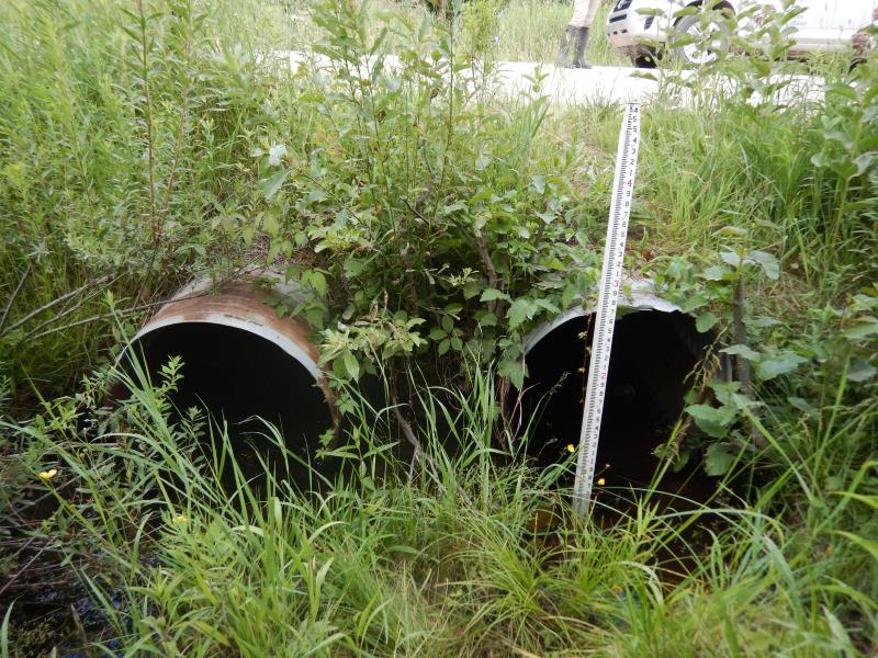
Inlet
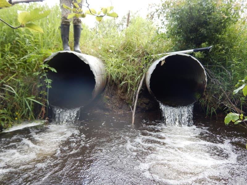
Outlet
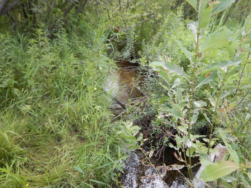
Upstream Conditions
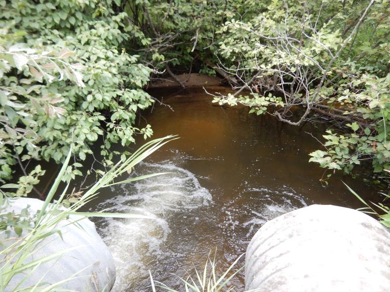
Downstream Conditions
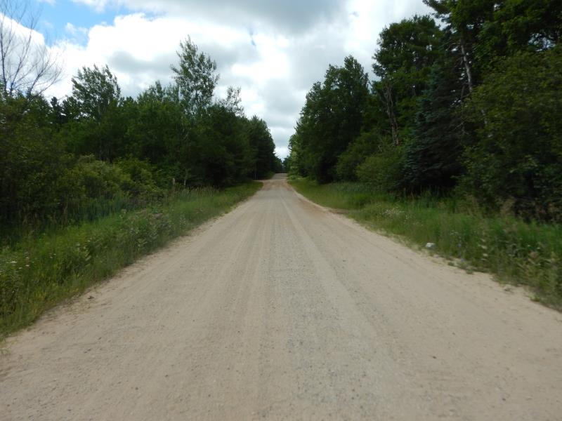
Road Approach - Left
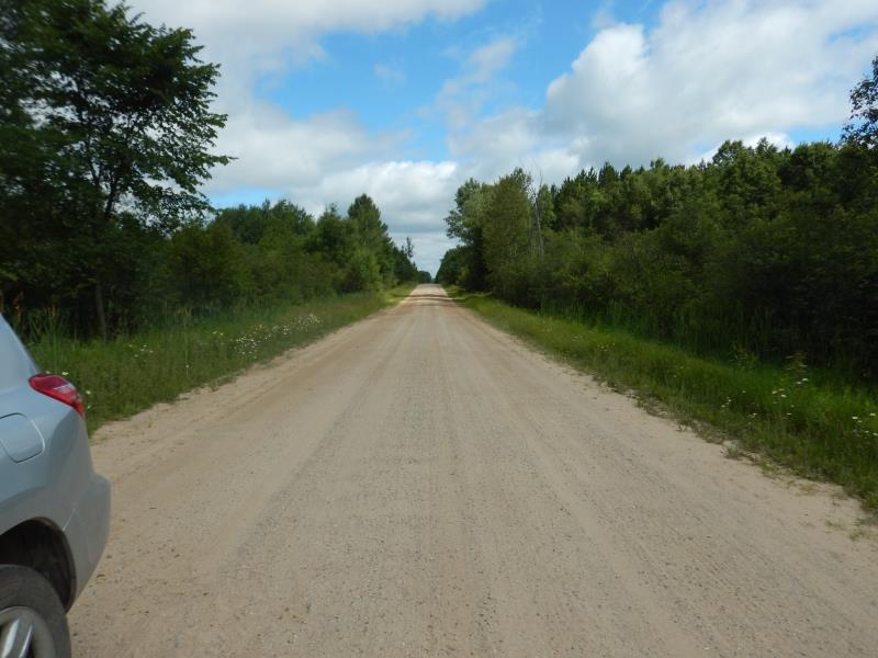
Road Approach - Right
Crossing Information
Type of Crossing: culvert(s)
Number of Structures: 2
Structure Shape: Round
Inlet Type: Projecting
Outlet Type: Freefall into Pool
Structure Material: Metal
Structure Substrate: None
General Conditions: Poor
Multiple Culverts/Spans | ||||
Culvert/Span | Width | Length | Height | Material |
1 |
2.6 ft. |
40.3 ft. |
2.6 ft. |
Metal |
2 |
2.6 ft. |
40.6 ft. |
2.6 ft. |
Metal |
Structure Interior: corrugated
Dimensions of Structure: Length 40.3 ft.
, Width 2.6 ft.
, Height 2.6 ft.
Perch Height: 0.6 ft.
Structure Inlet
Water Depth: 0.7 ft.
Embedded Depth of Structure: 0 ft.
Water Velocity*: 1.5 ft./sec.
Structure Outlet
Water Depth: 0.4 ft.
Embedded Depth of Structure: 0 ft.
Water Velocity*: 4.9 ft./sec.
*Water Velocities were measured 0.3 ft. below Surface
(with Meter)
Additional Comments
structure values are of culvert 1
Stream Information
Stream Flow: Less than Bankfull
Scour Pool: Length 20 ft.
, Width 15 ft.
, Depth 2 ft.
Riffle Information
Water Depth: 0.5 ft.
Bankfull Width: 7 ft.
Wetted Width: 6.2 ft.
Water Velocity: 1.2 ft./sec.
(Measured with Meter)
Dominant Substrate: Sand
Road Information
Gravel
County Road
Road Condition: Good
Road Width at Culvert: 20 ft.
Location of Low Point: At Stream
Runoff Path: Ditch
Embankments
Upstream
Fill Depth: 2 ft.
Slope: 1:1.5
Downstream
Fill Depth: 3 ft.
Slope: 1:1.5
Approaches
Left Approach
Length: 500 ft.
Slope: 1% to 5%
Vegetation: Heavy
LS Factor: 0.5
Erosion: 1.3774 tons/year
Right Approach
Length: 500 ft.
Slope: 1% to 5%
Vegetation: Heavy
LS Factor: 0.5
Erosion: 1.3774 tons/year
Erosion Information
Total Erosion at Crossing: 2.7548 tons/year
Summary Information
Fish Passability 0
Erosion is an area of concern for this site.
Perched culverts
�