Road Stream Crossing Site LM011
Manistee River Watershed, Little Manistee River Tributary
Frank Smith Rd
Ellsworth Twp,
Lake County
Information collected by:
Site Location
GPS Coordinates: 44.015233
, -85.662578
T19N
R11W
Sec 29
Owned by Private
Fish Passability 0
Perch Height: 0.7 ft.
Total Erosion: 0.5025 tons/year
Severity: Severe
Year Inventoried: 2019
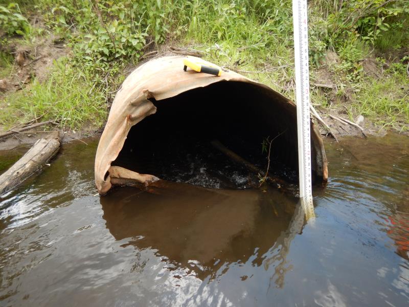
Inlet
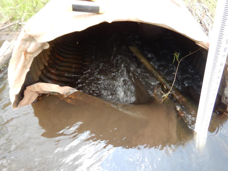
Inlet
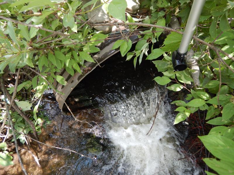
Outlet
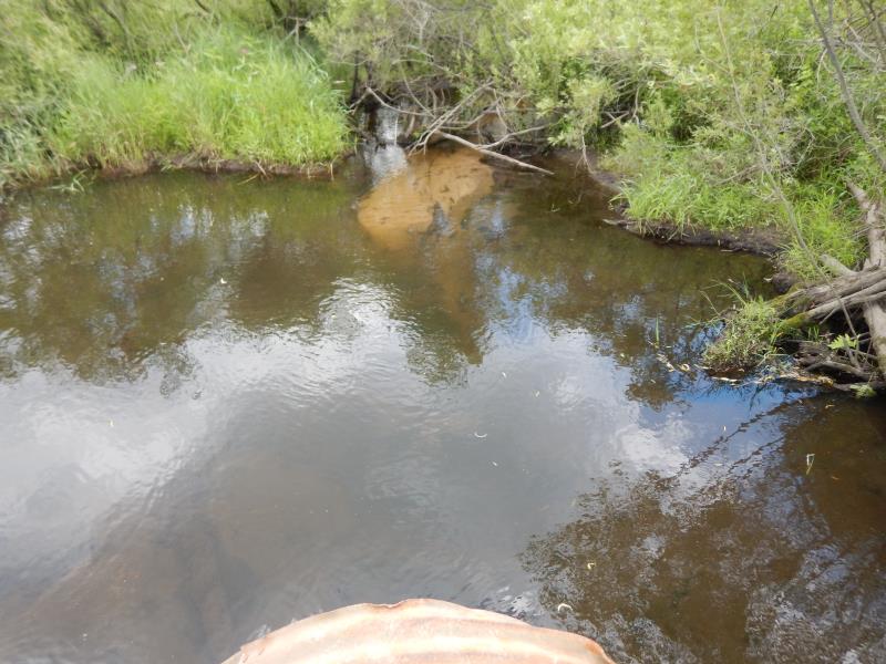
Upstream Conditions
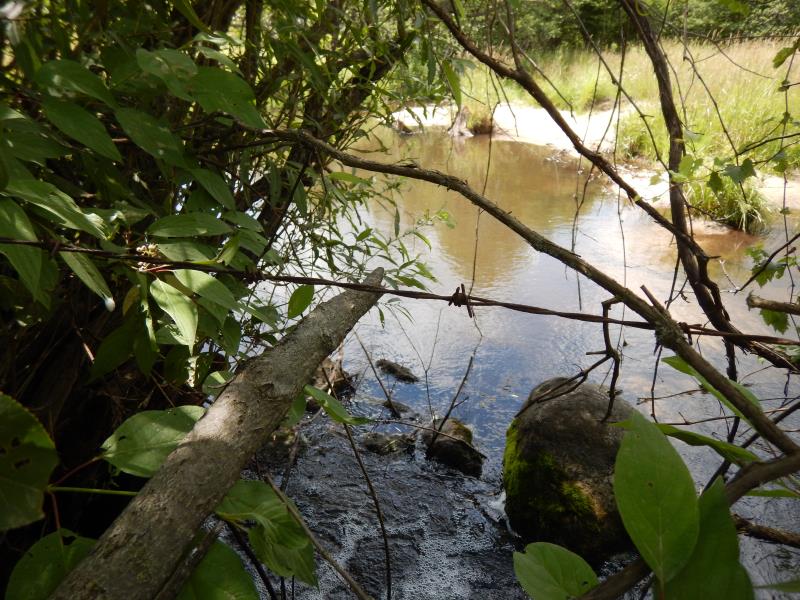
Downstream Conditions
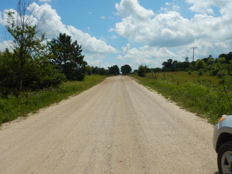
Road Approach - Left
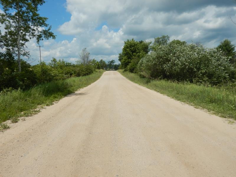
Road Approach - Right
Crossing Information
Type of Crossing: culvert(s)
Number of Structures: 1
Structure Shape: Pipe Arch
Inlet Type: Projecting
Outlet Type: Freefall into Pool
Structure Material: Metal
Structure Substrate: Mixture
General Conditions: Poor
Dimensions of Structure: Length 61.5 ft.
, Width 4 ft.
, Height 3 ft.
Percentage Crushed:
Inlet: 26% to 50%
Perch Height: 0.7 ft.
Structure Inlet
Water Depth: 1 ft.
Embedded Depth of Structure: 0 ft.
Water Velocity*: 3.4 ft./sec.
Structure Outlet
Water Depth: 0.3 ft.
Embedded Depth of Structure: 0 ft.
Water Velocity*: 4.8 ft./sec.
*Water Velocities were measured 0.5 ft. below Surface
(with Meter)
Stream Information
Stream Flow: Less than 1/2 Bankfull
Upstream Pond: Length 40 ft.
, Width 16 ft.
, Depth 1 ft.
Riffle Information
Water Depth: 0.5 ft.
Bankfull Width: 9.5 ft.
Wetted Width: 6.5 ft.
Water Velocity: 0.8 ft./sec.
(Measured with Meter)
Dominant Substrate: Sand
Road Information
Sand
County Road
Road Condition: Fair
Road Width at Culvert: 24 ft.
Location of Low Point: At Stream
Runoff Path: Roadway
Embankments
Upstream
Fill Depth: 2 ft.
Slope: 1:1.5
Downstream
Fill Depth: 3 ft.
Slope: 1:1.5
Approaches
Left Approach
Length: 100 ft.
Slope: 1% to 5%
Vegetation: Heavy
LS Factor: 0.38
Erosion: 0.2512 tons/year
Right Approach
Length: 100 ft.
Slope: 1% to 5%
Vegetation: Heavy
LS Factor: 0.38
Erosion: 0.2512 tons/year
Erosion Information
Total Erosion at Crossing: 0.5025 tons/year
Summary Information
Fish Passability 0
Fish Passage is an area of concern for this site.
culvert status is impaired, crushed and perched
These non-native species were observerd at this site: Reed Canary Grass, Thistle
�