Road Stream Crossing Site LM020
Manistee River Watershed, Little Manistee River
Spring St
Newkirk Twp,
Lake County
Information collected by:
Site Location
GPS Coordinates: 44.036159
, -85.686132
T19N
R12W
Sec 13
Owned by Private
Fish Passability 0.5
Total Erosion: 0.0886 tons/year
Severity: Moderate
Year Inventoried: 2019
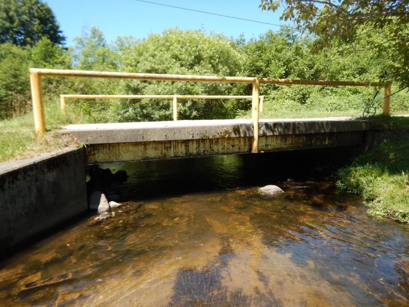
Inlet
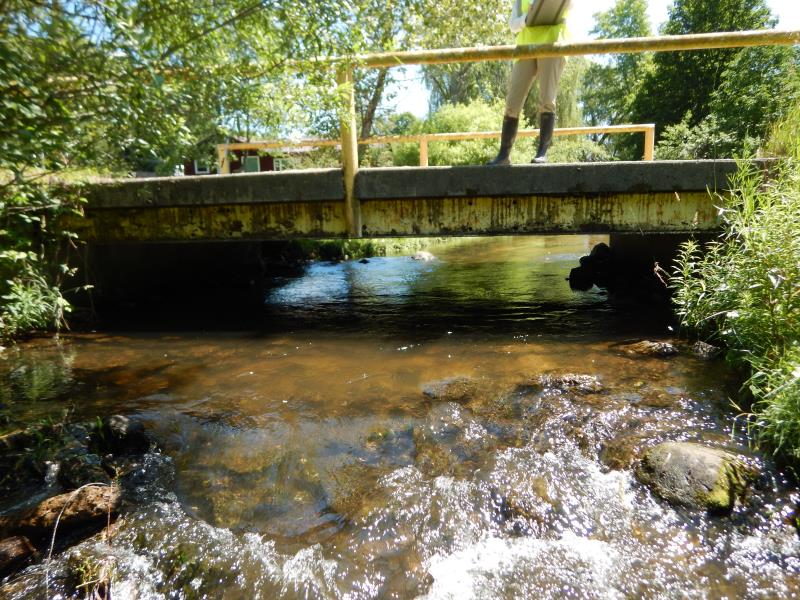
Outlet
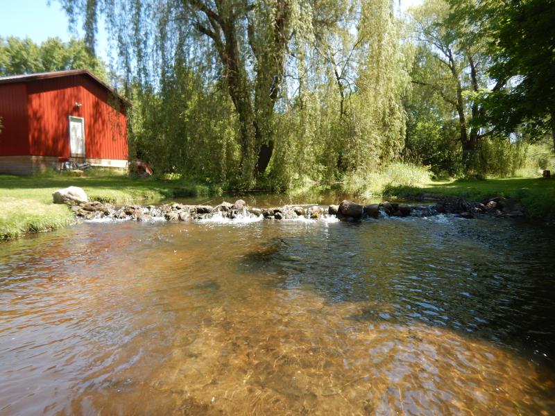
Upstream Conditions
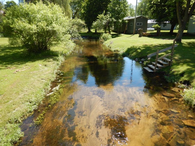
Upstream Conditions
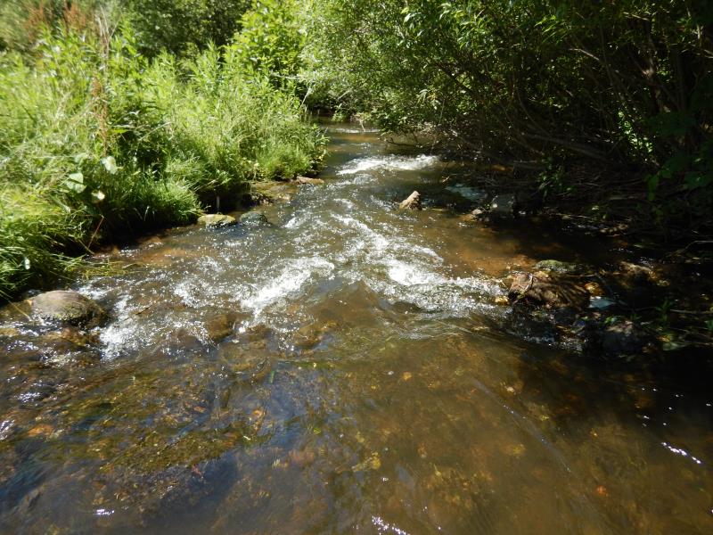
Downstream Conditions
Road Approach - Left
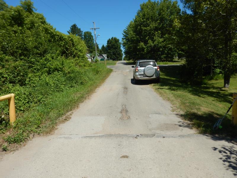
Road Approach - Right
Crossing Information
Type of Crossing: Bridge
Structure Shape: Open Bottom Square/Rectangle
Inlet Type: Wingwall 30-70 Degree
Outlet Type: At Stream Grade
Structure Material: Concrete
Structure Substrate: Rock
General Conditions: Good
Structure Interior: smooth
Dimensions of Structure: Length 18 ft.
, Width 16 ft.
, Height 3 ft.
Structure Inlet
Water Depth: 1 ft.
Embedded Depth of Structure: 0 ft.
Water Velocity*: 2 ft./sec.
Structure Outlet
Water Depth: 0.9 ft.
Embedded Depth of Structure: 0 ft.
Water Velocity*: 1.1 ft./sec.
*Water Velocities were measured 0.6 ft. below Surface
(with Meter)
Additional Comments
Rock barrier upstream 200 ft-possible fish passage problem
Stream Information
Stream Flow: Less than Bankfull
Riffle Information
Water Depth: 1.1 ft.
Bankfull Width: 18.5 ft.
Wetted Width: 16.5 ft.
Water Velocity: 0.8 ft./sec.
(Measured with Meter)
Dominant Substrate: Sand
Road Information
Paved
State Road
Road Condition: Good
Road Width at Culvert: 16 ft.
Location of Low Point: Other
Runoff Path: Ditch
Fill Depth: 0 ft.
Slope: 1:2
Fill Depth: 0 ft.
Slope: More than 1:2
Approaches
Left Approach
Length: 50 ft.
Slope: Less Than 1%
Vegetation: Partial
LS Factor: 0.05
Erosion: 0.0013 tons/year
Right Approach
Length: 300 ft.
Slope: 1% to 5%
Vegetation: Partial
LS Factor: 0.55
Erosion: 0.0873 tons/year
Erosion Information
Total Erosion at Crossing: 0.0886 tons/year
Summary Information
Fish Passability 0.5
�