Road Stream Crossing Site LM037
Manistee River Watershed, Wide Waters Outlet
N Widewater Road
Newkirk Twp,
Lake County
Information collected by:
Site Location
GPS Coordinates: 44.035797
, -85.774861
T19N
R12W
Sec 17
Owned by State
Fish Passability 0
Perch Height: 0.2 ft.
Total Erosion: 0.0193 tons/year
Severity: Severe
Year Inventoried: 2019

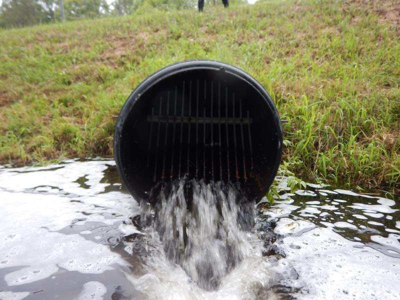
Inlet
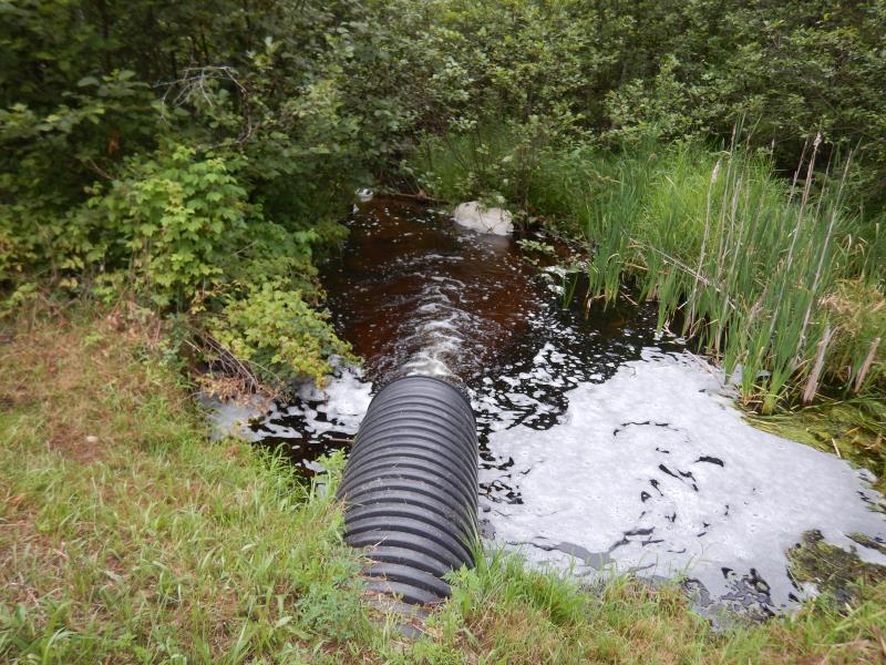
Outlet
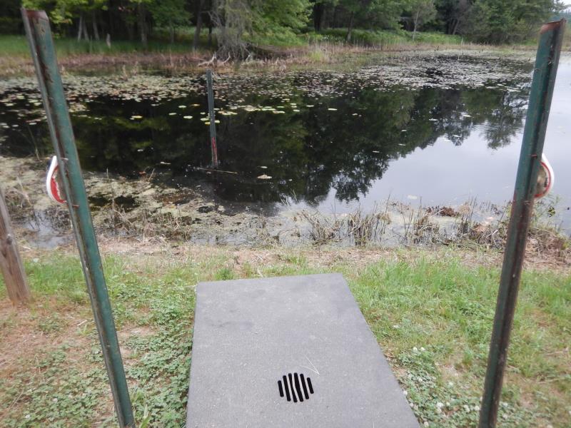
Upstream Conditions
Downstream Conditions
Road Approach - Left
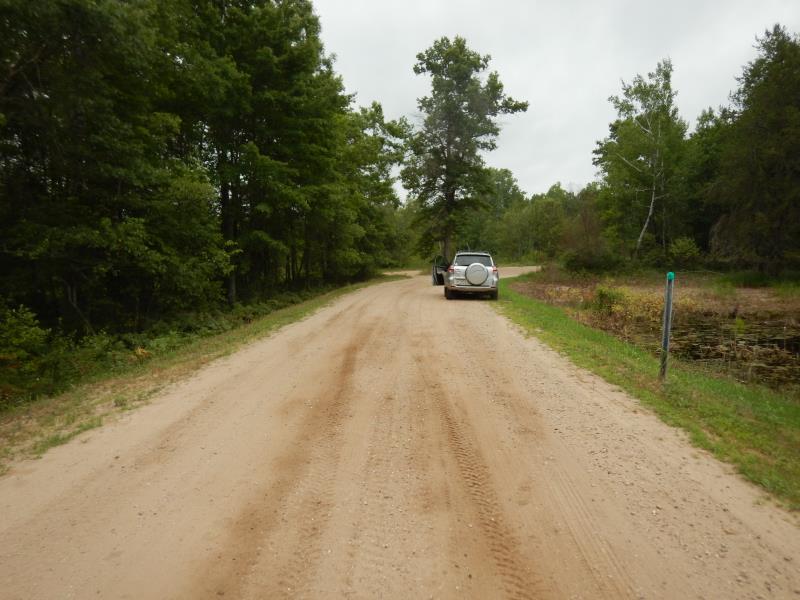
Road Approach - Right
Crossing Information
Type of Crossing: culvert(s)
Number of Structures: 1
Structure Shape: Round
Inlet Type: Trash Rack
Outlet Type: Freefall into Pool
Structure Material: Plastic
Structure Substrate: None
General Conditions: Good
Structure Interior: corrugated
Dimensions of Structure: Length 72 ft.
, Width 2 ft.
, Height 2 ft.
Perch Height: 0.2 ft.
Structure Inlet
Water Depth: 3.5 ft.
Embedded Depth of Structure: 0 ft.
Water Velocity*: 2.9 ft./sec.
Structure Outlet
Water Depth: 2.5 ft.
Embedded Depth of Structure: 0 ft.
Water Velocity*: 7 ft./sec.
*Water Velocities were measured 2.5 ft. below Surface
(with Meter)
Additional Comments
Inlet is submerged toward lake.
Stream Information
Stream Flow: Less than Bankfull
Riffle Information
Water Depth: 0.8 ft.
Bankfull Width: 8 ft.
Wetted Width: 6 ft.
Water Velocity: 1.3 ft./sec.
(Measured with Meter)
Dominant Substrate: Sand
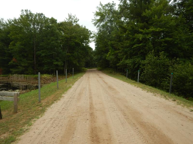
Road Information
Sand
County Road
Road Condition: Fair
Road Width at Culvert: 14 ft.
Location of Low Point: At Stream
Runoff Path: Ditch
Embankments
Upstream
Fill Depth: 5 ft.
Slope: More than 1:2
Downstream
Fill Depth: 5 ft.
Slope: More than 1:2
Approaches
Left Approach
Length: 50 ft.
Slope: Less Than 1%
Vegetation: Partial
LS Factor: 0.05
Erosion: 0.0096 tons/year
Right Approach
Length: 50 ft.
Slope: Less Than 1%
Vegetation: Partial
LS Factor: 0.05
Erosion: 0.0096 tons/year
Erosion Information
Total Erosion at Crossing: 0.0193 tons/year
Summary Information
Fish Passability 0
Fish Passage is an area of concern for this site.
Perched culvert and velocity.
�