Road Stream Crossing Site LIN_CRA014
Lincoln River Watershed, North Branch Lincoln River
N Custer Rd
Sherman Twp,
Mason County
Information collected by:
Site Location
GPS Coordinates: 44.05108
, -86.22079
T19N
R16W
Sec 10
Owned by Private
Fish Passability 1
Structure is NOT Perched
Total Erosion: 0.0406 tons/year
Severity: Minor
Year Inventoried: 2019
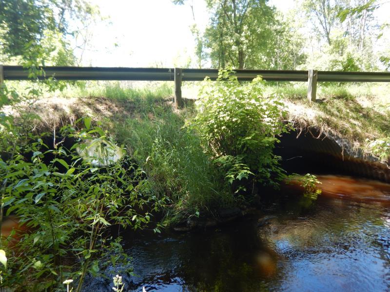
Inlet
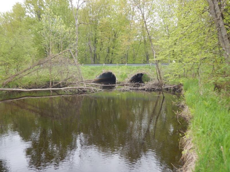
Outlet
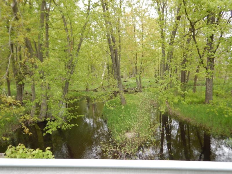
Upstream Conditions
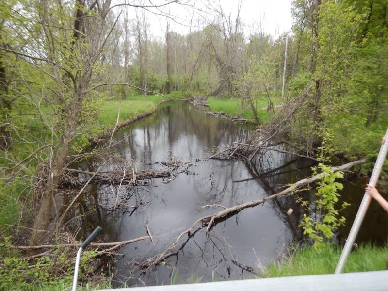
Downstream Conditions
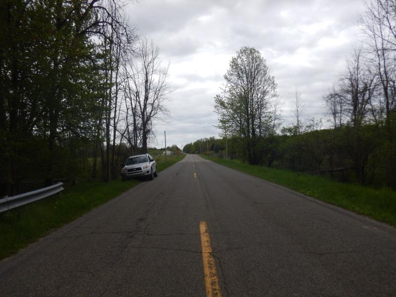
Road Approach - Left
Road Approach - Right
Crossing Information
Type of Crossing: culvert(s)
Number of Structures: 2
Structure Shape: Pipe Arch
Inlet Type: Mitered
Outlet Type: At Stream Grade
Structure Material: Metal
Structure Substrate: Sand
General Conditions: Good
Multiple Culverts/Spans | ||||
Culvert/Span | Width | Length | Height | Material |
2 |
12 ft. |
37 ft. |
8 ft. |
Metal |
Structure Interior: corrugated
Dimensions of Structure: Length 37 ft.
, Width 12 ft.
, Height 8 ft.
Structure is NOT Perched
Structure Inlet
Water Depth: 3.3 ft.
Embedded Depth of Structure: 0.3 ft.
Water Velocity*: 0.7 ft./sec.
Structure Outlet
Water Depth: 2.3 ft.
Embedded Depth of Structure: 0.6 ft.
Water Velocity*: 0.7 ft./sec.
*Water Velocities were measured 1 ft. below Surface
(with Meter)
Additional Comments
listed as Manistee National Forest; velocity culvert 1
Stream Information
Stream Flow: Less than Bankfull
Scour Pool: Length 0 ft.
, Width 0 ft.
, Depth 0 ft.
Upstream Pond: Length 0 ft.
, Width 46 ft.
, Depth 0 ft.
Riffle Information
Water Depth: 2.7 ft.
Bankfull Width: 24 ft.
Wetted Width: 22 ft.
Water Velocity: 0.8 ft./sec.
(Measured with Meter)
Dominant Substrate: Silt
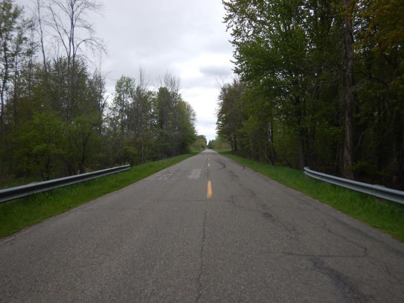
Road Information
Paved
County Road
Road Condition: Fair
Road Width at Culvert: 22 ft.
Location of Low Point: Other
Runoff Path: Ditch
Embankments
Upstream
Fill Depth: 2.5 ft.
Slope: Vertical
Downstream
Fill Depth: 2.5 ft.
Slope: 1:1
Approaches
Left Approach
Length: 500 ft.
Slope: Less Than 1%
Vegetation: Heavy
LS Factor: 0.05
Erosion: 0.0182 tons/year
Right Approach
Length: 500 ft.
Slope: Less Than 1%
Vegetation: Heavy
LS Factor: 0.05
Erosion: 0.0182 tons/year
Erosion Information
Total Erosion at Crossing: 0.0406 tons/year
Extent of Erosion: Minor
Location of Erosion | Erosion Dimensions | Eroded Material | Material Eroded | Total Erosion | ||
facing downstream | Length | Width | Depth | Reaching Stream? | (tons/year) | |
Left Upstream Embankment |
14 ft. |
3 ft. |
0.3 ft. |
yes |
Gravelly Loam |
0.0042 |
Summary Information
Fish Passability 1
A future visit to this site is recommended. Heavy sedimentation/deposition upstream of culvert #1
These non-native species were observerd at this site: Multiflora rose, Reed canary grass
�