Road Stream Crossing Site LIN_CRA025
Lincoln River Watershed, North Branch Lincoln River
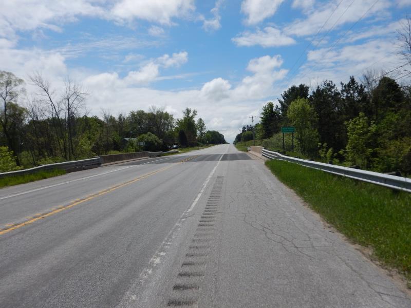
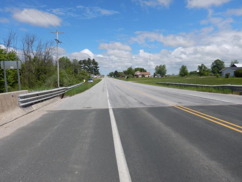
US-31
Victory Twp,
Mason County
Information collected by:
Site Location
GPS Coordinates: 44.057923
, -86.280213
T19N
R17W
Sec 13
Owned by Private
Fish Passability 0
Total Erosion: 0.8222 tons/year
Severity: Severe
Year Inventoried: 2019
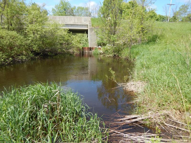
Inlet
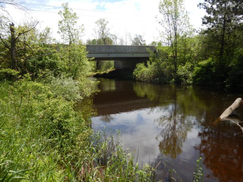
Outlet
Upstream Conditions
Downstream Conditions
Road Approach - Left
Road Approach - Right
Crossing Information
Type of Crossing: Bridge
Structure Shape: Open Bottom Square/Rectangle
Inlet Type: Headwall
Outlet Type: At Stream Grade
Structure Material: Concrete
Structure Substrate: Sand
General Conditions: Good
Structure Interior: smooth
Dimensions of Structure: Length 52 ft.
, Width 56.5 ft.
, Height 20 ft.
Structure Inlet
Water Depth: 5 ft.
Embedded Depth of Structure: 0 ft.
Water Velocity*: 3.3 ft./sec.
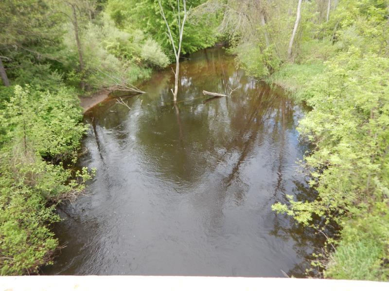
Structure Outlet
Water Depth: 4 ft.
Embedded Depth of Structure: 0 ft.
Water Velocity*: 1.8 ft./sec.
*Water Velocities were measured 3 ft. below Surface
(with Meter)
Stream Information
Stream Flow: Bankfull
Riffle Information
Water Depth: 1.5 ft.
Bankfull Width: 30 ft.
Wetted Width: 30 ft.
Water Velocity: 1.2 ft./sec.
(Measured with Meter)
Dominant Substrate: Sand
Road Information
Paved
Federal Road
Road Condition: Good
Road Width at Culvert: 48 ft.
Location of Low Point: At Stream
Runoff Path: Ditch
Fill Depth: 0 ft.
Slope: 1:1.5
Fill Depth: 0 ft.
Slope: 1:1.5
Approaches
Left Approach
Length: 500 ft.
Slope: 1% to 5%
Vegetation: Heavy
LS Factor: 0.5
Erosion: 0.3967 tons/year
Right Approach
Length: 500 ft.
Slope: 1% to 5%
Vegetation: Heavy
LS Factor: 0.5
Erosion: 0.3967 tons/year
Erosion Information
Total Erosion at Crossing: 0.8222 tons/year
Extent of Erosion: Minor
Location of Erosion | Erosion Dimensions | Eroded Material | Material Eroded | Total Erosion | ||
facing downstream | Length | Width | Depth | Reaching Stream? | (tons/year) | |
Right Upstream Streambank |
15 ft. |
1.5 ft. |
2 ft. |
yes |
Sandy Loam |
0.0288 |
Summary Information
Fish Passability 0
�