Road Stream Crossing Site LIN_CRA030
Lincoln River Watershed, North Branch Lincoln River Tributary
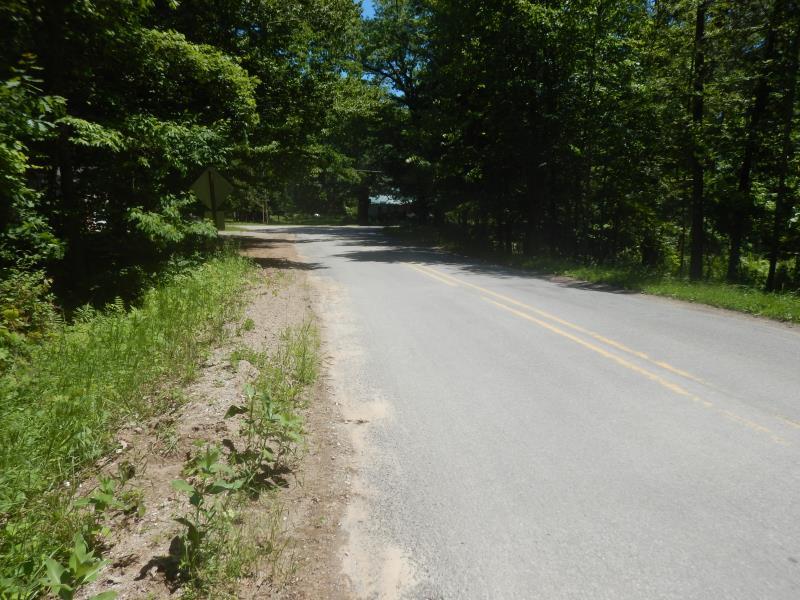
N Ford Lake Rd
Sheridan Twp,
Mason County
Information collected by:
Site Location
GPS Coordinates: 44.04103
, -86.12126
T19N
R15W
Sec 17
Owned by Private
Fish Passability 0.9
Total Erosion: 0.3767 tons/year
Severity: Moderate
Year Inventoried: 2019
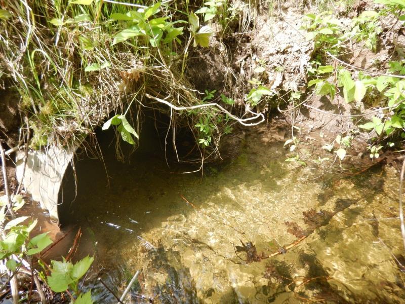
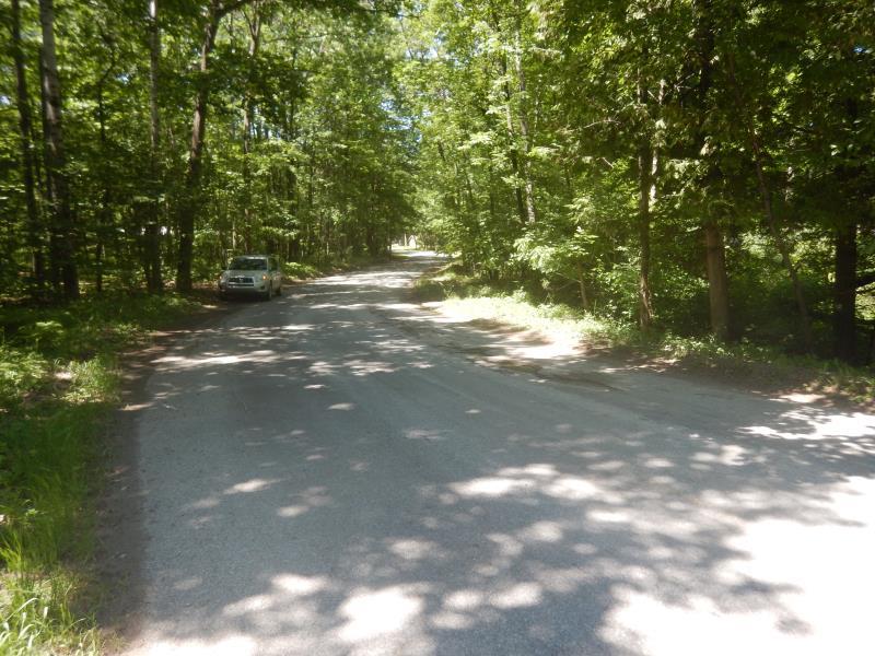
Inlet
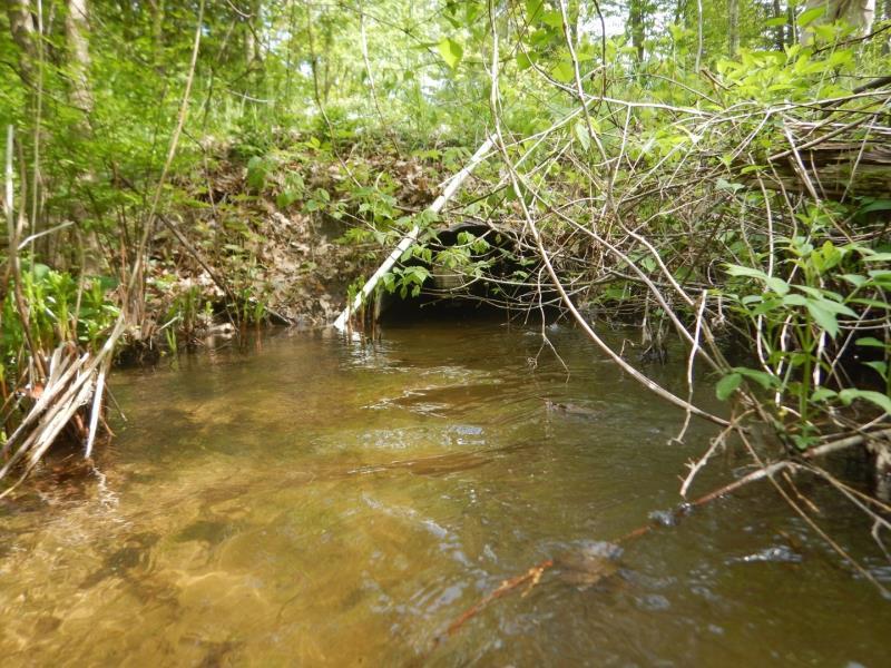
Outlet
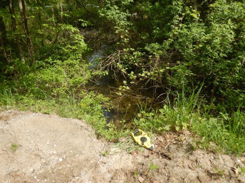
Upstream Conditions
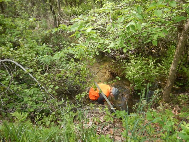
Downstream Conditions
Road Approach - Left
Road Approach - Right
Erosion
Crossing Information
Type of Crossing: culvert(s)
Number of Structures: 1
Structure Shape: Round
Inlet Type: Projecting
Outlet Type: At Stream Grade
Structure Material: Metal
Structure Substrate: Sand
General Conditions: Good
Dimensions of Structure: Length 36.5 ft.
, Width 3 ft.
, Height 3 ft.
Structure Inlet
Water Depth: 1.1 ft.
Embedded Depth of Structure: 0.4 ft.
Water Velocity*: 1.1 ft./sec.
Structure Outlet
Water Depth: 1.2 ft.
Embedded Depth of Structure: 0.4 ft.
Water Velocity*: 1.2 ft./sec.
*Water Velocities were measured 1 ft. below Surface
(with Meter)
Stream Information
Stream Flow: More than Bankfull
Riffle Information
Water Depth: 1 ft.
Bankfull Width: 9 ft.
Wetted Width: 30 ft.
Water Velocity: 1.4 ft./sec.
(Measured with Meter)
Dominant Substrate: Sand
Road Information
Paved
County Road
Road Condition: Good
Road Width at Culvert: 20 ft.
Location of Low Point: At Stream
Runoff Path: Roadway
Embankments
Upstream
Fill Depth: 3 ft.
Slope: Vertical
Downstream
Fill Depth: 2.5 ft.
Slope: 1:1
Approaches
Left Approach
Length: 180 ft.
Slope: 1% to 5%
Vegetation: Partial
LS Factor: 0.464
Erosion: 0.0552 tons/year
Right Approach
Length: 500 ft.
Slope: 1% to 5%
Vegetation: Partial
LS Factor: 0.64
Erosion: 0.2116 tons/year
Erosion Information
Total Erosion at Crossing: 0.3767 tons/year
Extent of Erosion: Moderate
Erosion is occurring and corrective actions can be installed to address the problem.
Location of Erosion | Erosion Dimensions | Eroded Material | Material Eroded | Total Erosion | ||
facing downstream | Length | Width | Depth | Reaching Stream? | (tons/year) | |
Right Upstream Embankment |
2 ft. |
1.5 ft. |
3.5 ft. |
yes |
Sand |
0.0539 |
Left Upstream Embankment |
4 ft. |
3 ft. |
2 ft. |
yes |
Gravel |
0.056 |
Summary Information
Fish Passability 0.9
Erosion is an area of concern for this site.
Road is bermed and runoff path is inlet of culvert
�