Road Stream Crossing Site LIN_CRA058
Lincoln River Watershed, North Branch Lincoln River
N Darr Rd
Sherman Twp,
Mason County
Information collected by:
Site Location
GPS Coordinates: 44.046386
, -86.26072
T19N
R16W
Sec 17
Fish Passability 0.9
Total Erosion: 0.7493 tons/year
Severity: Moderate
Year Inventoried: 2019
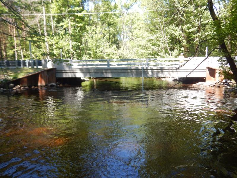
Inlet
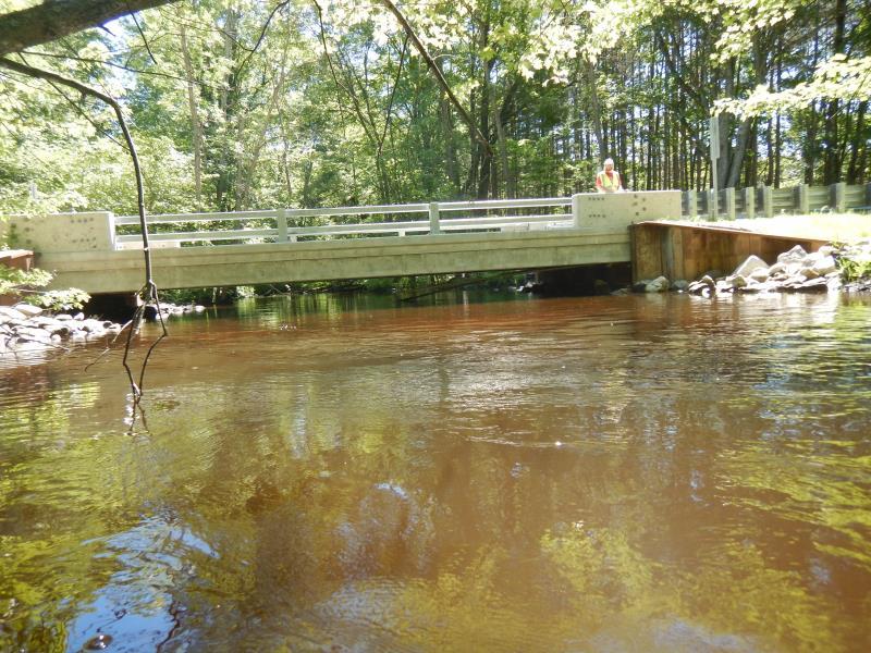
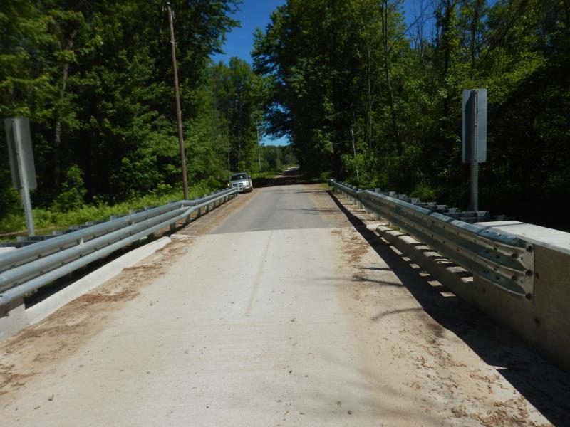
Outlet
Upstream Conditions
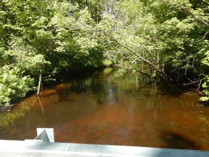
Downstream Conditions
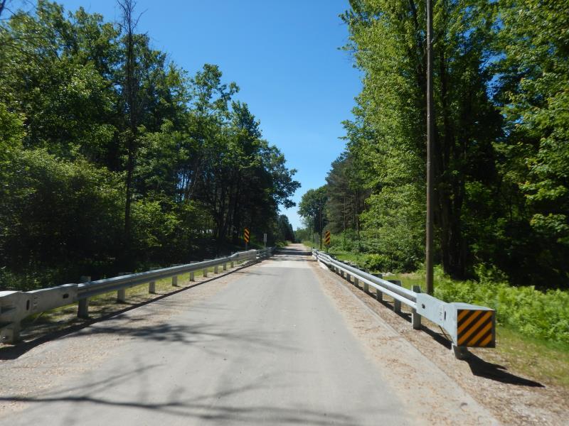
Road Approach - Left
Road Approach - Right
Crossing Information
Type of Crossing: Bridge
Structure Shape: Open Bottom Square/Rectangle
Inlet Type: Wingwall 30-70 Degree
Outlet Type: At Stream Grade
Structure Material: Concrete
Structure Substrate: Rock
General Conditions: New
Structure Interior: smooth
Dimensions of Structure: Length 19 ft.
, Width 38.5 ft.
, Height 4 ft.
Structure Inlet
Water Depth: 2 ft.
Embedded Depth of Structure: 0 ft.
Water Velocity*: 1.3 ft./sec.
Structure Outlet
Water Depth: 1.8 ft.
Embedded Depth of Structure: 0 ft.
Water Velocity*: 1.2 ft./sec.
*Water Velocities were measured 1.3 ft. below Surface
(with Meter)
Stream Information
Stream Flow: Less than Bankfull
Riffle Information
Water Depth: 2.9 ft.
Bankfull Width: 32 ft.
Wetted Width: 30 ft.
Water Velocity: 0.9 ft./sec.
(Measured with Meter)
Dominant Substrate: Sand
Road Information
Gravel
County Road
Road Condition: Good
Road Width at Culvert: 16 ft.
Location of Low Point: Other
Runoff Path: Roadway
Fill Depth: 0 ft.
Slope: Vertical
Fill Depth: 0 ft.
Slope: Vertical
Approaches
Left Approach
Length: 300 ft.
Slope: 1% to 5%
Vegetation: Partial
LS Factor: 0.55
Erosion: 0.7273 tons/year
Right Approach
Length: 100 ft.
Slope: Less Than 1%
Vegetation: Partial
LS Factor: 0.05
Erosion: 0.022 tons/year
Erosion Information
Total Erosion at Crossing: 0.7493 tons/year
Summary Information
Fish Passability 0.9
�