Road Stream Crossing Site LIN_CRA059
Lincoln River Watershed, North Branch Lincoln River Tributary
E Beyer Rd
Sherman Twp,
Mason County
Information collected by:
Site Location
GPS Coordinates: 44.063086
, -86.246438
T19N
R16W
Sec 8
Owned by Private
Fish Passability 0.9
Total Erosion: 0.1703 tons/year
Severity: Moderate
Year Inventoried: 2019
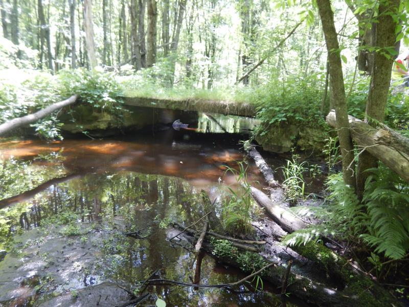
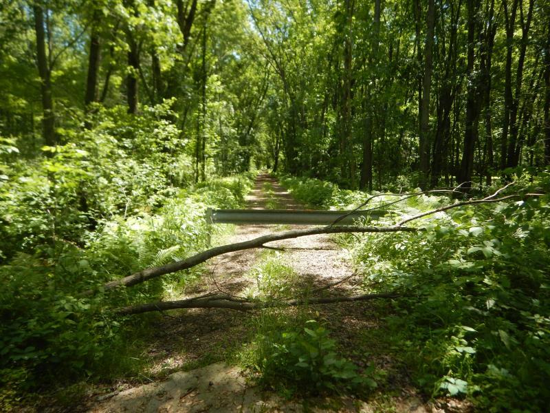
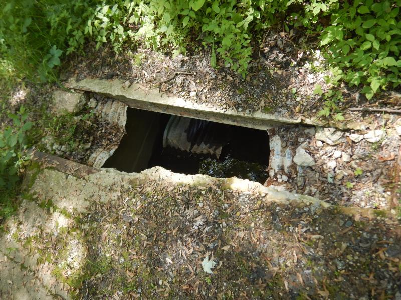
Inlet
Outlet
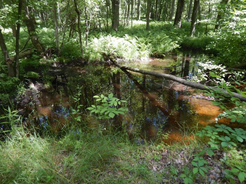
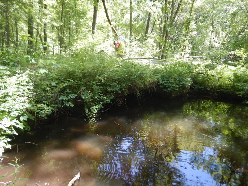
Upstream Conditions
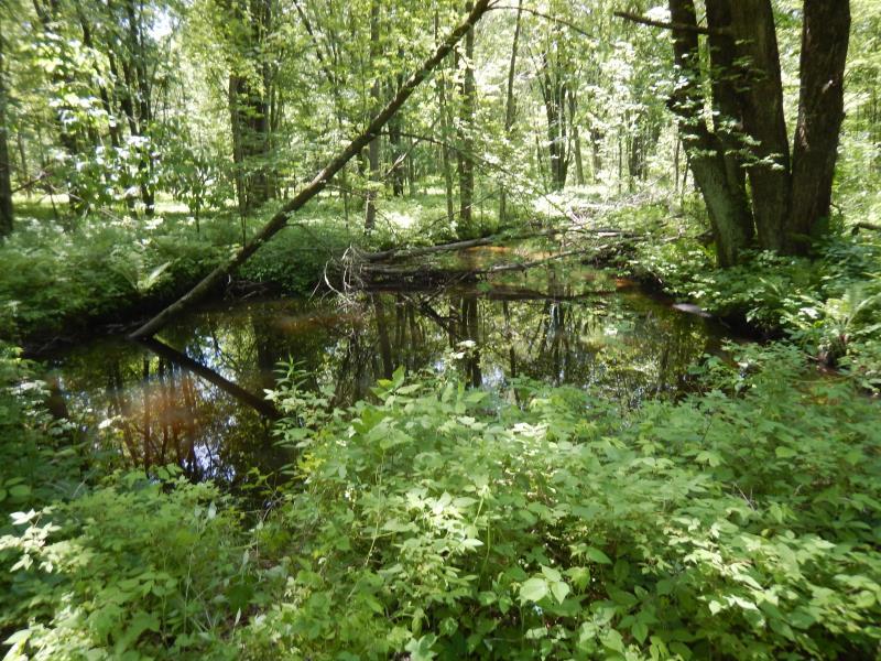
Downstream Conditions
Road Approach - Left
Road Approach - Right
Erosion
Crossing Information
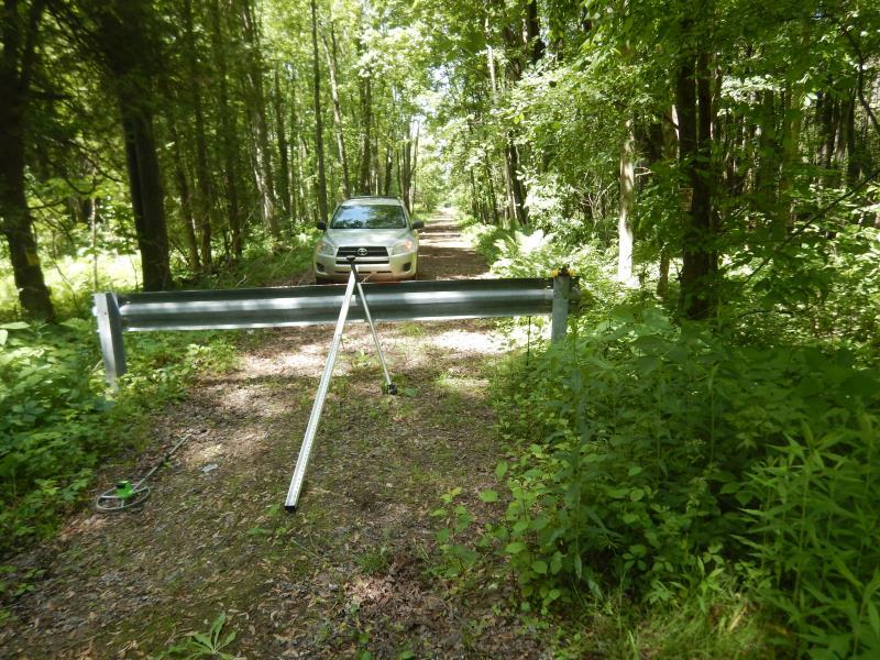
Type of Crossing: Bridge
Structure Shape: Open Bottom Square/Rectangle
Inlet Type: Wingwall 10-30 Degree
Outlet Type: At Stream Grade
Structure Material: Concrete
Structure Substrate: Sand
General Conditions: Poor
Structure Interior: smooth
Structure is Rusted through
Dimensions of Structure: Length 15 ft.
, Width 12 ft.
, Height 4.5 ft.
Structure Inlet
Water Depth: 2 ft.
Embedded Depth of Structure: 0 ft.
Water Velocity*: 0.4 ft./sec.
Structure Outlet
Water Depth: 3.3 ft.
Embedded Depth of Structure: 0 ft.
Water Velocity*: 0.5 ft./sec.
*Water Velocities were measured 1 ft. below Surface
(with Meter)
Additional Comments
Bridge is collapsed with a semi-permanent barricade. No thru traffic. Difficult to reach, suggest visiting in dryer months only.
Stream Information
Stream Flow: Less than Bankfull
Scour Pool: Length 30 ft.
, Width 30 ft.
, Depth 4 ft.
Upstream Pond: Length 25 ft.
, Width 25 ft.
, Depth 2.5 ft.
Riffle Information
Water Depth: 0.6 ft.
Bankfull Width: 16 ft.
Wetted Width: 12 ft.
Water Velocity: 0.8 ft./sec.
(Measured with Meter)
Dominant Substrate: Sand
Road Information
Native Surface
County Road
Road Condition: Poor
Road Width at Culvert: 15 ft.
Location of Low Point: At Stream
Runoff Path: Ditch
Embankments
Upstream
Fill Depth: 0.1 ft.
Slope: Vertical
Downstream
Fill Depth: 0.1 ft.
Slope: Vertical
Approaches
Left Approach
Length: 100 ft.
Slope: 1% to 5%
Vegetation: Heavy
LS Factor: 0.38
Erosion: 0.157 tons/year
Right Approach
Length: 50 ft.
Slope: Less Than 1%
Vegetation: Heavy
LS Factor: 0.05
Erosion: 0.0103 tons/year
Erosion Information
Total Erosion at Crossing: 0.1703 tons/year
Extent of Erosion: Minor
Erosion is occurring and corrective actions can be installed to address the problem.
Location of Erosion | Erosion Dimensions | Eroded Material | Material Eroded | Total Erosion | ||
facing downstream | Length | Width | Depth | Reaching Stream? | (tons/year) | |
Right Downstream Embankment |
3 ft. |
3 ft. |
1 ft. |
yes |
Sandy Loam |
0.0029 |
Summary Information
Fish Passability 0.9
�