Road Stream Crossing Site LIN_MLCD007
Lincoln River Watershed, Frog Paradise Drain
Custer Rd
Sherman Twp,
Mason County
Information collected by:

Site Location
GPS Coordinates: 43.99543
, -86.22045
T19N
R16W
Sec 34
Owned by Private
Fish Passability 0.5
Total Erosion: 1.8916 tons/year
Severity: Severe
Year Inventoried: 2019
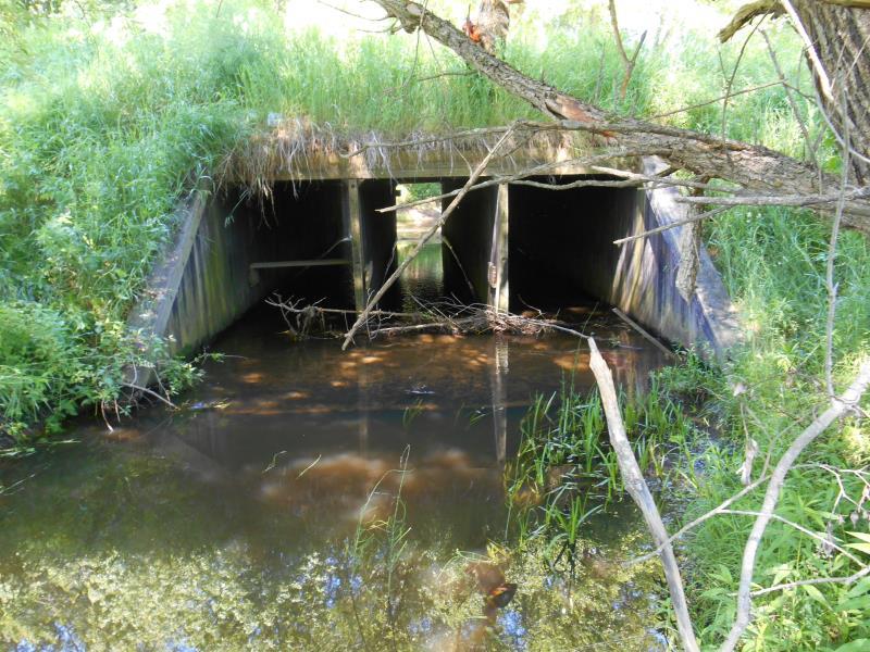
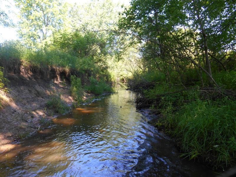
Inlet
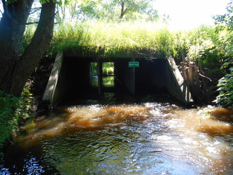
Outlet
Upstream Conditions
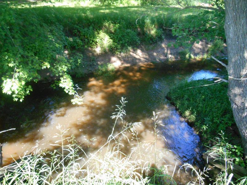
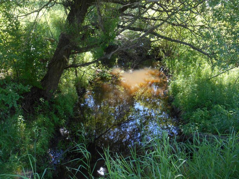
Downstream Conditions
Downstream Conditions
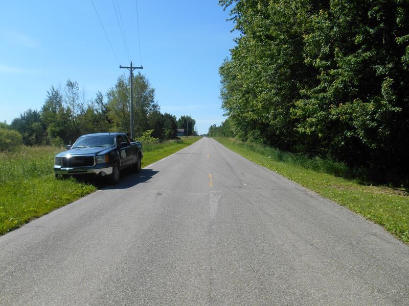
Road Approach - Left
Road Approach - Right
Crossing Information
Type of Crossing: culvert(s)
Number of Structures: 1
Structure Shape: Square/Rectangle
Inlet Type: Apron
Outlet Type: Outlet Apron
Structure Material: Wood
Structure Substrate: None
General Conditions: Fair
Structure Interior: smooth
Dimensions of Structure: Length 54 ft.
, Width 15.5 ft.
, Height 6 ft.
Percentage Plugged:
Inlet: 1% to 25%
Structure Inlet
Water Depth: 0.4 ft.
Embedded Depth of Structure: 0 ft.
Water Velocity*: 1 ft./sec.
Structure Outlet
Water Depth: 0.8 ft.
Embedded Depth of Structure: 0.1 ft.
Water Velocity*: 1.2 ft./sec.
*Water Velocities were measured at the Surface
(with Meter)
Stream Information
Stream Flow: Less than Bankfull
Scour Pool: Length 23 ft.
, Width 37 ft.
, Depth 1.6 ft.
Riffle Information
Water Depth: 1.5 ft.
Bankfull Width: 16 ft.
Wetted Width: 14 ft.
Water Velocity: 0.2 ft./sec.
(Measured with Meter)
Dominant Substrate: Silt
Road Information
Paved
County Road
Road Condition: Good
Road Width at Culvert: 24 ft.
Location of Low Point: At Stream
Runoff Path: Ditch
Embankments
Upstream
Fill Depth: 2 ft.
Slope: 1:2
Downstream
Fill Depth: 3 ft.
Slope: 1:2
Approaches
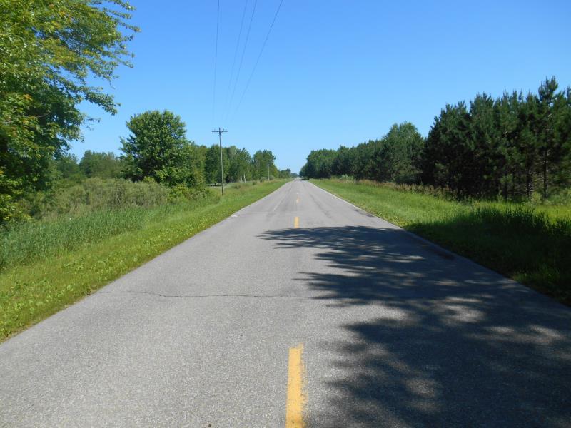
Left Approach
Length: 500 ft.
Slope: Less Than 1%
Vegetation: Partial
LS Factor: 0.055
Erosion: 0.0218 tons/year
Right Approach
Length: 500 ft.
Slope: Less Than 1%
Vegetation: Partial
LS Factor: 0.055
Erosion: 0.0218 tons/year
Erosion Information
Total Erosion at Crossing: 1.8916 tons/year
Extent of Erosion: Moderate
Notes: River makes sharp right turn, outside bank is eroding
Location of Erosion | Erosion Dimensions | Eroded Material | Material Eroded | Total Erosion | ||
facing downstream | Length | Width | Depth | Reaching Stream? | (tons/year) | |
Right Downstream Embankment |
40 ft. |
2 ft. |
6 ft. |
yes |
Sand |
1.848 |
Summary Information
Fish Passability 0.5
Erosion is an area of concern for this site.
Erosion occuring downstream is direct sediment discharge
A future visit to this site is recommended. To assist downstream landowner with erosion issues
�