Road Stream Crossing Site LIN_MLCD010
Lincoln River Watershed, South Branch of Lincoln River
Tuttle Rd
Sherman Twp,
Mason County
Information collected by:

Site Location
GPS Coordinates: 44.006
, -86.24105
T19N
R16W
Sec 28
Owned by Private
Fish Passability 0
Total Erosion: 0.4569 tons/year
Severity: Severe
Year Inventoried: 2019
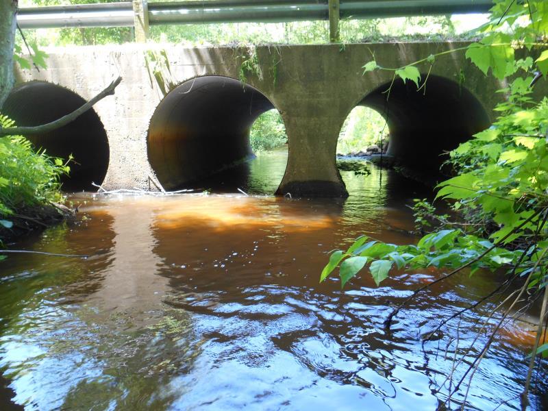
Inlet
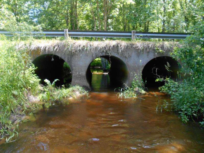
Outlet
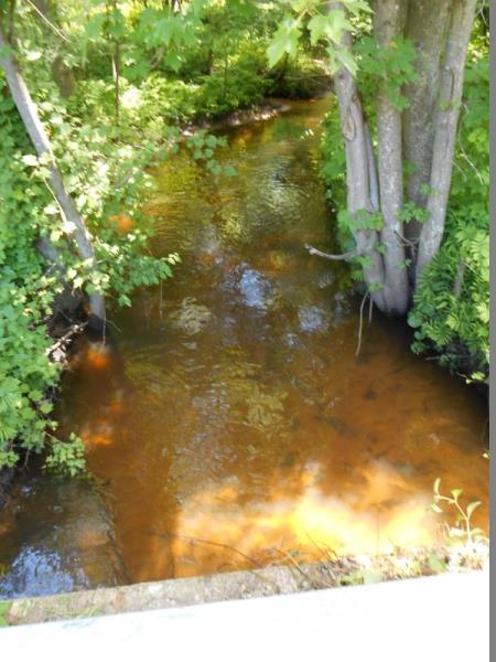
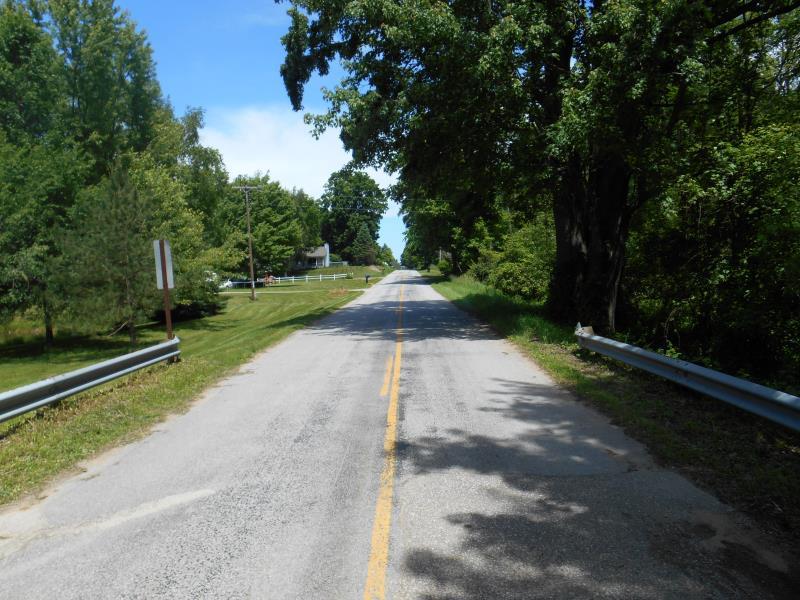
Upstream Conditions
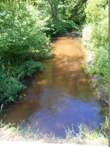
Downstream Conditions
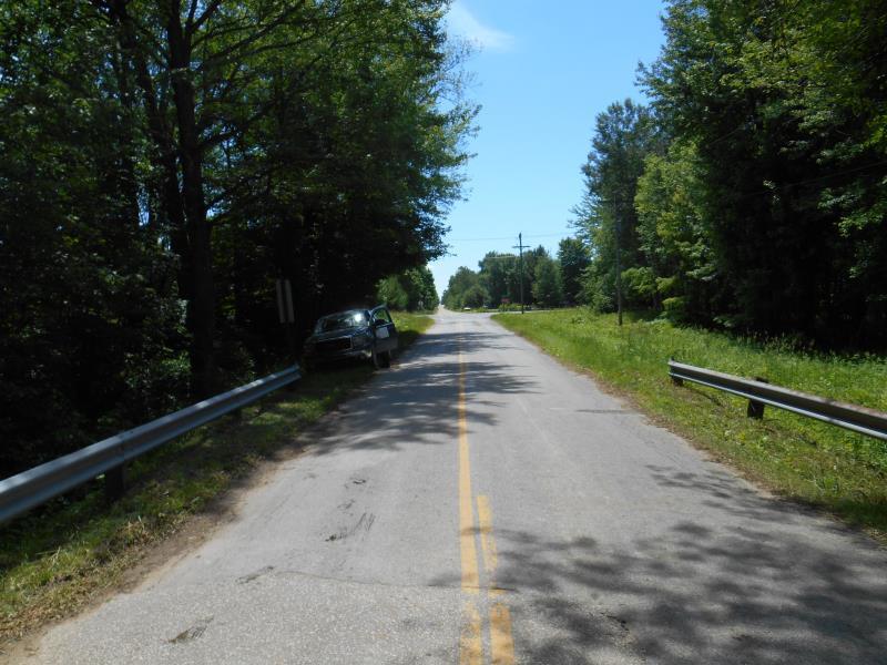
Road Approach - Left
Road Approach - Right
Crossing Information
Type of Crossing: culvert(s)
Number of Structures: 3
Structure Shape: Round
Inlet Type: Headwall
Outlet Type: At Stream Grade
Structure Material: Metal
Structure Substrate: Sand
General Conditions: Good
Multiple Culverts/Spans | ||||
Culvert/Span | Width | Length | Height | Material |
1 |
6.5 ft. |
28.5 ft. |
6.5 ft. |
Metal |
2 |
6.5 ft. |
28.5 ft. |
6.5 ft. |
Metal |
3 |
6.5 ft. |
28.5 ft. |
6.4 ft. |
Metal |
Structure Interior: corrugated
Dimensions of Structure: Length 28.5 ft.
, Width 6.5 ft.
, Height 6.5 ft.
Percentage Plugged:
Outlet: 76% to 100%
Structure Inlet
Water Depth: 1.2 ft.
Embedded Depth of Structure: 0 ft.
Water Velocity*: 0 ft./sec.
Water Depth: 0 ft.
Embedded Depth of Structure: 0.7 ft.
Water Velocity*: 0 ft./sec.
*Water Velocities were measured at the Surface
(with Meter)
Additional Comments
Culvert #3 data used
Stream Information
Stream Flow: Less than Bankfull
Riffle Information
Water Depth: 1.3 ft.
Bankfull Width: 15 ft.
Wetted Width: 13 ft.
Water Velocity: 0.2 ft./sec.
(Measured with Meter)
Dominant Substrate: Sand
Road Information
Paved
County Road
Road Condition: Fair
Road Width at Culvert: 19 ft.
Location of Low Point: Other
Runoff Path: Ditch
Embankments
Upstream
Fill Depth: 1 ft.
Slope: 1:2
Downstream
Fill Depth: 1 ft.
Slope: 1:2
Approaches
Left Approach
Length: 300 ft.
Slope: 1% to 5%
Vegetation: Partial
LS Factor: 0.55
Erosion: 0.1036 tons/year
Right Approach
Length: 500 ft.
Slope: Less Than 1%
Vegetation: Partial
LS Factor: 0.055
Erosion: 0.0173 tons/year
Erosion Information
Total Erosion at Crossing: 0.4569 tons/year
Extent of Erosion: Moderate
Notes: Erosion is occurring where concrete face and sediment meet.
Location of Erosion | Erosion Dimensions | Eroded Material | Material Eroded | Total Erosion | ||
facing downstream | Length | Width | Depth | Reaching Stream? | (tons/year) | |
Right Downstream Streambank |
8 ft. |
4 ft. |
1.5 ft. |
yes |
Gravel |
0.084 |
Left Downstream Streambank |
10 ft. |
4 ft. |
1.5 ft. |
yes |
Gravel |
0.105 |
Right Upstream Streambank |
8 ft. |
4 ft. |
1.5 ft. |
yes |
Gravel |
0.084 |
Left Upstream Streambank |
6 ft. |
3 ft. |
1.5 ft. |
yes |
Gravel |
0.063 |
Summary Information
Fish Passability 0
A future visit to this site is recommended. Right tube is completely blocked by sediment.
�