Road Stream Crossing Site LIN_MLCD011
Lincoln River Watershed, South Branch of Lincoln River
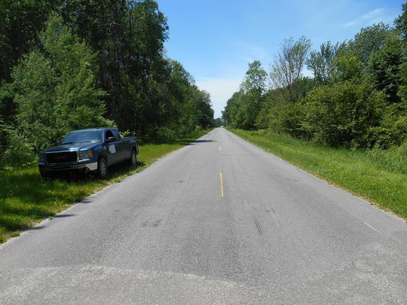
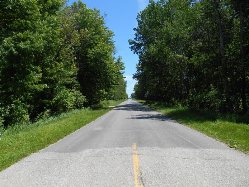
Sugar Grove Rd
Sherman Twp,
Mason County
Information collected by:

Site Location
GPS Coordinates: 44.00503
, -86.23424
T19N
R16W
Sec 28
Owned by Private
Fish Passability 0
Total Erosion: 0.0524 tons/year
Severity: Severe
Year Inventoried: 2019
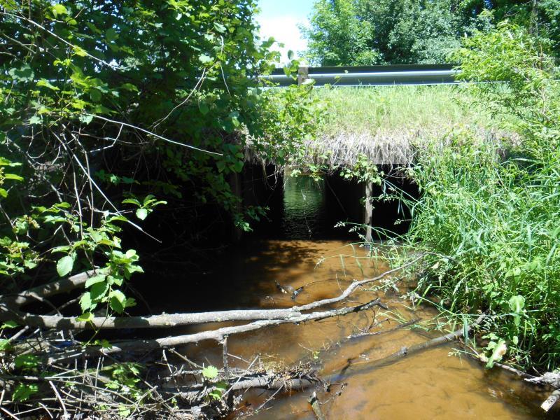
Inlet
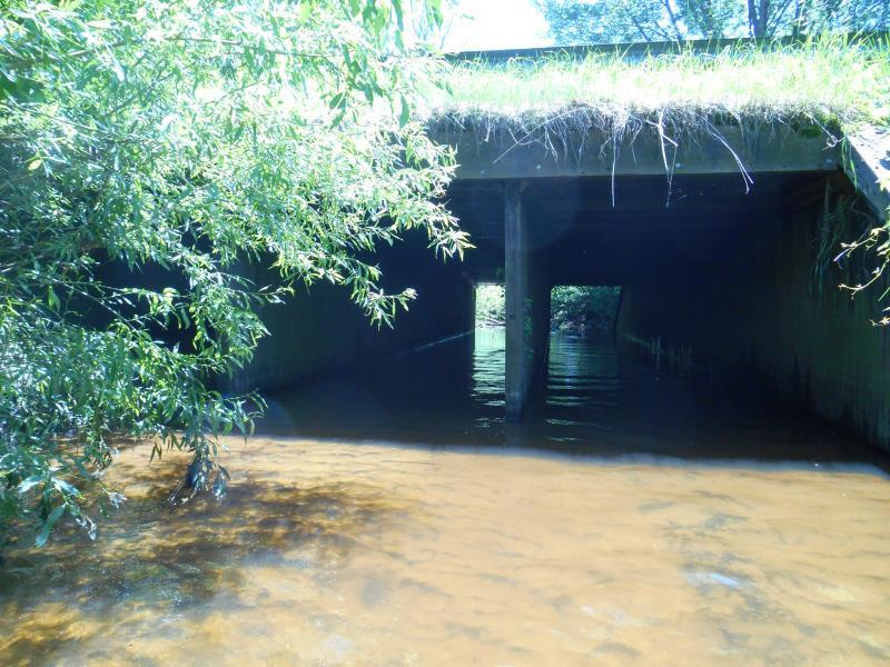
Outlet
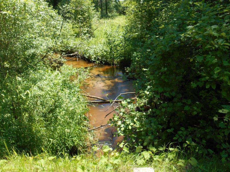
Upstream Conditions

Downstream Conditions
Road Approach - Left
Road Approach - Right
Crossing Information
Type of Crossing: culvert(s)
Number of Structures: 3
Structure Shape: Square/Rectangle
Inlet Type: Apron
Outlet Type: Outlet Apron
Structure Material: Wood
Structure Substrate: Sand
General Conditions: Fair
Multiple Culverts/Spans | ||||
Culvert/Span | Width | Length | Height | Material |
1 |
6 ft. |
57 ft. |
5.8 ft. |
Wood |
2 |
6 ft. |
57 ft. |
5.8 ft. |
Wood |
3 |
6 ft. |
57 ft. |
5.8 ft. |
Wood |
Structure Interior: smooth
Dimensions of Structure: Length 57 ft.
, Width 6 ft.
, Height 5.8 ft.
Percentage Plugged:
Inlet: 51% to 75%
Structure Inlet
Water Depth: 0.4 ft.
Embedded Depth of Structure: 1.8 ft.
Water Velocity*: 0 ft./sec.
Water Depth: 0 ft.
Embedded Depth of Structure: 1 ft.
Water Velocity*: 0 ft./sec.
*Water Velocities were measured at the Surface
(with Meter)
Additional Comments
Culvert #3 data used
Stream Information
Stream Flow: Less than Bankfull
Riffle Information
Water Depth: 0.7 ft.
Bankfull Width: 21 ft.
Wetted Width: 18 ft.
Water Velocity: 1.5 ft./sec.
(Measured with Meter)
Dominant Substrate: Sand
Road Information
Paved
County Road
Road Condition: Good
Road Width at Culvert: 22.5 ft.
Location of Low Point: At Stream
Runoff Path: Ditch
Embankments
Upstream
Fill Depth: 1.5 ft.
Slope: 1:2
Downstream
Fill Depth: 1.5 ft.
Slope: 1:2
Approaches
Left Approach
Length: 500 ft.
Slope: Less Than 1%
Vegetation: Partial
LS Factor: 0.055
Erosion: 0.0205 tons/year
Right Approach
Length: 500 ft.
Slope: Less Than 1%
Vegetation: Partial
LS Factor: 0.055
Erosion: 0.0205 tons/year
Erosion Information
Total Erosion at Crossing: 0.0524 tons/year
Extent of Erosion: Minor
Location of Erosion | Erosion Dimensions | Eroded Material | Material Eroded | Total Erosion | ||
facing downstream | Length | Width | Depth | Reaching Stream? | (tons/year) | |
Right Upstream Embankment |
6 ft. |
3 ft. |
2 ft. |
yes |
Sandy Loam |
0.0115 |
Summary Information
Fish Passability 0
These non-native species were observerd at this site: Autumn Olive
�