Road Stream Crossing Site LIN_MLCD012
Lincoln River Watershed, Amber Creek
Pratt Rd
Victory Twp,
Mason County
Information collected by:

Site Location
GPS Coordinates: 43.99483
, -86.30154
T19N
R17W
Sec 35
Owned by Private
Fish Passability 0.9
Total Erosion: 1.1575 tons/year
Severity: Moderate
Year Inventoried: 2019
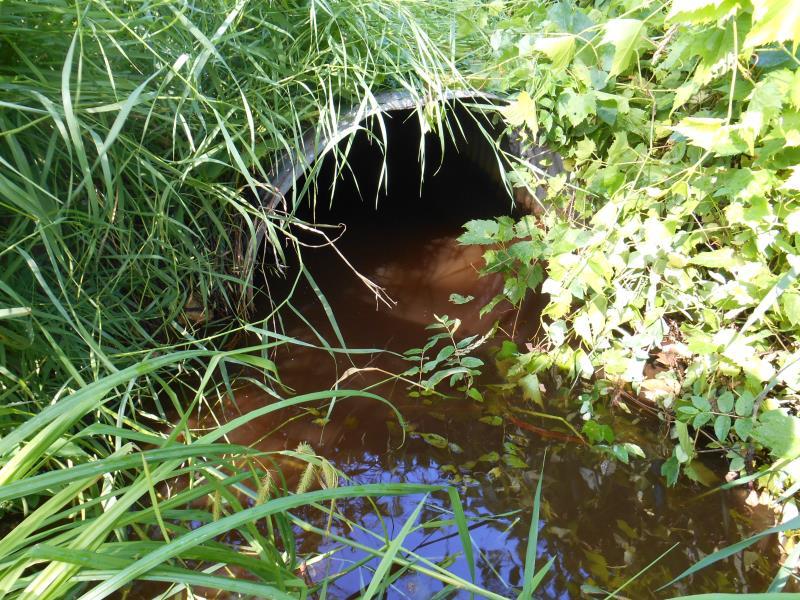
Inlet
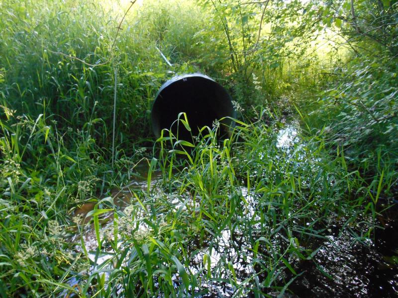
Outlet
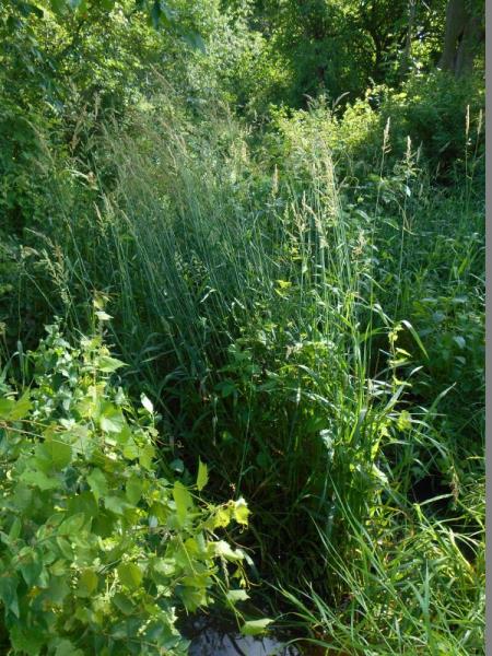
Upstream Conditions
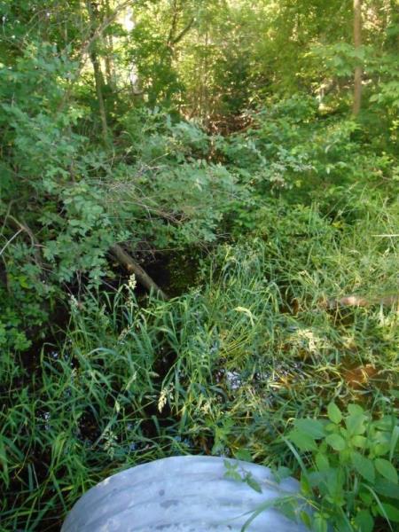
Downstream Conditions
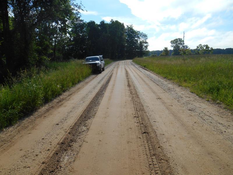
Road Approach - Left
Road Approach - Right
Crossing Information
Type of Crossing: culvert(s)
Number of Structures: 1
Structure Shape: Round
Inlet Type: Projecting
Outlet Type: At Stream Grade
Structure Material: Metal
Structure Substrate: Mixture
General Conditions: Good
Structure Interior: corrugated
Dimensions of Structure: Length 58 ft.
, Width 3 ft.
, Height 3 ft.
Structure Inlet
Water Depth: 0.6 ft.
Embedded Depth of Structure: 0 ft.
Water Velocity*: 0.4 ft./sec.
Structure Outlet
Water Depth: 0.8 ft.
Embedded Depth of Structure: 0.8 ft.
Water Velocity*: 0.1 ft./sec.
*Water Velocities were measured 0.4 ft. below Surface
(with Meter)
Stream Information
Stream Flow: Less than 1/2 Bankfull
Upstream Pond: Length 12 ft.
, Width 10.5 ft.
Riffle Information
Water Depth: 0.5 ft.
Bankfull Width: 12.5 ft.
Wetted Width: 8.5 ft.
Water Velocity: 1 ft./sec.
(Measured with Meter)
Dominant Substrate: Silt
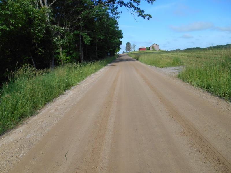
Road Information
Gravel
County Road
Road Condition: Good
Road Width at Culvert: 20 ft.
Location of Low Point: At Stream
Runoff Path: Ditch
Embankments
Upstream
Fill Depth: 3 ft.
Slope: More than 1:2
Downstream
Fill Depth: 3 ft.
Slope: More than 1:2
Approaches
Left Approach
Length: 400 ft.
Slope: 1% to 5%
Vegetation: Heavy
LS Factor: 0.48
Erosion: 1.0579 tons/year
Right Approach
Length: 300 ft.
Slope: Less Than 1%
Vegetation: Heavy
LS Factor: 0.05
Erosion: 0.0826 tons/year
Erosion Information
Total Erosion at Crossing: 1.1575 tons/year
Extent of Erosion: Minor
Notes: Embankment of inlet, left side facing downstream
Location of Erosion | Erosion Dimensions | Eroded Material | Material Eroded | Total Erosion | ||
facing downstream | Length | Width | Depth | Reaching Stream? | (tons/year) | |
Left Upstream Embankment |
10 ft. |
1 ft. |
2 ft. |
yes |
Silt |
0.017 |
Summary Information
Fish Passability 0.9
These non-native species were observerd at this site: a vine-like Nightshade
�