Road Stream Crossing Site LIN_MLCD024
Lincoln River Watershed, Drainage of South Branch of Lincoln River
Hansen Rd
Custer Twp,
Mason County
Information collected by:

Site Location
GPS Coordinates: 43.975833
, -86.182777
T18N
R16W
Sec 11
Owned by Private
Total Erosion: 0.4443 tons/year
Severity: Minor
Year Inventoried: 2019
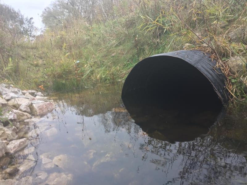
Outlet
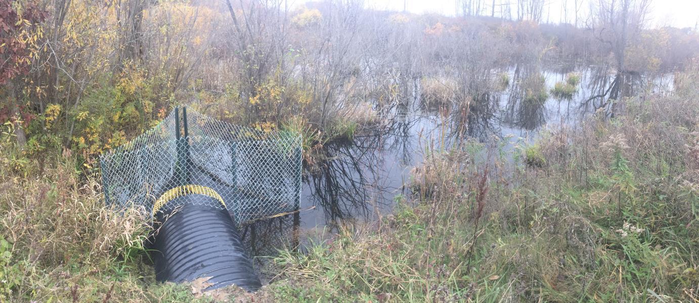
Upstream Conditions
Crossing Information
Type of Crossing: culvert(s)
Number of Structures: 1
Structure Shape: Round
Inlet Type: Trash Rack
Outlet Type: At Stream Grade
Structure Material: Metal
Structure Substrate: Rock
General Conditions: Good
Dimensions of Structure: Length 61 ft.
, Width 2.5 ft.
, Height 2.5 ft.
Structure Inlet
Water Depth: 1.6 ft.
Embedded Depth of Structure: 0 ft.
Structure Outlet
Water Depth: 1.1 ft.
Embedded Depth of Structure: 0.4 ft.
Water Velocity*: 0.6 ft./sec.
*Water Velocities were measured 0.4 ft. below Surface
(with Meter)
Additional Comments
Survey conducted less then 24 hours after rain event
Stream Information
Stream Flow: Less than Bankfull
Riffle Information
Water Depth: 0.6 ft.
Bankfull Width: 3.5 ft.
Wetted Width: 2 ft.
Water Velocity: 3.8 ft./sec.
(Measured with Meter)
Dominant Substrate: Organics
Road Information
Paved
County Road
Road Condition: Good
Road Width at Culvert: 21 ft.
Location of Low Point: At Stream
Runoff Path: Ditch
Embankments
Upstream
Fill Depth: 4 ft.
Slope: 1:1.5
Downstream
Fill Depth: 4 ft.
Slope: 1:1.5
Approaches
Left Approach
Length: 500 ft.
Slope: 1% to 5%
Vegetation: Partial
LS Factor: 0.64
Erosion: 0.2221 tons/year
Right Approach
Length: 500 ft.
Slope: 1% to 5%
Vegetation: Partial
LS Factor: 0.64
Erosion: 0.2221 tons/year
Erosion Information
Total Erosion at Crossing: 0.4443 tons/year
Summary Information
�