Road Stream Crossing Site LIN_MLCD025
Lincoln River Watershed, Cemetery Creek
US-31
Custer Twp,
Mason County
Information collected by:

Site Location
GPS Coordinates: 43.989444
, -86.275833
T18N
R16W
Sec 6
Owned by Private
Fish Passability 0.9
Total Erosion: 0.0745 tons/year
Severity: Minor
Year Inventoried: 2019
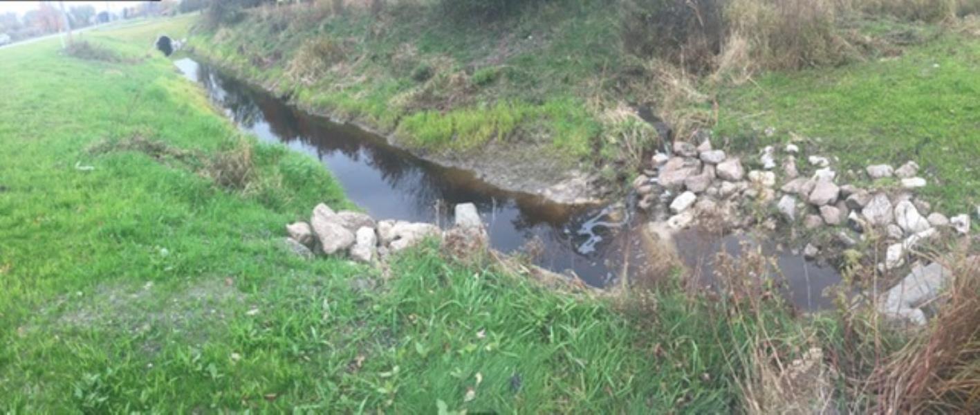
Upstream Conditions
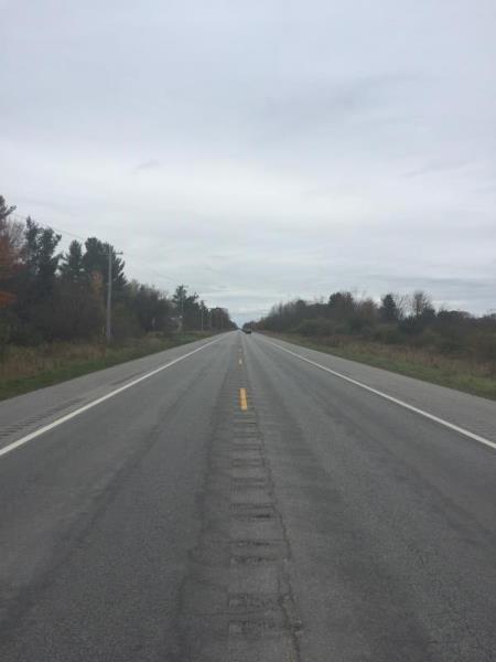
Road Approach - Left
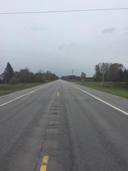
Road Approach - Right
Crossing Information
Type of Crossing: culvert(s)
Number of Structures: 1
Structure Shape: Square/Rectangle
Inlet Type: Wingwall 10-30 Degree
Outlet Type: Outlet Apron
Structure Material: Concrete
Structure Substrate: Sand
General Conditions: Fair
Structure Interior: smooth
Dimensions of Structure: Length 114 ft.
, Width 7.8 ft.
, Height 5.5 ft.
Structure Inlet
Water Depth: 0.5 ft.
Embedded Depth of Structure: 0.3 ft.
Water Velocity*: 1.2 ft./sec.
Structure Outlet
Water Depth: 0.7 ft.
Embedded Depth of Structure: 0.7 ft.
Water Velocity*: 1 ft./sec.
*Water Velocities were measured 0.3 ft. below Surface
(with Meter)
Additional Comments
Survey conducted less then 24 hours after rain event. This ditch received maintanence in summer 2019
Stream Information
Stream Flow: Less than Bankfull
Riffle Information
Water Depth: 0.6 ft.
Bankfull Width: 9 ft.
Wetted Width: 9 ft.
Water Velocity: 0.6 ft./sec.
(Measured with Meter)
Dominant Substrate: Clay
Road Information
Paved
Federal Road
Road Condition: Good
Road Width at Culvert: 41 ft.
Location of Low Point: Other
Runoff Path: Ditch
Embankments
Upstream
Fill Depth: 4 ft.
Slope: More than 1:2
Downstream
Fill Depth: 4 ft.
Slope: More than 1:2
Approaches
Left Approach
Length: 500 ft.
Slope: Less Than 1%
Vegetation: Partial
LS Factor: 0.055
Erosion: 0.0373 tons/year
Right Approach
Length: 500 ft.
Slope: Less Than 1%
Vegetation: Partial
LS Factor: 0.055
Erosion: 0.0373 tons/year
Erosion Information
Total Erosion at Crossing: 0.0745 tons/year
Summary Information
Fish Passability 0.9
�