Road Stream Crossing Site GTBAY_BRD009
Boardman River Watershed, Boardman River Tributary
Supply Road
Union Twp,
Grand Traverse County
Information collected by:
Site Location
GPS Coordinates: 44.677438
, -85.402573
T26N
R9W
Sec 04
Owned by Private
Fish Passability 0
Total Erosion: 0.1981 tons/year
Severity: Severe
Year Inventoried: 2020
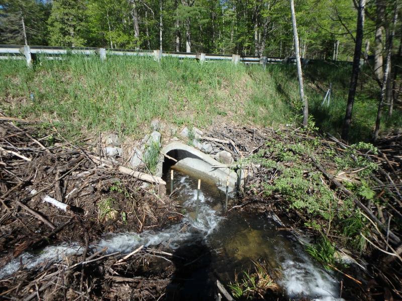
Inlet
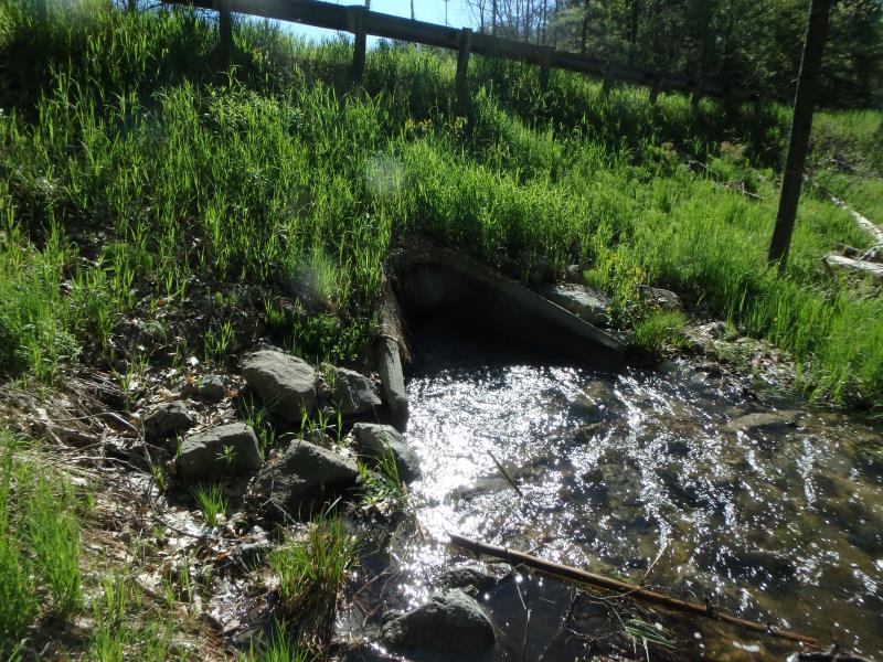
Outlet
Upstream Conditions
Upstream Conditions
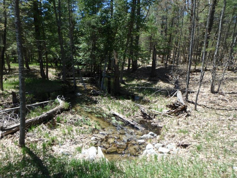
Downstream Conditions
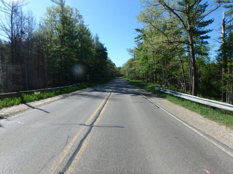
Road Approach - Left

Road Approach - Right
Crossing Information
Type of Crossing: culvert(s)
Structure Shape: Round
Inlet Type: Apron
Outlet Type: At Stream Grade
Structure Material: Concrete
Structure Substrate: Sand
General Conditions: Fair
Structure Interior: smooth
Dimensions of Structure: Length 55 ft.
, Width 3 ft.
, Height 3 ft.
Structure Inlet
Water Depth: 0.5 ft.
Embedded Depth of Structure: 0 ft.
Water Velocity*: 3.6 ft./sec.
Structure Outlet
Water Depth: 1 ft.
Embedded Depth of Structure: 0 ft.
Water Velocity*: 3.3 ft./sec.
*Water Velocities were measured 0.3 ft. below Surface
(with Meter)
Additional Comments
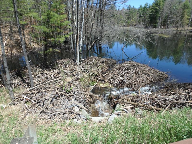
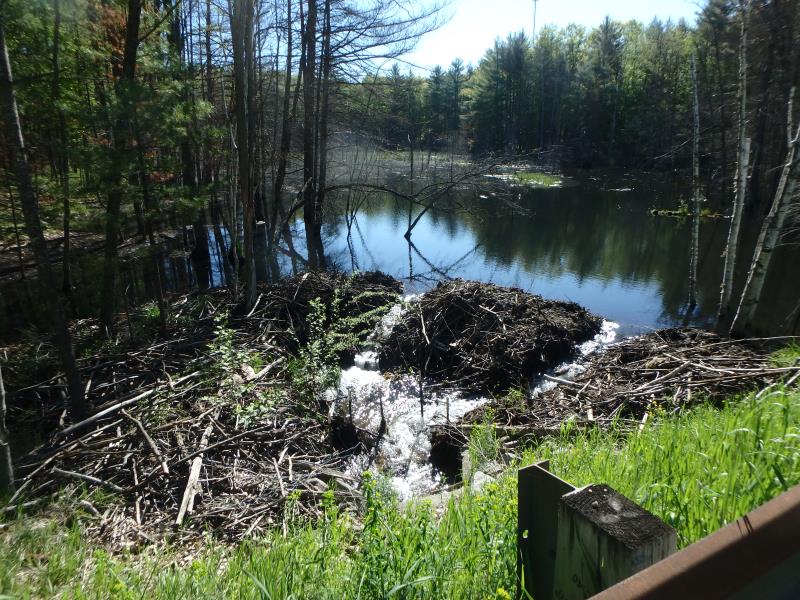
Major beaver activity. Flooding upstream
Stream Information
Stream Flow: More than Bankfull
Riffle Information
Water Depth: 1.2 ft.
Bankfull Width: 5 ft.
Wetted Width: 30 ft.
Water Velocity: 1.7 ft./sec.
(Measured with Meter)
Dominant Substrate: Sand
Road Information
Paved
County Road
Road Condition: Good
Road Width at Culvert: 23.5 ft.
Location of Low Point: Other
Runoff Path: Ditch
Embankments
Upstream
Fill Depth: 6 ft.
Slope: 1:1.5
Downstream
Fill Depth: 7 ft.
Slope: 1:1.5
Approaches
Left Approach
Length: 100 ft.
Slope: Less Than 1%
Vegetation: Heavy
LS Factor: 0.05
Erosion: 0.0039 tons/year
Right Approach
Length: 500 ft.
Slope: 1% to 5%
Vegetation: Heavy
LS Factor: 0.5
Erosion: 0.1942 tons/year
Erosion Information
Total Erosion at Crossing: 0.1981 tons/year
Summary Information
Fish Passability 0
These non-native species were observerd at this site: Reed Canary Grass
�