Road Stream Crossing Site GTBAY_BRD010
Boardman River Watershed, S Branch Boardman River
Brown Bridge Rd
Union Twp,
Grand Traverse County
Information collected by:
Site Location
GPS Coordinates: 44.656788
, -85.438489
T26N
R9W
Sec 18
Owned by Private
Fish Passability 1
Total Erosion: 0.0417 tons/year
Severity: Minor
Year Inventoried: 2020
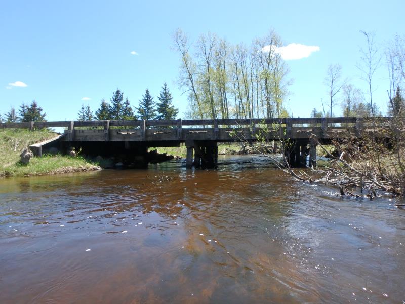
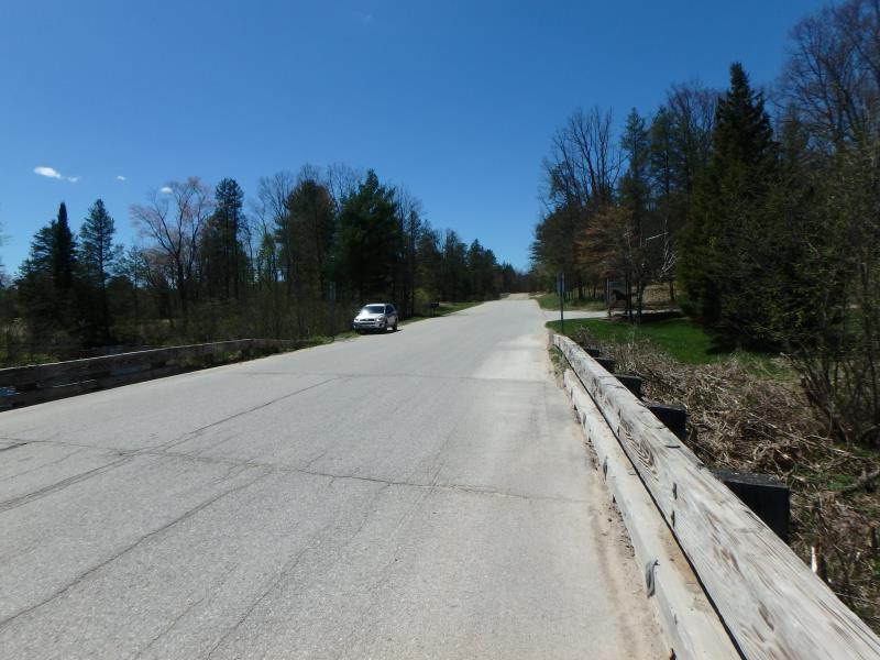
Inlet
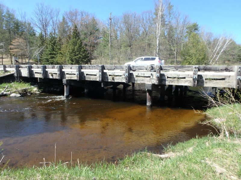
Outlet
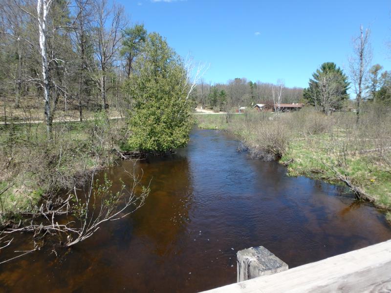
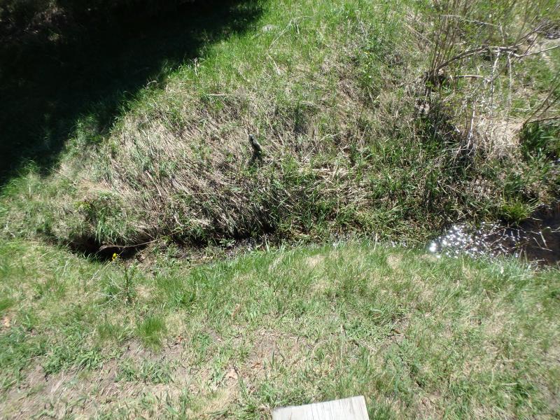
Upstream Conditions
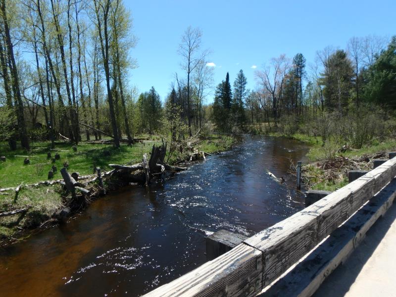
Downstream Conditions
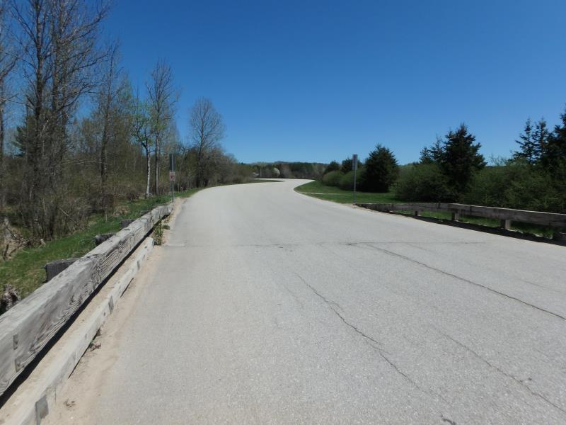
Road Approach - Left
Road Approach - Right
Other
Crossing Information
Type of Crossing: Bridge
Structure Shape: Open Bottom Square/Rectangle
Inlet Type: Wingwall 30-70 Degree
Outlet Type: At Stream Grade
Structure Material: Wood
Structure Substrate: Sand
General Conditions: Good
Structure Interior: smooth
Dimensions of Structure: Length 33 ft.
, Width 60 ft.
, Height 8 ft.
Structure Inlet
Water Depth: 3 ft.
Embedded Depth of Structure: 0 ft.
Water Velocity*: 3.7 ft./sec.
Structure Outlet
Water Depth: 3 ft.
Embedded Depth of Structure: 0 ft.
Water Velocity*: 4.8 ft./sec.
*Water Velocities were measured 1.8 ft. below Surface
(with Meter)
Additional Comments
Next to Ranch Rudolf. Structure width greater than bank full and structure water velocity in line with riffle water velocity. �Severity score equals 12 so considered minor.
Stream Information
Stream Flow: Less than Bankfull
Riffle Information
Water Depth: 2.5 ft.
Bankfull Width: 36 ft.
Wetted Width: 35 ft.
Water Velocity: 3.7 ft./sec.
(Measured with Meter)
Dominant Substrate: Gravel
Road Information
Paved
County Road
Road Condition: Good
Road Width at Culvert: 31 ft.
Location of Low Point: Other
Runoff Path: Ditch
Embankments
Upstream
Fill Depth: 1 ft.
Slope: Vertical
Downstream
Fill Depth: 1 ft.
Slope: Vertical
Approaches
Left Approach
Length: 50 ft.
Slope: Less Than 1%
Vegetation: Heavy
LS Factor: 0.05
Erosion: 0.0026 tons/year
Right Approach
Length: 100 ft.
Slope: Less Than 1%
Vegetation: Heavy
LS Factor: 0.05
Erosion: 0.0051 tons/year
Erosion Information
Total Erosion at Crossing: 0.0417 tons/year
Extent of Erosion: Minor
Location of Erosion | Erosion Dimensions | Eroded Material | Material Eroded | Total Erosion | ||
facing downstream | Length | Width | Depth | Reaching Stream? | (tons/year) | |
Left Downstream Embankment |
17 ft. |
1 ft. |
2 ft. |
yes |
Gravelly Loam |
0.034 |
Summary Information
Fish Passability 1
�