Road Stream Crossing Site GTBAY_BRD015
Boardman River Watershed, Boardman River
Shumsky Rd
Blair Twp,
Grand Traverse County
Information collected by:
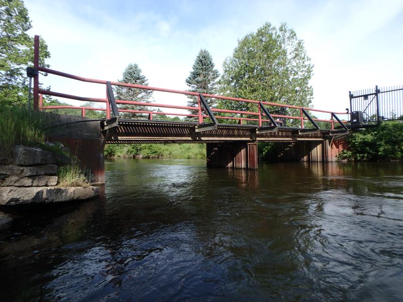
Site Location
GPS Coordinates: 44.648233
, -85.587706
T26N
R11W
Sec 13
Owned by Private
Fish Passability 0.9
Total Erosion: 0.0093 tons/year
Severity: Minor
Year Inventoried: 2020
Inlet
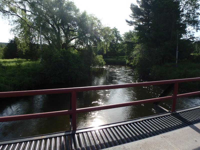
Upstream Conditions
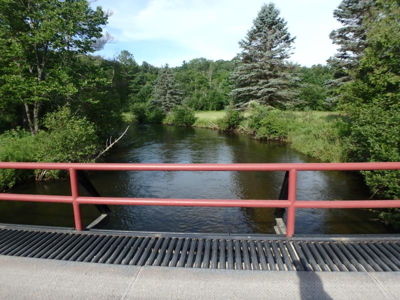
Downstream Conditions
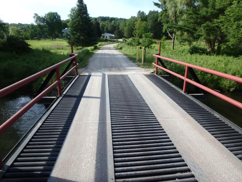
Road Approach - Left
Road Approach - Right
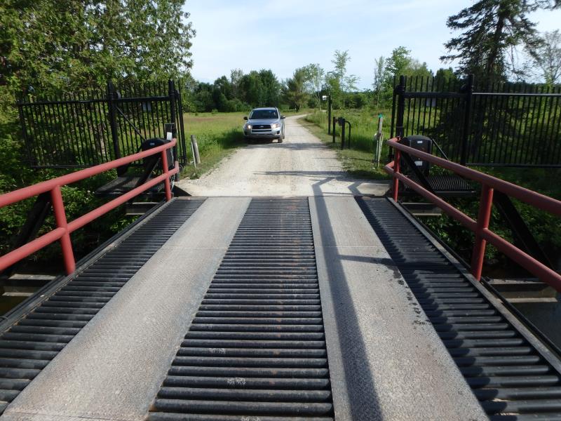
Crossing Information
Type of Crossing: Bridge
Structure Shape: Open Bottom Square/Rectangle
Inlet Type: Headwall
Outlet Type: At Stream Grade
Structure Material: Metal
Structure Substrate: Sand
General Conditions: Good
Structure Interior: corrugated
Dimensions of Structure: Length 13.5 ft.
, Width 37 ft.
, Height 6.5 ft.
Structure Inlet
Water Depth: 4 ft.
Embedded Depth of Structure: 0 ft.
Water Velocity*: 3.2 ft./sec.
Structure Outlet
Water Depth: 4 ft.
Embedded Depth of Structure: 0 ft.
Water Velocity*: 3.2 ft./sec.
*Water Velocities were measured 2.4 ft. below Surface
(with Meter)
Additional Comments
Structure wide and structure water velocity in line with riffle water velocities in system.� Severity score equals 10 so considered minor.
Stream Information
Stream Flow: Less than Bankfull
Riffle Information
Water Depth: 3.5 ft.
Bankfull Width: 51 ft.
Wetted Width: 45 ft.
Water Velocity: 1.9 ft./sec.
(Measured with Meter)
Dominant Substrate: Sand
Road Information
Gravel
Private Road
Road Condition: Good
Road Width at Culvert: 13.5 ft.
Location of Low Point: Other
Runoff Path: Ditch
Fill Depth: 0 ft.
Slope: Vertical
Fill Depth: 0 ft.
Slope: Vertical
Approaches
Left Approach
Length: 25 ft.
Slope: Less Than 1%
Vegetation: Partial
LS Factor: 0.05
Erosion: 0.0046 tons/year
Right Approach
Length: 25 ft.
Slope: Less Than 1%
Vegetation: Heavy
LS Factor: 0.05
Erosion: 0.0046 tons/year
Erosion Information
Total Erosion at Crossing: 0.0093 tons/year
Summary Information
Fish Passability 0.9
�