Road Stream Crossing Site GTBAY_BRD016
Boardman River Watershed, Boardman River
Boardman Acre Drive
Blair Twp,
Grand Traverse County
Information collected by:
Site Location
GPS Coordinates: 44.650056
, -85.590199
T26N
R11W
Sec 13
Owned by State
Private
Private
Fish Passability 1
Total Erosion: 0.2877 tons/year
Severity: Minor
Year Inventoried: 2020
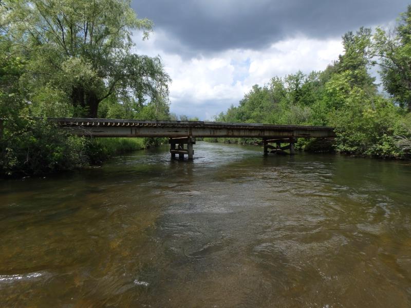
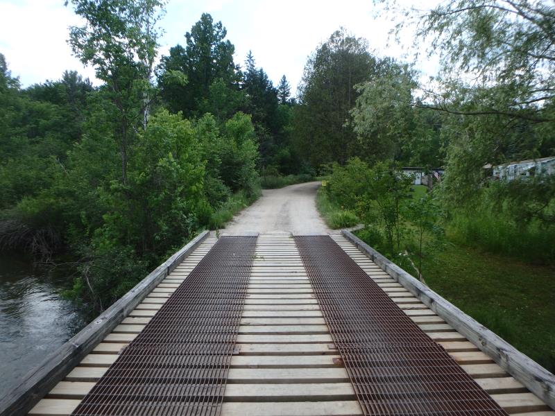
Inlet
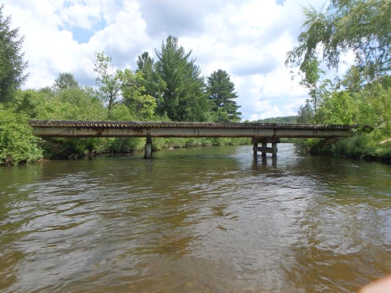
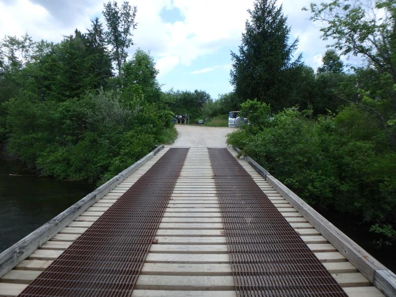
Outlet
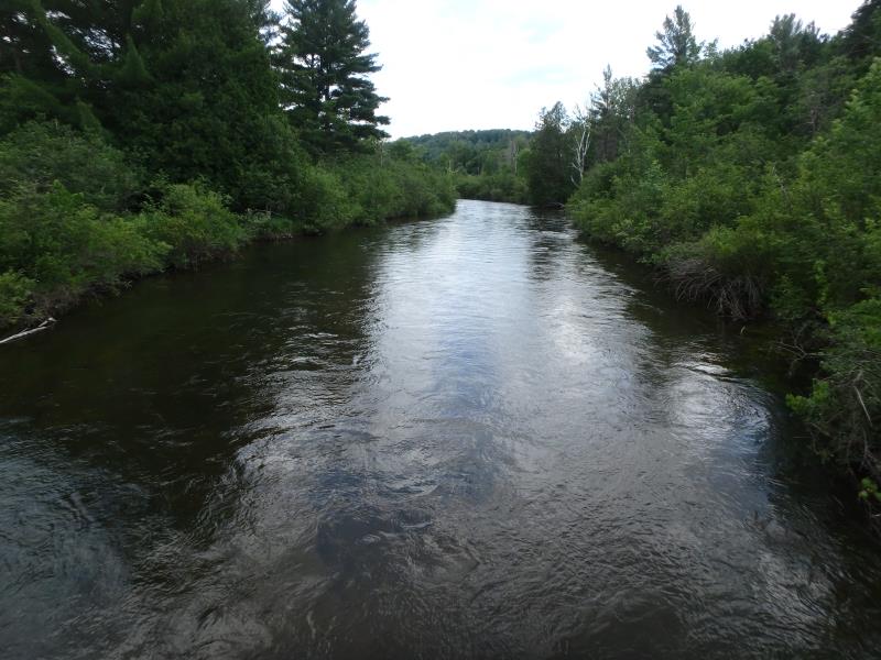
Upstream Conditions
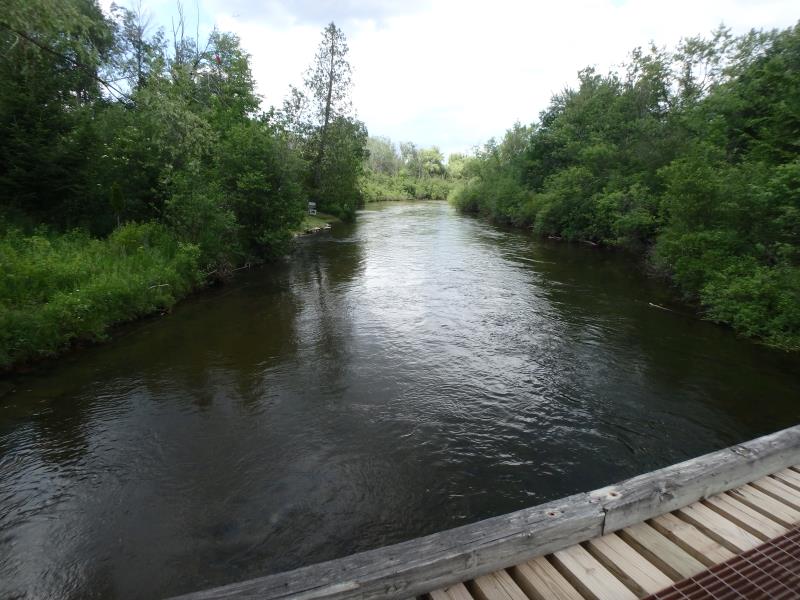
Downstream Conditions
Road Approach - Left
Road Approach - Right
Crossing Information
Type of Crossing: Bridge
Structure Shape: Open Bottom Square/Rectangle
Inlet Type: Headwall
Outlet Type: At Stream Grade
Structure Material: Wood
Structure Substrate: Sand
General Conditions: Fair
Structure Interior: corrugated
Dimensions of Structure: Length 70 ft.
, Width 12 ft.
, Height 7 ft.
Structure Inlet
Water Depth: 3.2 ft.
Embedded Depth of Structure: 0 ft.
Water Velocity*: 2.3 ft./sec.
Structure Outlet
Water Depth: 3.1 ft.
Embedded Depth of Structure: 0 ft.
Water Velocity*: 2.3 ft./sec.
*Water Velocities were measured 1.8 ft. below Surface
(with Meter)
Additional Comments
Structure width greater than bank full and structure water velocity in line with riffle water velocity. �Severity score equals 14 so considered minor.
Stream Information
Stream Flow: Less than Bankfull
Riffle Information
Water Depth: 2 ft.
Bankfull Width: 64 ft.
Wetted Width: 60 ft.
Water Velocity: 2.8 ft./sec.
(Measured with Meter)
Dominant Substrate: Gravel
Road Information
Gravel
County Road
Road Condition: Fair
Road Width at Culvert: 11 ft.
Location of Low Point: At Stream
Runoff Path: Ditch
Fill Depth: 0 ft.
Slope: Vertical
Fill Depth: 0 ft.
Slope: Vertical
Approaches
Left Approach
Length: 200 ft.
Slope: 1% to 5%
Vegetation: Heavy
LS Factor: 0.43
Erosion: 0.2606 tons/year
Right Approach
Length: 30 ft.
Slope: 1% to 5%
Vegetation: Heavy
LS Factor: 0.298
Erosion: 0.0271 tons/year
Erosion Information
Total Erosion at Crossing: 0.2877 tons/year
Summary Information
Fish Passability 1
These non-native species were observerd at this site: Purple Loosestrife, Sweet White Clover
�