Road Stream Crossing Site GTBAY_LEE046
West Bay Shoreline & Tributaries Watershed, Unnamed
M-22
Leelanau Twp,
Leelanau County
Information collected by:
Site Location
GPS Coordinates: 45.00244592
, -85.63196495
T30N
R11W
Sec 15
Owned by Private
Fish Passability 0
Perch Height: 2.9 ft.
Total Erosion: 3.7247 tons/year
Severity: Severe
Year Inventoried: 2020
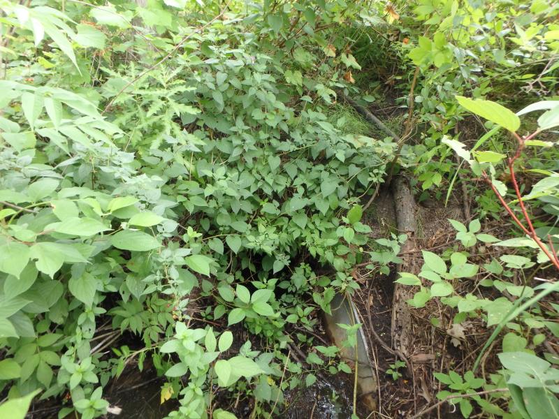
Inlet
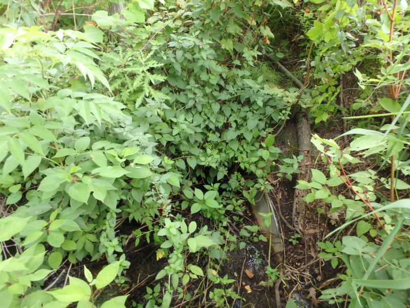
Inlet
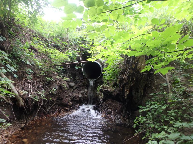
Outlet
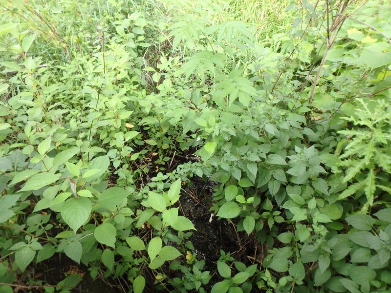
Upstream Conditions
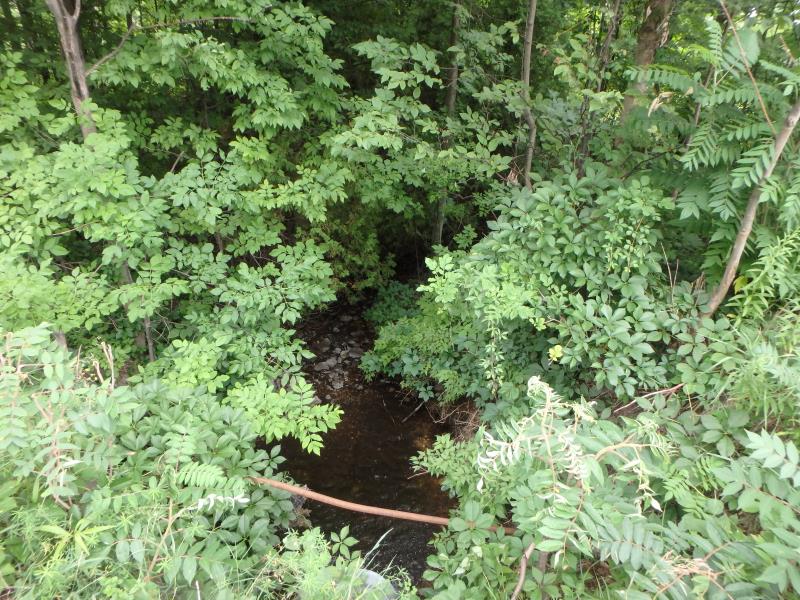
Downstream Conditions
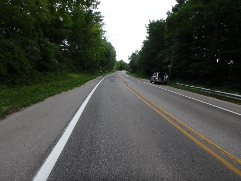
Road Approach - Left
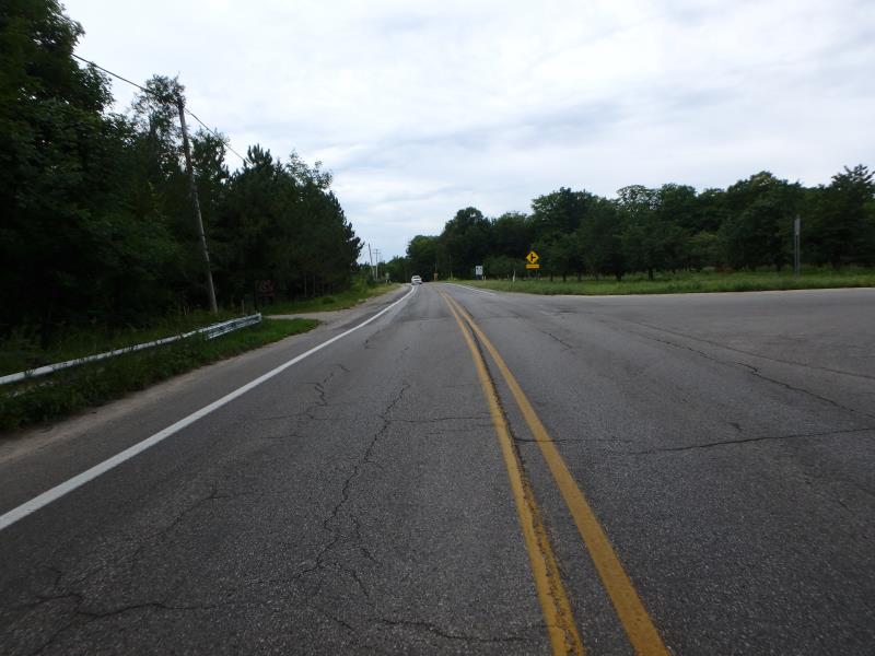
Road Approach - Right
Crossing Information
Type of Crossing: culvert(s)
Number of Structures: 1
Structure Shape: Round
Inlet Type: Apron
Outlet Type: Freefall onto Riprap
Structure Material: Metal
Structure Substrate: None
General Conditions: Good
Structure Interior: corrugated
Dimensions of Structure: Length 60 ft.
, Width 2.1 ft.
, Height 2.1 ft.
Perch Height: 2.9 ft.
Structure Inlet
Water Depth: 0.2 ft.
Embedded Depth of Structure: 0 ft.
Water Velocity*: 1.8 ft./sec.
Structure Outlet
Water Depth: 0.1 ft.
Embedded Depth of Structure: 0 ft.
Water Velocity*: 4.4 ft./sec.
*Water Velocities were measured 0.1 ft. below Surface
(with Meter)
Stream Information
Stream Flow: Less than 1/2 Bankfull
Scour Pool: Length 10.6 ft.
, Width 8.7 ft.
, Depth 1.5 ft.
Riffle Information
Water Depth: 0.1 ft.
Bankfull Width: 4.5 ft.
Wetted Width: 3.4 ft.
Water Velocity: 1.3 ft./sec.
(Measured with Meter)
Dominant Substrate: Gravel
Road Information
Paved
State Road
Road Width at Culvert: 37.5 ft.
Location of Low Point: Other
Runoff Path: Ditch
Embankments
Upstream
Fill Depth: 3.2 ft.
Slope: 1:2
Downstream
Fill Depth: 4.5 ft.
Slope: 1:1
Approaches
Left Approach
Length: 25 ft.
Slope: Less Than 1%
Vegetation: Heavy
LS Factor: 0.05
Erosion: 0.0015 tons/year
Right Approach
Length: 75 ft.
Slope: 1% to 5%
Vegetation: Heavy
LS Factor: 0.36
Erosion: 0.0335 tons/year
Erosion Information
Total Erosion at Crossing: 3.7247 tons/year
Extent of Erosion: Severe
Erosion is occurring and corrective actions can be installed to address the problem.
Location of Erosion | Erosion Dimensions | Eroded Material | Material Eroded | Total Erosion | ||
facing downstream | Length | Width | Depth | Reaching Stream? | (tons/year) | |
Right Downstream Embankment |
7.4 ft. |
4.6 ft. |
11.7 ft. |
yes |
Sand |
1.9048 |
Left Downstream Embankment |
6.1 ft. |
8.1 ft. |
13.3 ft. |
yes |
Sand |
1.7849 |
Summary Information
Fish Passability 0
Fish Passage is an area of concern for this site.
Large Drop
These non-native species were observerd at this site: Bladder Campion
�