Road Stream Crossing Site GTBAY_LEE052
West Bay Shoreline & Tributaries Watershed, Unnamed
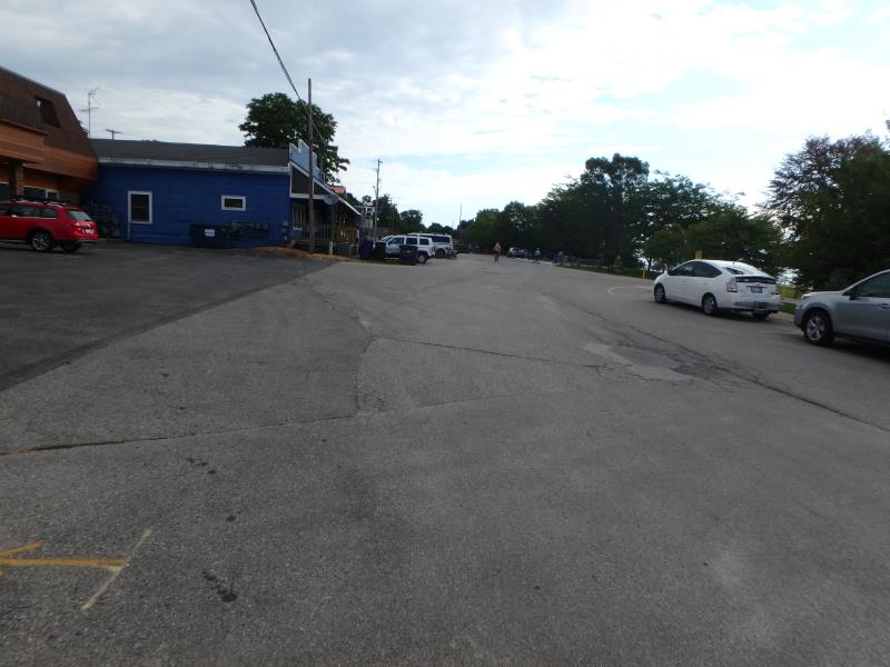
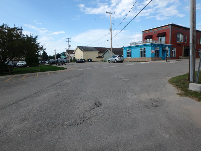
Front Street
Suttons Bay Twp,
Leelanau County
Information collected by:
Site Location
GPS Coordinates: 44.97696519
, -85.65037278
T30N
R11W
Sec 28
Owned by Local Government
Private
Private
Fish Passability 0
Total Erosion: 0.08 tons/year
Severity: Severe
Year Inventoried: 2020
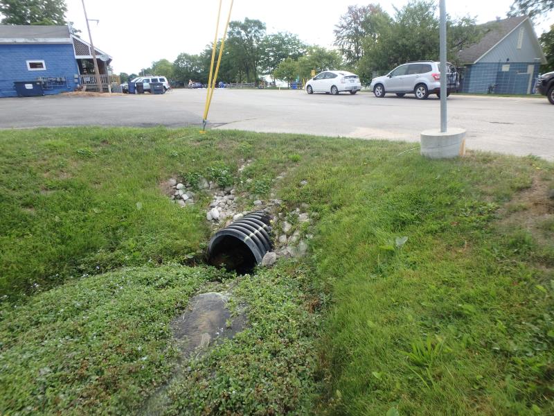
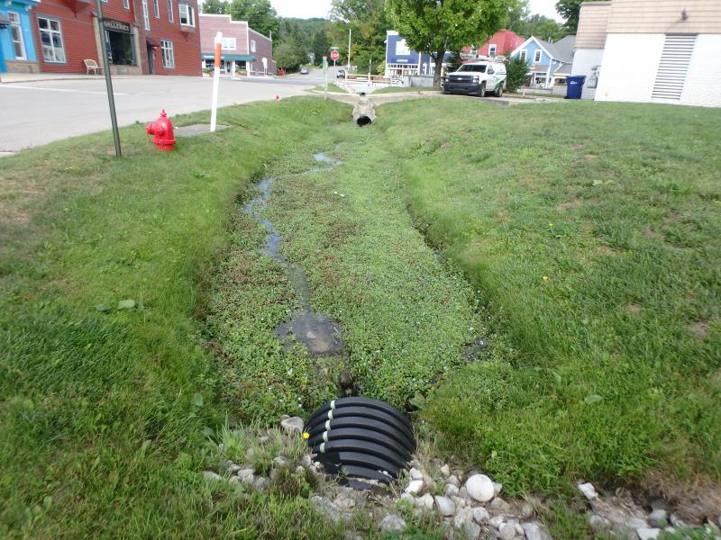
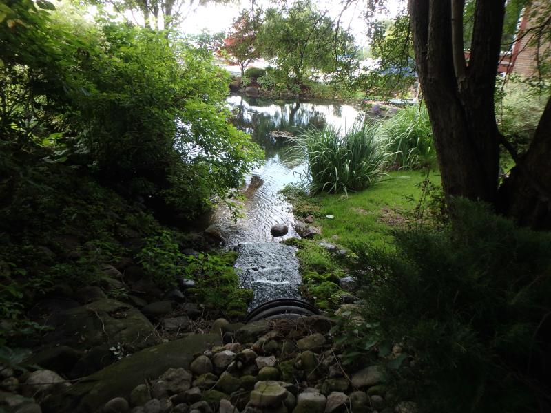
Inlet
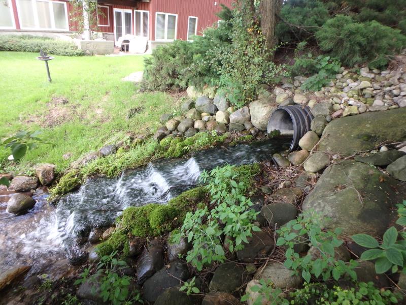
Outlet
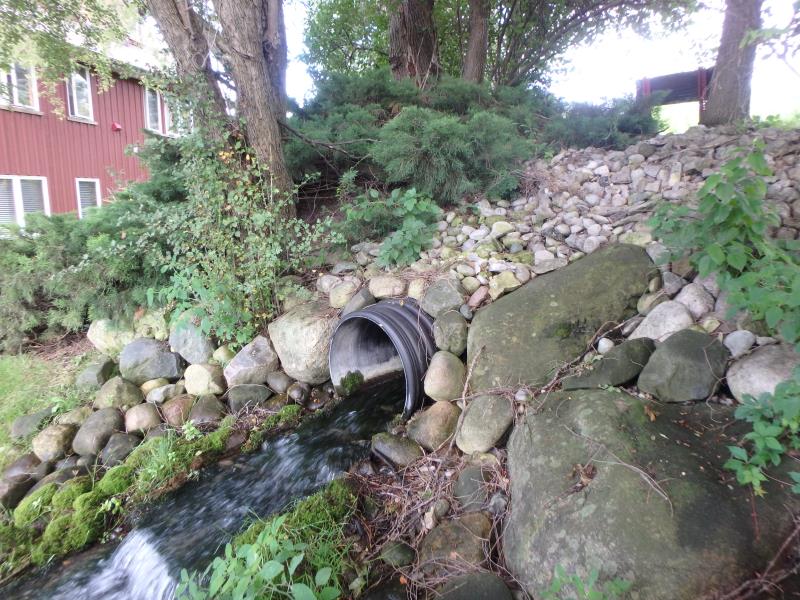
Outlet
Upstream Conditions
Downstream Conditions
Road Approach - Left
Road Approach - Right
Crossing Information
Type of Crossing: culvert(s)
Number of Structures: 1
Structure Shape: Round
Inlet Type: Projecting
Outlet Type: Cascade over Riprap
Structure Material: Plastic
Structure Substrate: None
General Conditions: Good
Structure Interior: smooth
Dimensions of Structure: Length 133.6 ft.
, Width 2 ft.
, Height 2 ft.
Structure Inlet
Water Depth: 0.4 ft.
Embedded Depth of Structure: 0 ft.
Water Velocity*: 1.4 ft./sec.
Structure Outlet
Water Depth: 0.2 ft.
Embedded Depth of Structure: 0 ft.
Water Velocity*: 3.9 ft./sec.
*Water Velocities were measured at the Surface
(with Meter)
Stream Information
Stream Flow: Less than 1/2 Bankfull
Riffle Information
Water Depth: 0.3 ft.
Bankfull Width: 5.2 ft.
Wetted Width: 4.5 ft.
Water Velocity: 0.4 ft./sec.
(Measured with Meter)
Dominant Substrate: Organics
Road Information
Paved
Town Road
Road Condition: Fair
Road Width at Culvert: 44 ft.
Location of Low Point: At Stream
Runoff Path: Roadway
Embankments
Upstream
Fill Depth: 1.9 ft.
Slope: Less than 1:2
Downstream
Fill Depth: 3.4 ft.
Slope: 1:2
Approaches
Left Approach
Length: 100 ft.
Slope: 1% to 5%
Vegetation: Partial
LS Factor: 0.39
Erosion: 0.0567 tons/year
Right Approach
Length: 50 ft.
Slope: 1% to 5%
Vegetation: Partial
LS Factor: 0.32
Erosion: 0.0233 tons/year
Erosion Information
Total Erosion at Crossing: 0.08 tons/year
Erosion is occurring and corrective actions can be installed to address the problem.
Summary Information
Fish Passability 0
Fish Passage is an area of concern for this site.
outlets onto steps
�