Road Stream Crossing Site GTBAY_LEE068
West Bay Shoreline & Tributaries Watershed, Northport Creek
W Third Street
Leelanau Twp,
Leelanau County
Information collected by:
Site Location
GPS Coordinates: 45.1311503
, -85.61786508
T32N
R11W
Sec 34
Owned by Local Government
Fish Passability 0
Perch Height: 3.85 ft.
Total Erosion: 10.5577 tons/year
Severity: Severe
Year Inventoried: 2020
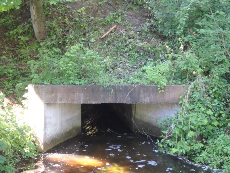
Inlet
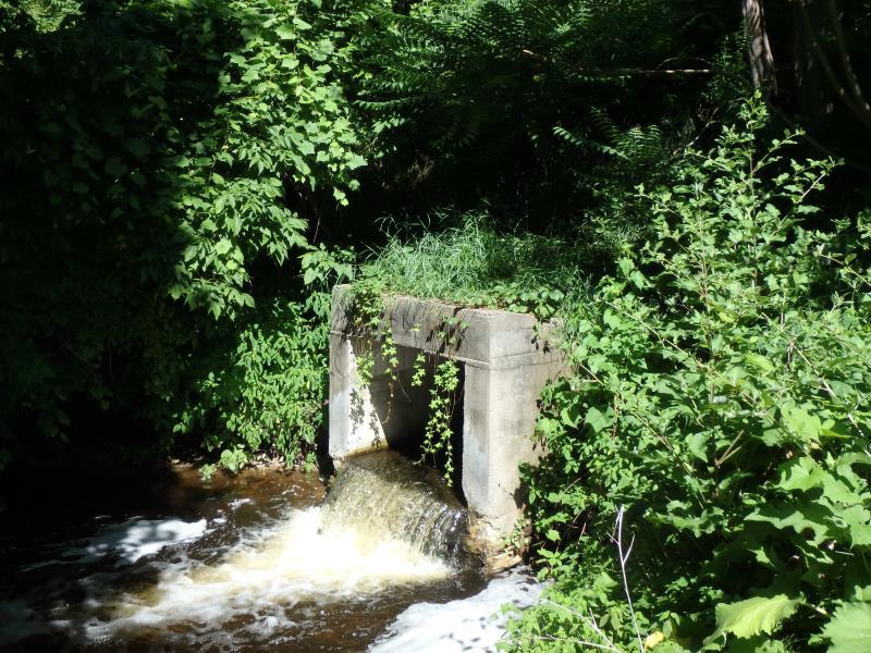
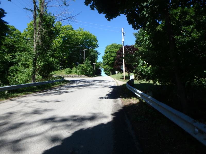
Outlet
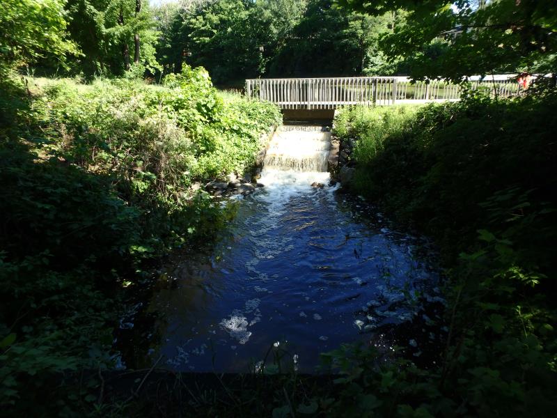
Upstream Conditions
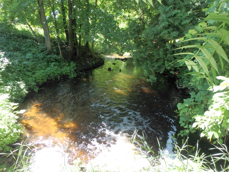
Downstream Conditions
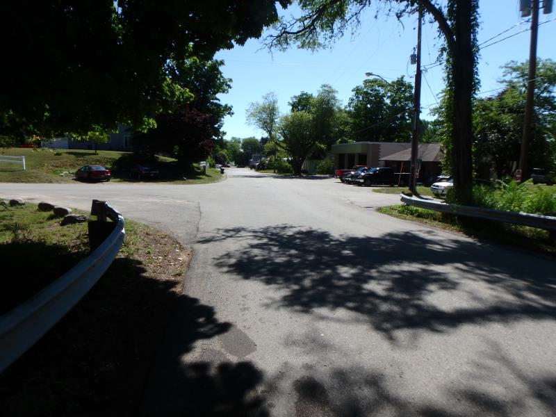
Road Approach - Left
Road Approach - Right
Crossing Information
Type of Crossing: culvert(s)
Number of Structures: 1
Structure Shape: Square/Rectangle
Inlet Type: Wingwall 30-70 Degree
Outlet Type: Freefall into Pool
Structure Material: Concrete
Structure Substrate: None
General Conditions: Good
Structure Interior: smooth
Dimensions of Structure: Length 75 ft.
, Width 7 ft.
, Height 3.85 ft.
Perch Height: 3.85 ft.
Structure Inlet
Water Depth: 0.8 ft.
Embedded Depth of Structure: 0 ft.
Water Velocity*: 3.7 ft./sec.
Structure Outlet
Water Depth: 0.2 ft.
Embedded Depth of Structure: 0 ft.
Water Velocity*: 3.2 ft./sec.
*Water Velocities were measured 0.1 ft. below Surface
(with Meter)
Stream Information
Stream Flow: Less than 1/2 Bankfull
Scour Pool: Length 32 ft.
, Width 28.7 ft.
, Depth 1.5 ft.
Upstream Pond: Length 29.7 ft.
, Width 21.2 ft.
, Depth 0.3 ft.
Riffle Information
Water Depth: 0.1 ft.
Bankfull Width: 27.9 ft.
Wetted Width: 15.4 ft.
Water Velocity: 1.7 ft./sec.
Dominant Substrate: Gravel
Road Information
Paved
Town Road
Road Condition: Fair
Road Width at Culvert: 24 ft.
Location of Low Point: Other
Runoff Path: Roadway
Embankments
Upstream
Fill Depth: 8.7 ft.
Slope: Vertical
Downstream
Fill Depth: 11.5 ft.
Slope: Vertical
Approaches
Left Approach
Length: 20 ft.
Slope: 1% to 5%
Vegetation: Partial
LS Factor: 0.235
Erosion: 0.0037 tons/year
Right Approach
Length: 759 ft.
Slope: 6% to 10%
Vegetation: Heavy
LS Factor: 1.875
Erosion: 1.1292 tons/year
Erosion Information
Total Erosion at Crossing: 10.5577 tons/year
Extent of Erosion: Severe
Erosion is occurring and corrective actions can be installed to address the problem.
Notes: Put in steps/planting. May be sand dumping.
Location of Erosion | Erosion Dimensions | Eroded Material | Material Eroded | Total Erosion | ||
facing downstream | Length | Width | Depth | Reaching Stream? | (tons/year) | |
Right Upstream Embankment |
11.9 ft. |
20.7 ft. |
36 ft. |
yes |
Sand |
9.4248 |
Summary Information
Fish Passability 0
Fish Passage is an area of concern for this site.
Downstream perch will make fish passage diffiucult and erosion issues
�