Road Stream Crossing Site GTBAY_LEE072
West Bay Shoreline & Tributaries Watershed, Unnamed
Woolsey Lake Rd
Leelanau Twp,
Leelanau County
Information collected by:
Site Location
GPS Coordinates: 45.16315945
, -85.56441167
T32N
R11W
Sec 24
Owned by State
Fish Passability 1
Severity: Moderate
Year Inventoried: 2020
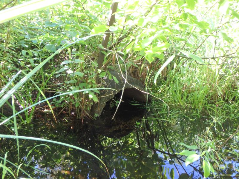
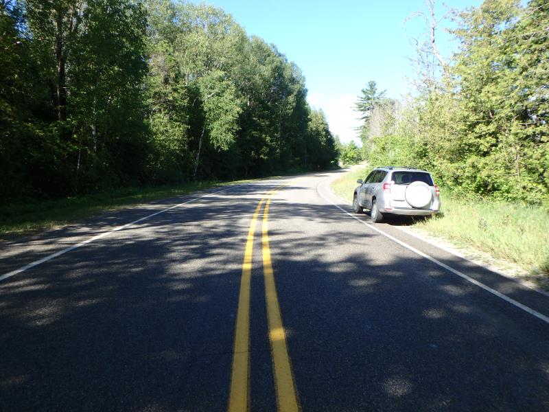
Inlet
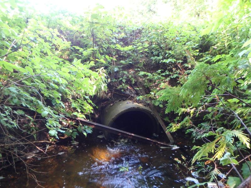
Outlet
Upstream Conditions
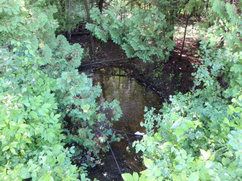
Downstream Conditions
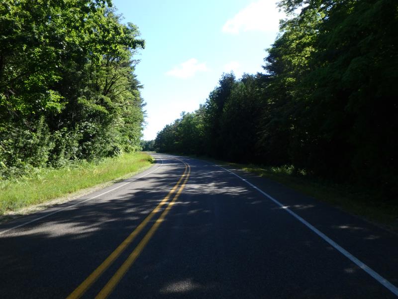
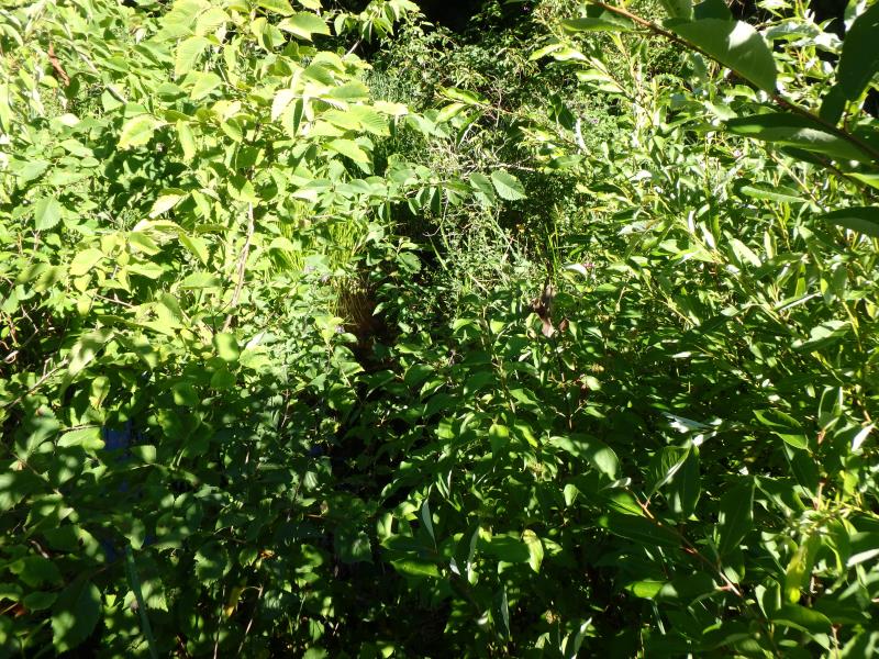
Road Approach - Left
Road Approach - Right
Crossing Information
Type of Crossing: culvert(s)
Number of Structures: 1
Structure Shape: Round
Inlet Type: Projecting
Outlet Type: At Stream Grade
Structure Material: Concrete
Structure Substrate: None
General Conditions: Fair
Structure Interior: smooth
Dimensions of Structure: Length 55.9 ft.
, Width 2.05 ft.
, Height 2.25 ft.
Structure Inlet
Water Depth: 1.05 ft.
Embedded Depth of Structure: 0 ft.
Water Velocity*: 6 ft./sec.
Structure Outlet
Water Depth: 0.5 ft.
Embedded Depth of Structure: 0 ft.
Water Velocity*: 0.1 ft./sec.
*Water Velocities were measured 0.5 ft. below Surface
(with Meter)
Additional Comments
Possible typo on inlet velocity. Looks like it should be .6 instead of 6. based on double check of inlet velocity it is .1. change severity to moderate and passabiliy to 1.
Stream Information
Stream Flow: Less than 1/2 Bankfull
Scour Pool: Length 14.8 ft.
, Width 14.8 ft.
, Depth 1.8 ft.
Upstream Pond: Length 20.9 ft.
, Width 18.5 ft.
, Depth 1.15 ft.
Riffle Information
Water Depth: 0.11 ft.
Bankfull Width: 6.8 ft.
Wetted Width: 5.8 ft.
Water Velocity: 0.9 ft./sec.
(Measured with Meter)
Dominant Substrate: Gravel
Road Information
Paved
County Road
Road Condition: Good
Road Width at Culvert: 34.7 ft.
Location of Low Point: At Stream
Runoff Path: Roadway
Embankments
Upstream
Fill Depth: 1.8 ft.
Slope: Less than 1:2
Downstream
Fill Depth: 4.6 ft.
Slope: 1:2
Approaches
Left Approach
Length: 592 ft.
Slope: 1% to 5%
Vegetation: Heavy
LS Factor: 0.518
Length: 1221 ft.
Slope: 1% to 5%
Vegetation: Heavy
Erosion Information
Extent of Erosion: Severe
Notes: Steep bank, severe erosion, exposed roots near culvert
Location of Erosion | Erosion Dimensions | Eroded Material | Material Eroded | Total Erosion | ||
facing downstream | Length | Width | Depth | Reaching Stream? | (tons/year) | |
Left Downstream Embankment |
3.7 ft. |
4.4 ft. |
2.3 ft. |
yes |
Sand |
0.1872 |
Left Downstream Embankment |
4.4 ft. |
3.3 ft. |
0.8 ft. |
yes |
Sand |
0.0774 |
Summary Information
Fish Passability 1
Erosion is an area of concern for this site.
�