Road Stream Crossing Site GTBAY_LEE073
West Bay Shoreline & Tributaries Watershed, Unnamed
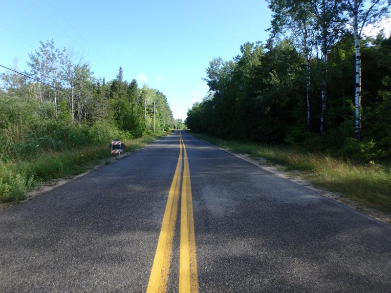
Seven Pines Rd
Leelanau Twp,
Leelanau County
Information collected by:
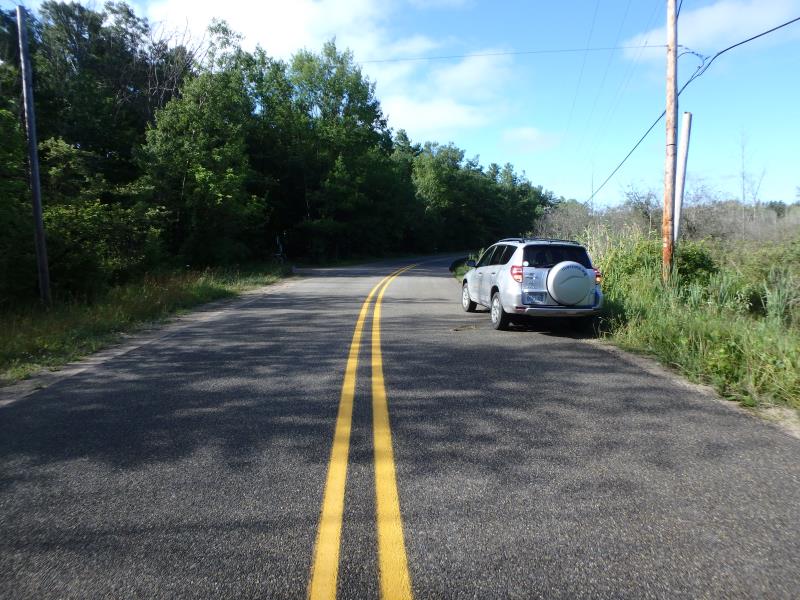
Site Location
GPS Coordinates: 45.16321586
, -85.56439097
T32N
R10W
Sec 19
Owned by State
Private
Private
Fish Passability 0.9
Total Erosion: 0.2845 tons/year
Severity: Moderate
Year Inventoried: 2020
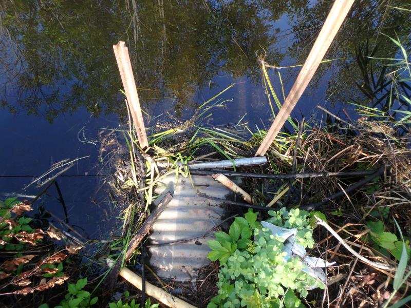
Inlet
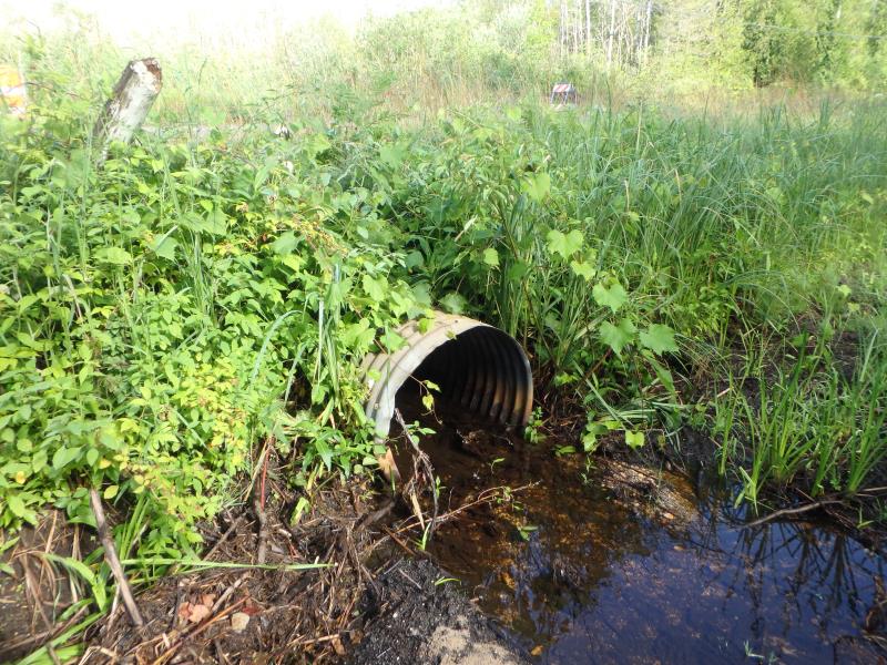
Outlet
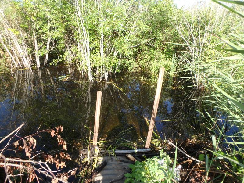
Upstream Conditions
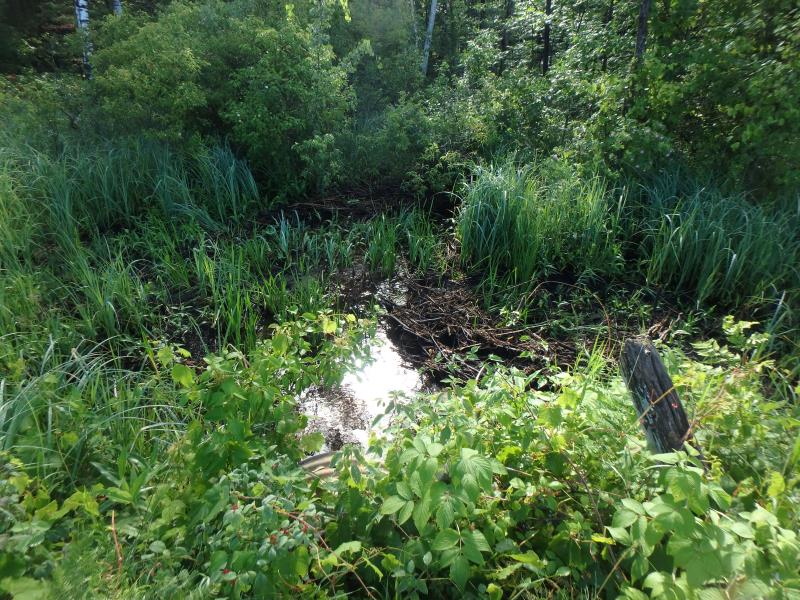
Downstream Conditions
Road Approach - Left
Road Approach - Right
Other
Crossing Information
Type of Crossing: culvert(s)
Number of Structures: 1
Structure Shape: Round
Inlet Type: Trash Rack
Outlet Type: At Stream Grade
Structure Material: Metal
Structure Substrate: Gravel
General Conditions: Fair
Structure Interior: corrugated
Dimensions of Structure: Length 49.85 ft.
, Width 2.3 ft.
, Height 2.5 ft.
Percentage Plugged:
Inlet: 51% to 75%
Outlet: 0%
In Pipe: 0%
Structure Inlet
Water Depth: 0.9 ft.
Embedded Depth of Structure: 0.9 ft.
Water Velocity*: 0.2 ft./sec.
Structure Outlet
Water Depth: 0.5 ft.
Embedded Depth of Structure: 0.2 ft.
Water Velocity*: 1.3 ft./sec.
*Water Velocities were measured 0.3 ft. below Surface
(with Meter)
Stream Information
Stream Flow: Less than 1/2 Bankfull
Riffle Information
Water Depth: 0.4 ft.
Bankfull Width: 6 ft.
Wetted Width: 2 ft.
Water Velocity: 0.8 ft./sec.
(Measured with Meter)
Dominant Substrate: Sand
Road Information
Paved
County Road
Road Condition: Fair
Road Width at Culvert: 29 ft.
Location of Low Point: At Stream
Runoff Path: Roadway
Embankments
Upstream
Fill Depth: 0.65 ft.
Slope: Less than 1:2
Downstream
Fill Depth: 1.9 ft.
Slope: 1:2
Approaches
Left Approach
Length: 510.6 ft.
Slope: 1% to 5%
Vegetation: Heavy
LS Factor: 0.502
Erosion: 0.2458 tons/year
Right Approach
Length: 100 ft.
Slope: 1% to 5%
Vegetation: Heavy
LS Factor: 0.38
Erosion: 0.0364 tons/year
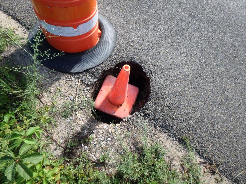
Erosion Information
Total Erosion at Crossing: 0.2845 tons/year
Extent of Erosion: Minor
Erosion is occurring and corrective actions can be installed to address the problem.
Location of Erosion | Erosion Dimensions | Eroded Material | Material Eroded | Total Erosion | ||
facing downstream | Length | Width | Depth | Reaching Stream? | (tons/year) | |
Right Downstream Embankment |
1.4 ft. |
2.5 ft. |
1.5 ft. |
yes |
Sand |
0.0023 |
Summary Information
Fish Passability 0.9
Fish Passage is an area of concern for this site.
These non-native species were observerd at this site: Phragmites, Spotted Knapweed
�