Road Stream Crossing Site GTBAY_MC004
Mitchell Creek Watershed, Mitchell Creek
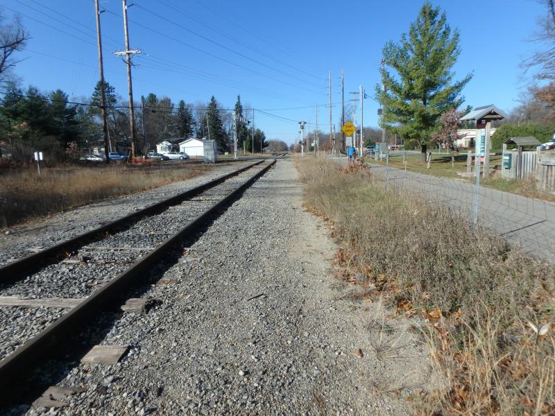
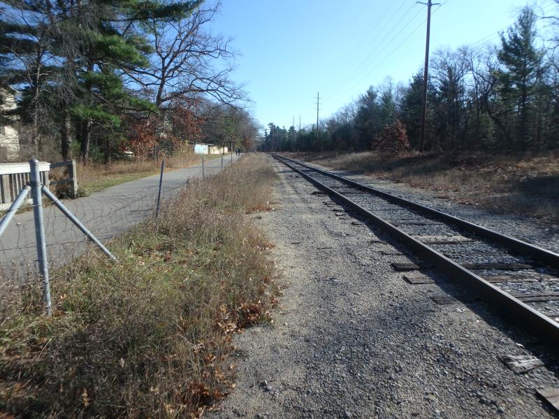
Tart Trail and Railroad Crossing
Acme Twp,
Grand Traverse County
Information collected by:
Site Location
GPS Coordinates: 44.745447
, -85.560042
T27N
R10W
Sec 07
Owned by State
Fish Passability 0
Total Erosion: 0.4721 tons/year
Severity: Severe
Year Inventoried: 2020
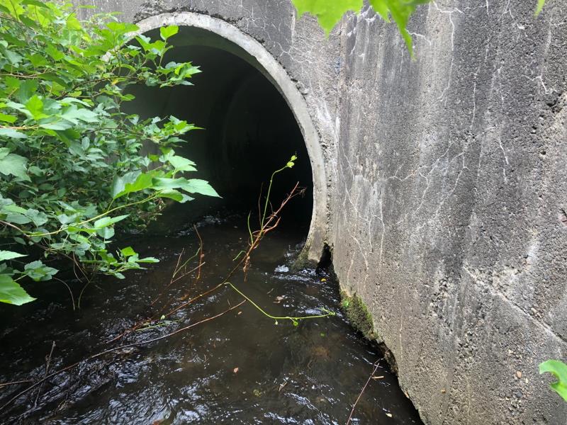
Inlet
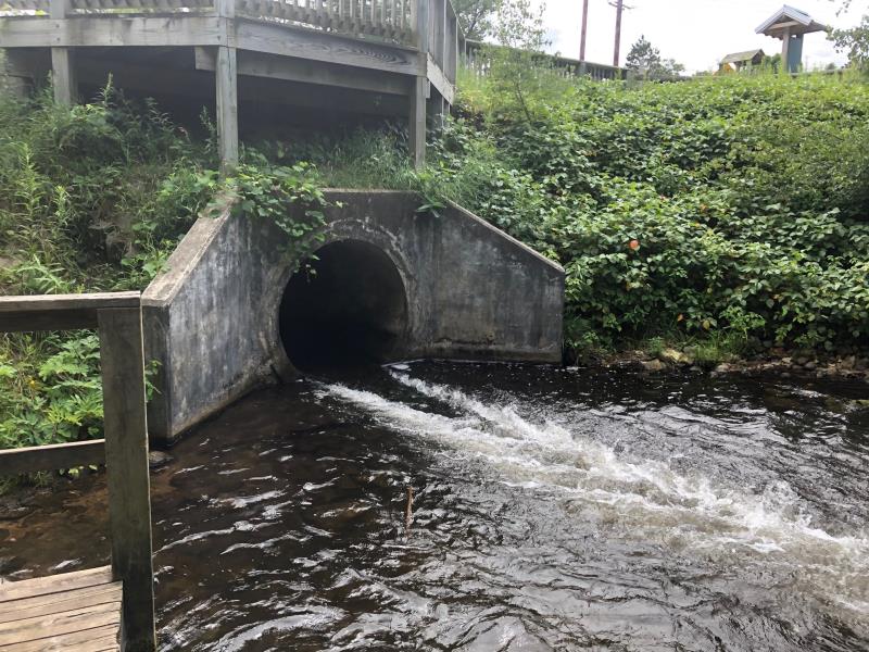
Outlet
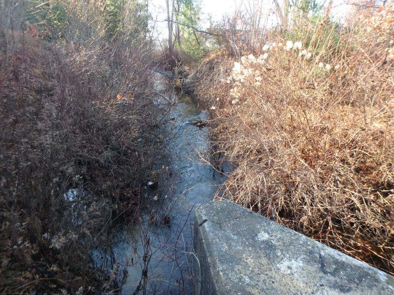
Upstream Conditions
Downstream Conditions
Road Approach - Left
Road Approach - Right
Crossing Information
Type of Crossing: culvert(s)
Structure Shape: Round
Inlet Type: Wingwall 30-70 Degree
Outlet Type: Other
Structure Material: Concrete
Structure Substrate: None
General Conditions: Fair
Structure Interior: smooth
Dimensions of Structure: Length 69 ft.
, Width 5 ft.
, Height 5 ft.
Structure Inlet
Water Depth: 1.2 ft.
Embedded Depth of Structure: 0 ft.
Water Velocity*: 5.2 ft./sec.
Structure Outlet
Water Depth: 0.6 ft.
Embedded Depth of Structure: 0 ft.
Water Velocity*: 11.6 ft./sec.
*Water Velocities were measured 0.7 ft. below Surface
(with Meter)
Additional Comments
Outlet cascades into pool
Stream Information
Stream Flow: Less than Bankfull
Scour Pool: Length 47 ft.
, Width 36 ft.
, Depth 3.6 ft.
Riffle Information
Water Depth: 1.3 ft.
Bankfull Width: 23.3 ft.
Wetted Width: 19.5 ft.
Water Velocity: 1.3 ft./sec.
(Measured with Meter)
Dominant Substrate: Sand
Road Information
Paved
Private Road
Road Condition: Good
Road Width at Culvert: 70 ft.
Location of Low Point: At Stream
Runoff Path: Ditch
Embankments
Upstream
Fill Depth: 3 ft.
Slope: Less than 1:2
Downstream
Fill Depth: 5 ft.
Slope: Less than 1:2
Approaches
Left Approach
Length: 100 ft.
Slope: 1% to 5%
Vegetation: Partial
LS Factor: 0.39
Erosion: 0.0902 tons/year
Right Approach
Length: 300 ft.
Slope: 1% to 5%
Vegetation: Partial
LS Factor: 0.55
Erosion: 0.3818 tons/year
Erosion Information
Total Erosion at Crossing: 0.4721 tons/year
Summary Information
Fish Passability 0
These non-native species were observerd at this site: Spotted Knapweed, Bull Thistle
�