Road Stream Crossing Site GTBAY_MC019
Mitchell Creek Watershed, Mitchell Creek
Townline Rd
East Bay Twp,
Grand Traverse County
Information collected by:
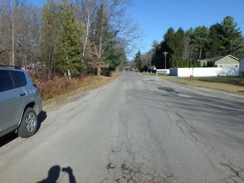
Site Location
GPS Coordinates: 44.73010683
, -85.5749769
T27N
R10W
Sec 18
Owned by Private
Fish Passability 0.9
Total Erosion: 0.1564 tons/year
Severity: Moderate
Year Inventoried: 2020
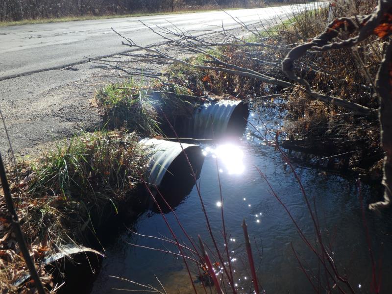
Inlet
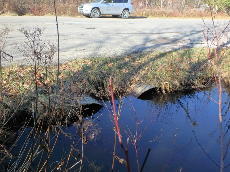
Outlet
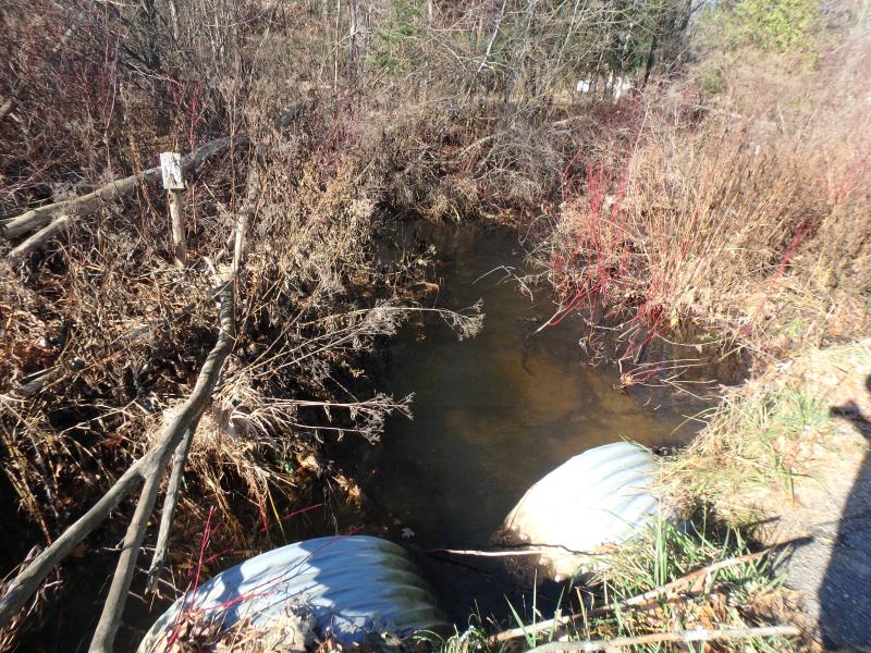
Upstream Conditions
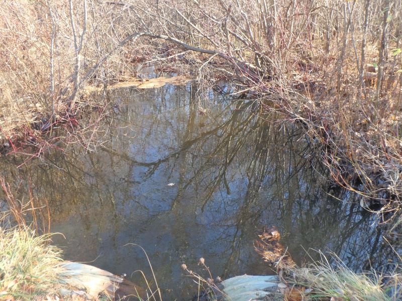
Downstream Conditions
Road Approach - Left
Road Approach - Right
Crossing Information
Type of Crossing: culvert(s)
Number of Structures: 3
Structure Shape: Ellipse
Inlet Type: Projecting
Outlet Type: At Stream Grade
Structure Material: Metal
Structure Substrate: Sand
General Conditions: Fair
Multiple Culverts/Spans | ||||
Culvert/Span | Width | Length | Height | Material |
1 |
3.4 ft. |
46 ft. |
2.5 ft. |
Metal |
2 |
3.4 ft. |
46 ft. |
2.5 ft. |
Metal |
3 |
3.5 ft. |
46 ft. |
2.4 ft. |
Metal |
Structure Interior: corrugated
Dimensions of Structure: Length 46 ft.
, Width 3.2 ft.
, Height 2.4 ft.
Structure Inlet
Water Depth: 1.1 ft.
Embedded Depth of Structure: 0 ft.
Water Velocity*: 0.7 ft./sec.
Structure Outlet
Water Depth: 1.4 ft.
Embedded Depth of Structure: 0.2 ft.
Water Velocity*: 0.4 ft./sec.
*Water Velocities were measured 0.7 ft. below Surface
(with Meter)
Additional Comments
Structure water depth and velocities recorded for culvert #3
Stream Information
Stream Flow: Less than Bankfull
Riffle Information
Water Depth: 0.8 ft.
Bankfull Width: 35 ft.
Wetted Width: 16 ft.
Water Velocity: 1.3 ft./sec.
(Measured with Meter)
Dominant Substrate: Sand
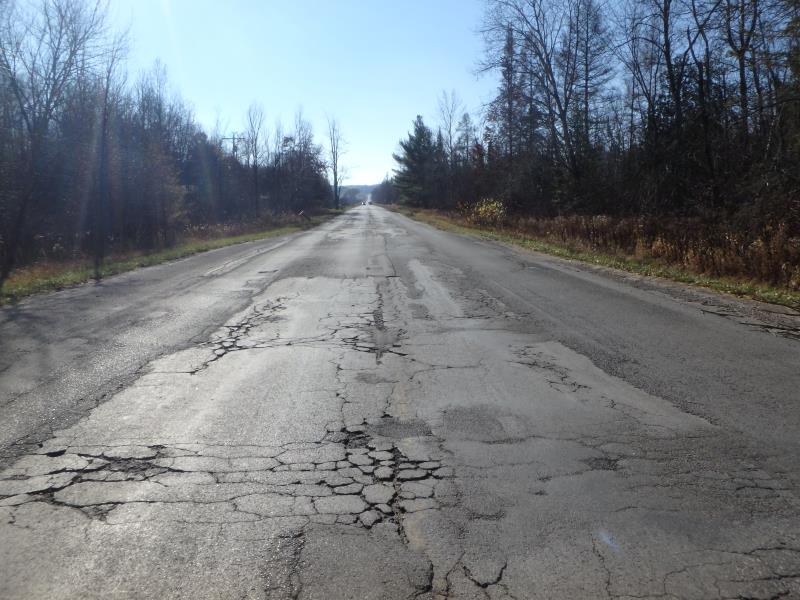
Road Information
Paved
County Road
Road Condition: Poor
Road Width at Culvert: 39 ft.
Location of Low Point: At Stream
Runoff Path: Ditch
Embankments
Upstream
Fill Depth: 0.7 ft.
Slope: Vertical
Downstream
Fill Depth: 1 ft.
Slope: Vertical
Approaches
Left Approach
Length: 75 ft.
Slope: 1% to 5%
Vegetation: Partial
LS Factor: 0.36
Erosion: 0.0348 tons/year
Right Approach
Length: 150 ft.
Slope: 1% to 5%
Vegetation: Heavy
LS Factor: 0.4
Erosion: 0.0774 tons/year
Erosion Information
Total Erosion at Crossing: 0.1564 tons/year
Extent of Erosion: Moderate
Erosion is occurring and corrective actions can be installed to address the problem.
Notes: Eroding and undercutting shoulder upstream
Location of Erosion | Erosion Dimensions | Eroded Material | Material Eroded | Total Erosion | ||
facing downstream | Length | Width | Depth | Reaching Stream? | (tons/year) | |
Right Downstream Embankment |
0.7 ft. |
2.5 ft. |
2.2 ft. |
yes |
Sandy Loam |
0.0103 |
Right Downstream Embankment |
1.5 ft. |
2 ft. |
0.9 ft. |
yes |
Sand |
0.0104 |
Right Upstream Embankment |
1.4 ft. |
1.5 ft. |
2.5 ft. |
yes |
Sandy Loam |
0.0235 |
Summary Information
Fish Passability 0.9
Erosion is an area of concern for this site.
These non-native species were observerd at this site: Purple Clover, Queen Anne's Lace
�