Road Stream Crossing Site GTBAY_MCT010
Mitchell Creek Watershed, Four Mile Creek
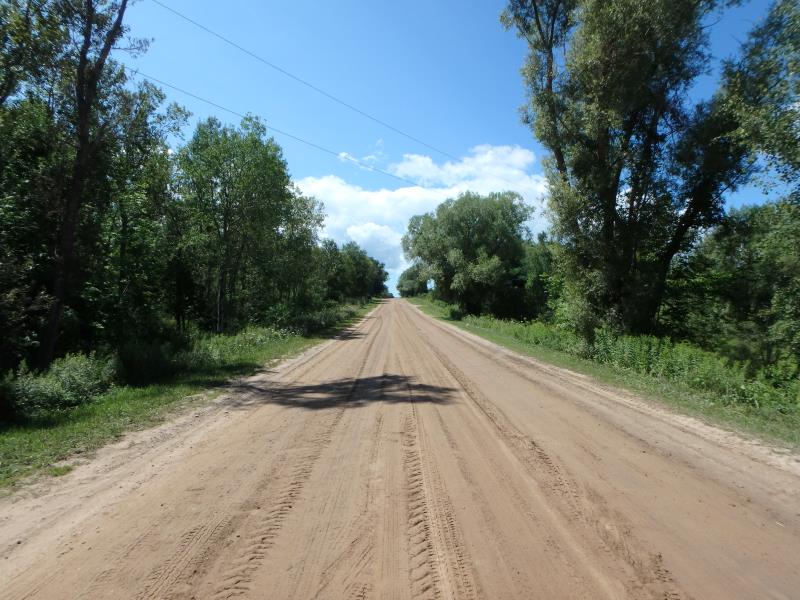
Vanderlip Rd
East Bay Twp,
Grand Traverse County
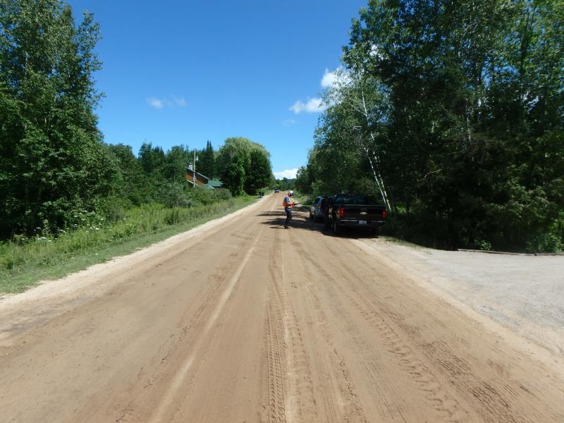
Information collected by:
Site Location
GPS Coordinates: 44.72276973
, -85.5455684
T27N
R10W
Sec 20
Owned by Private
Fish Passability 0
Perch Height: 0.4 ft.
Total Erosion: 9.1753 tons/year
Severity: Severe
Year Inventoried: 2020
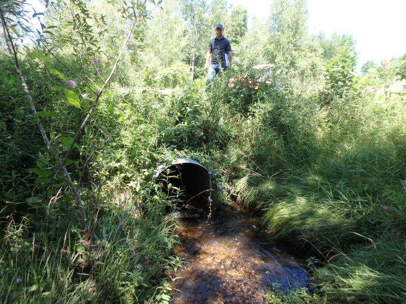
Inlet
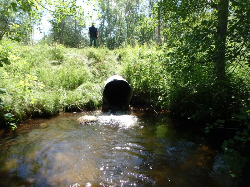
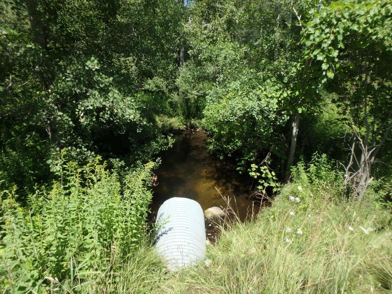
Outlet
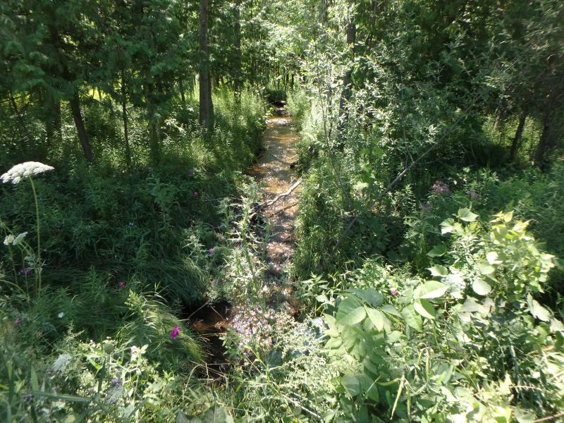
Upstream Conditions
Downstream Conditions
Road Approach - Left
Road Approach - Right
Crossing Information
Type of Crossing: culvert(s)
Number of Structures: 1
Structure Shape: Round
Inlet Type: Projecting
Outlet Type: Freefall into Pool
Structure Material: Metal
Structure Substrate: None
General Conditions: Good
Structure Interior: corrugated
Dimensions of Structure: Length 61 ft.
, Width 3 ft.
, Height 3 ft.
Perch Height: 0.4 ft.
Structure Inlet
Water Depth: 0.3 ft.
Embedded Depth of Structure: 0 ft.
Water Velocity*: 3 ft./sec.
Structure Outlet
Water Depth: 0.35 ft.
Embedded Depth of Structure: 0 ft.
Water Velocity*: 3.7 ft./sec.
*Water Velocities were measured 0.15 ft. below Surface
(with Meter)
Stream Information
Stream Flow: Less than Bankfull
Scour Pool: Length 28.6 ft.
, Width 23 ft.
, Depth 2.6 ft.
Riffle Information
Water Depth: 2.2 ft.
Bankfull Width: 7.3 ft.
Wetted Width: 5.6 ft.
Water Velocity: 2.3 ft./sec.
(Measured with Meter)
Dominant Substrate: Gravel
Road Information
Gravel
County Road
Road Condition: Fair
Road Width at Culvert: 26.2 ft.
Location of Low Point: At Stream
Runoff Path: Ditch
Embankments
Upstream
Fill Depth: 3.4 ft.
Slope: 1:2
Downstream
Fill Depth: 4.3 ft.
Slope: 1:1.5
Approaches
Left Approach
Length: 949 ft.
Slope: 1% to 5%
Vegetation: Heavy
LS Factor: 0.565
Erosion: 3.8693 tons/year
Right Approach
Length: 999 ft.
Slope: 1% to 5%
Vegetation: Heavy
LS Factor: 0.57
Erosion: 4.1092 tons/year
Erosion Information
Total Erosion at Crossing: 9.1753 tons/year
Extent of Erosion: Severe
Erosion is occurring and corrective actions can be installed to address the problem.
Notes: Erosion is undercutting culvert
Location of Erosion | Erosion Dimensions | Eroded Material | Material Eroded | Total Erosion | ||
facing downstream | Length | Width | Depth | Reaching Stream? | (tons/year) | |
Right Upstream Embankment |
1.6 ft. |
2.3 ft. |
2.8 ft. |
yes |
Sand |
0.0986 |
Left Downstream Embankment |
13 ft. |
2.8 ft. |
2.7 ft. |
yes |
Sandy Loam |
0.6739 |
Right Downstream Embankment |
13 ft. |
1 ft. |
1.7 ft. |
yes |
Sandy Loam |
0.4243 |
Summary Information
Fish Passability 0
Fish Passage is an area of concern for this site.
These non-native species were observerd at this site: Thistle, Queen Anne's Lace
�