Road Stream Crossing Site GTBAY_S060
Boardman River Watershed, Robbin's Creek
Broad Rd
Garfield Twp,
Grand Traverse County
Information collected by:
Site Location
GPS Coordinates: 44.700329
, -85.630156
T27N
R11W
Sec 34
Owned by Private
Fish Passability 0
Total Erosion: 0.3915 tons/year
Severity: Severe
Year Inventoried: 2020
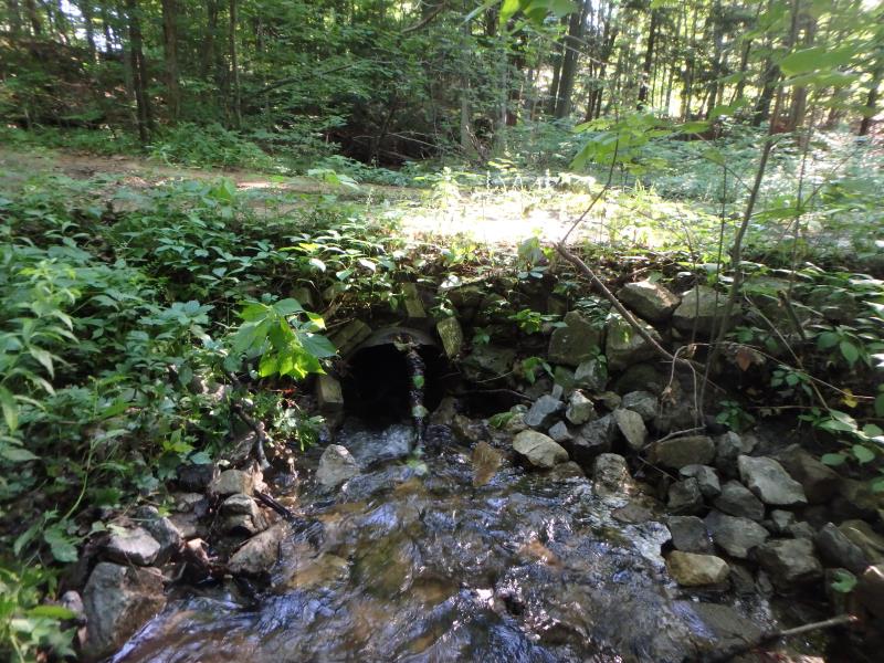
Inlet
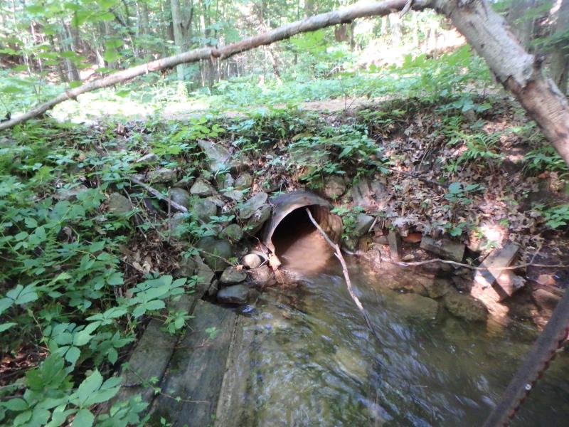
Outlet
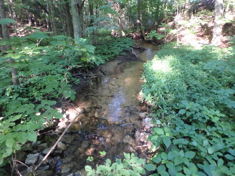
Upstream Conditions
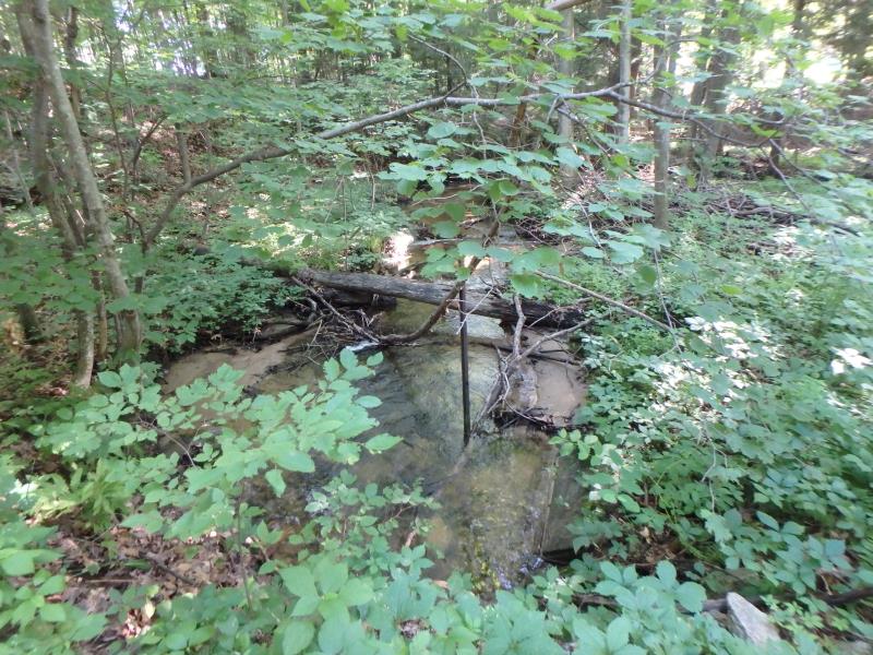
Downstream Conditions

Road Approach - Left
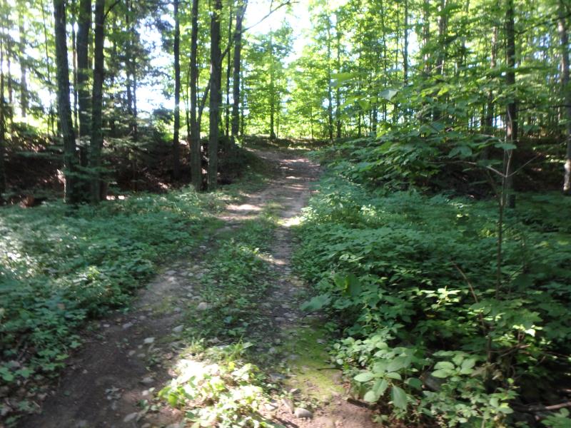
Road Approach - Right
Crossing Information
Type of Crossing: culvert(s)
Structure Shape: Round
Inlet Type: Projecting
Outlet Type: At Stream Grade
Structure Material: Metal
Structure Substrate: None
General Conditions: Fair
Structure Interior: corrugated
Dimensions of Structure: Length 13.5 ft.
, Width 2 ft.
, Height 2 ft.
Structure Inlet
Water Depth: 0.4 ft.
Embedded Depth of Structure: 0 ft.
Water Velocity*: 4.7 ft./sec.
Structure Outlet
Water Depth: 0.6 ft.
Embedded Depth of Structure: 0 ft.
Water Velocity*: 3.4 ft./sec.
*Water Velocities were measured 0.3 ft. below Surface
(with Meter)
Stream Information
Stream Flow: Less than 1/2 Bankfull
Riffle Information
Water Depth: 0.5 ft.
Bankfull Width: 10.4 ft.
Wetted Width: 6.4 ft.
Water Velocity: 1.2 ft./sec.
(Measured with Meter)
Dominant Substrate: Sand
Road Information
Native Surface
Private Road
Road Condition: Poor
Road Width at Culvert: 7 ft.
Location of Low Point: At Stream
Runoff Path: Ditch
Embankments
Upstream
Fill Depth: 1.3 ft.
Slope: 1:1
Downstream
Fill Depth: 1.5 ft.
Slope: 1:1
Approaches
Left Approach
Length: 100 ft.
Slope: 6% to 10%
Vegetation: Partial
LS Factor: 1.04
Erosion: 0.2006 tons/year
Right Approach
Length: 100 ft.
Slope: 6% to 10%
Vegetation: Heavy
LS Factor: 0.99
Erosion: 0.1909 tons/year
Erosion Information
Total Erosion at Crossing: 0.3915 tons/year
Location of Erosion | Erosion Dimensions | Eroded Material | Material Eroded | Total Erosion | ||
facing downstream | Length | Width | Depth | Reaching Stream? | (tons/year) | |
Left Approach |
75 ft. |
7 ft. |
0.2 ft. |
yes |
Sand |
|
Right Approach |
75 ft. |
7 ft. |
0.2 ft. |
yes |
Sand |
|
Summary Information
Fish Passability 0
�