Road Stream Crossing Site GTBAY_S339
Boardman River Watershed, Miller Creek
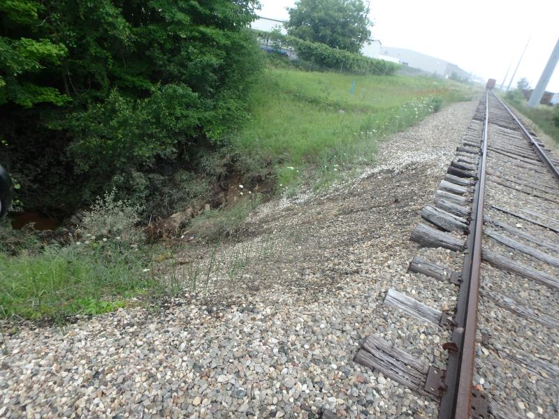
Railroad
Garfield Twp,
Grand Traverse County
Information collected by:
Site Location
GPS Coordinates: 44.72332
, -85.62397
T27N
R11W
Sec 22
Owned by Private
Fish Passability 0
Perch Height: 1 ft.
Total Erosion: 4.8057 tons/year
Severity: Severe
Year Inventoried: 2020
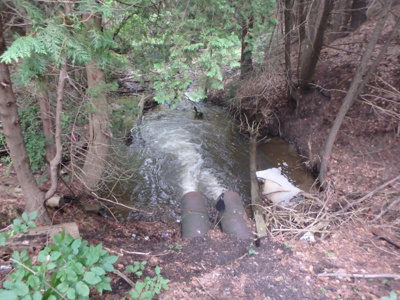
Inlet
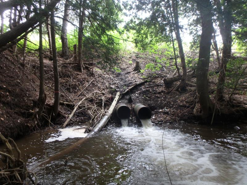
Outlet
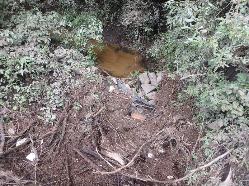
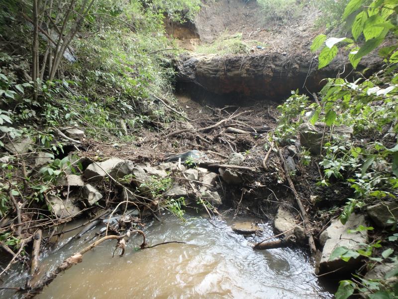
Upstream Conditions
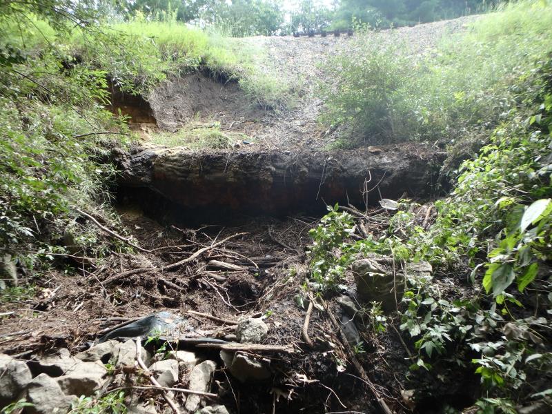
Upstream Conditions
Downstream Conditions
Road Approach - Left
Crossing Information
Type of Crossing: culvert(s)
Number of Structures: 2
Structure Shape: Round
Inlet Type: Projecting
Outlet Type: Freefall into Pool
Structure Material: Metal
Structure Substrate: Mixture
General Conditions: Poor
Structure Interior: smooth
Dimensions of Structure: Length 100 ft.
, Width 2 ft.
, Height 2 ft.
Percentage Plugged:
Inlet: 51% to 75%
Perch Height: 1 ft.
Structure Inlet
Water Depth: 0.6 ft.
Embedded Depth of Structure: 0 ft.
Water Velocity*: 2 ft./sec.
Structure Outlet
Water Depth: 0.4 ft.
Embedded Depth of Structure: 0 ft.
Water Velocity*: 11.3 ft./sec.
*Water Velocities were measured 0.1 ft. below Surface
(with Meter)
Additional Comments
Structure length estimated. Water depth and velocity measurements recorded for culvert #1
Stream Information
Stream Flow: Less than Bankfull
Scour Pool: Length 25 ft.
, Width 25 ft.
, Depth 4.5 ft.
Riffle Information
Water Depth: 0.5 ft.
Bankfull Width: 30.5 ft.
Wetted Width: 11.2 ft.
Water Velocity: 2.7 ft./sec.
(Measured with Meter)
Dominant Substrate: Cobble
Road Information
Gravel
Other Road
Road Condition: Poor
Road Width at Culvert: 8 ft.
Location of Low Point: At Stream
Runoff Path: Ditch
Embankments
Upstream
Fill Depth: 20 ft.
Slope: Vertical
Downstream
Fill Depth: 20 ft.
Slope: 1:1
Approaches
Left Approach
Length: 200 ft.
Slope: Less Than 1%
Vegetation: Partial
LS Factor: 0.05
Erosion: 0.022 tons/year
Right Approach
Length: 200 ft.
Slope: Less Than 1%
Vegetation: Partial
LS Factor: 0.05
Erosion: 0.022 tons/year
Erosion Information
Total Erosion at Crossing: 4.8057 tons/year
Extent of Erosion: Severe
Notes: Upstream inlet covered in erosion debris. Erosion reaching RR tracks - > beginning to erode under railroad ties.
Location of Erosion | Erosion Dimensions | Eroded Material | Material Eroded | Total Erosion | ||
facing downstream | Length | Width | Depth | Reaching Stream? | (tons/year) | |
Left Upstream Embankment |
30 ft. |
4 ft. |
4 ft. |
yes |
Sandy Loam |
2.304 |
Right Upstream Embankment |
30 ft. |
4 ft. |
4 ft. |
yes |
Sandy Loam |
2.304 |
Left Downstream Embankment |
20 ft. |
10 ft. |
0.2 ft. |
yes |
Sandy Loam |
0.0768 |
Right Downstream Embankment |
20 ft. |
10 ft. |
0.2 ft. |
yes |
Sandy Loam |
0.0768 |
Summary Information
Fish Passability 0
Erosion is an area of concern for this site.
Fish passage and erosion. Could eventually cause unstabilization of RR
A future visit to this site is recommended. Severe erosion and possible future safety concern
These non-native species were observerd at this site: Spotted Knapweed
�