Road Stream Crossing Site GTBAY_S454
Boardman River Watershed, Jaxon Creek Tributary
E Blair Town Hall Rd
Paradise Twp,
Grand Traverse County
Information collected by:
Site Location
GPS Coordinates: 44.62806
, -85.56837
T26N
R10W
Sec 30
Owned by State
Fish Passability 0.9
Total Erosion: 2.7494 tons/year
Severity: Severe
Year Inventoried: 2020

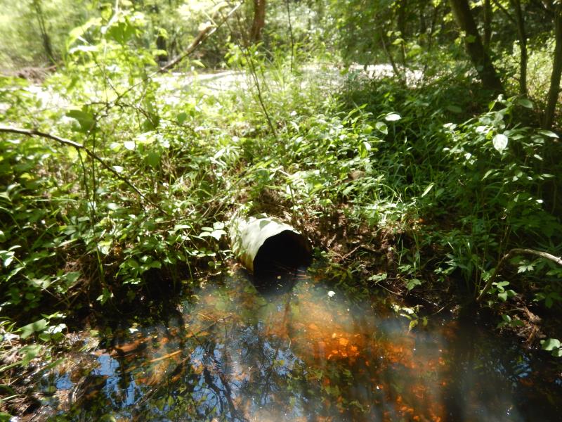
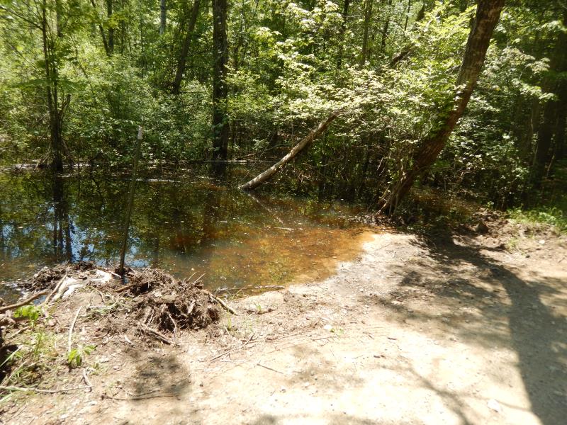
Inlet
Outlet
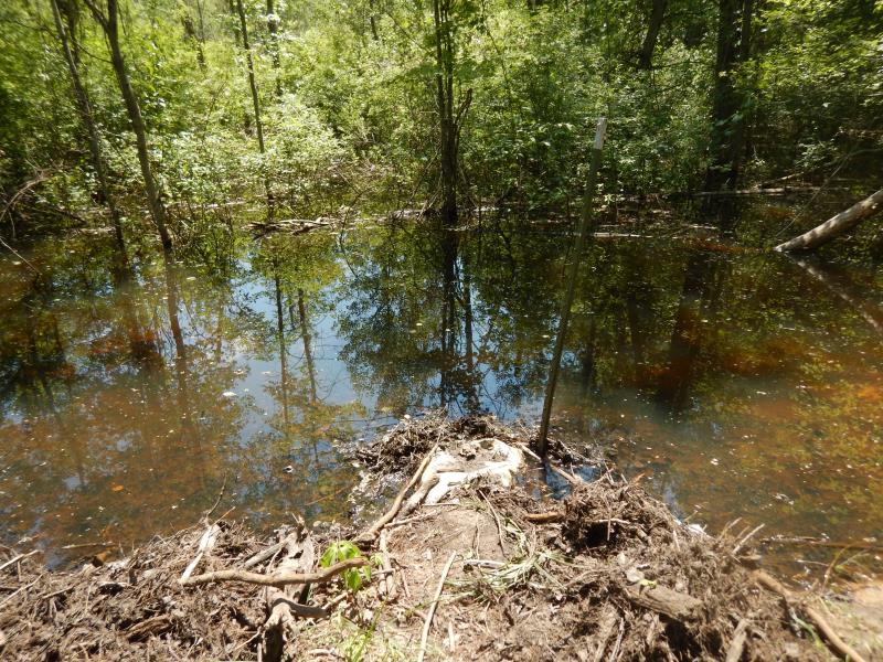
Upstream Conditions
Downstream Conditions
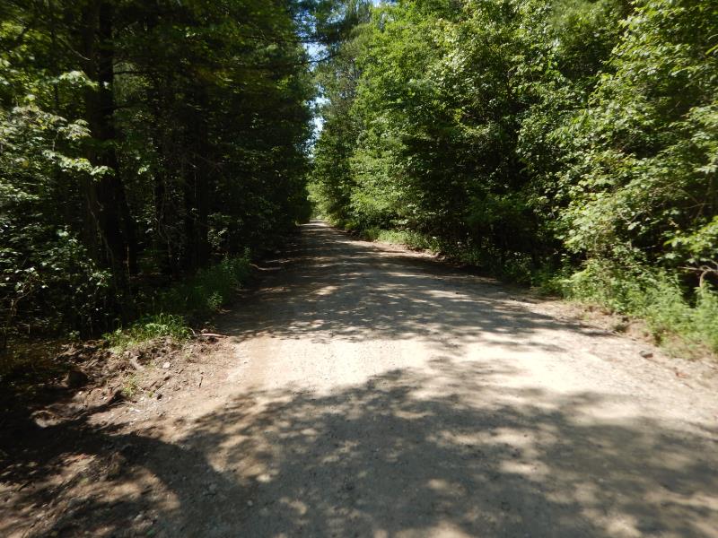
Road Approach - Left

Road Approach - Right
Erosion
Crossing Information
Type of Crossing: culvert(s)
Structure Shape: Round
Inlet Type: Projecting
Outlet Type: At Stream Grade
Structure Material: Metal
Structure Substrate: Mixture
General Conditions: Poor
Structure Interior: corrugated
Dimensions of Structure: Length 29 ft.
, Width 1.3 ft.
, Height 1.3 ft.
Percentage Plugged:
Inlet: 76% to 100%
Percentage Crushed:
Inlet: 26% to 50%
Structure Inlet
Water Depth: 1 ft.
Embedded Depth of Structure: 1 ft.
Water Velocity*: 0 ft./sec.
Structure Outlet
Water Depth: 0.6 ft.
Embedded Depth of Structure: 0 ft.
Water Velocity*: 0 ft./sec.
*Water Velocities were measured 0.6 ft. below Surface
(with Float Test)
Stream Information
Stream Flow: More than Bankfull
Riffle Information
Water Depth: 0.1 ft.
Bankfull Width: 3 ft.
Wetted Width: 1 ft.
Water Velocity: 0.1 ft./sec.
(Measured with Float Test)
Dominant Substrate: Gravel
Road Information
Gravel
County Road
Road Condition: Poor
Road Width at Culvert: 17 ft.
Location of Low Point: At Stream
Runoff Path: Ditch
Embankments
Upstream
Fill Depth: 1 ft.
Slope: More than 1:2
Downstream
Fill Depth: 1.5 ft.
Slope: More than 1:2
Approaches
Left Approach
Length: 500 ft.
Slope: 1% to 5%
Vegetation: Partial
LS Factor: 0.64
Erosion: 1.4986 tons/year
Right Approach
Length: 500 ft.
Slope: 1% to 5%
Vegetation: Heavy
LS Factor: 0.5
Erosion: 1.1708 tons/year
Erosion Information
Total Erosion at Crossing: 2.7494 tons/year
Extent of Erosion: Severe
Notes: Road erosion causing buildup at crossing inlet
Location of Erosion | Erosion Dimensions | Eroded Material | Material Eroded | Total Erosion | ||
facing downstream | Length | Width | Depth | Reaching Stream? | (tons/year) | |
Left Upstream Embankment |
10 ft. |
6 ft. |
0.2 ft. |
yes |
Gravelly Loam |
0.04 |
Right Upstream Embankment |
10 ft. |
6 ft. |
0.2 ft. |
yes |
Gravelly Loam |
0.04 |
Summary Information
Fish Passability 0.9
Erosion is an area of concern for this site.
Road erosion is severe
A future visit to this site is recommended. Plugged inlet causing flooding upstream
�