Road Stream Crossing Site GTBAY_S715
Boardman River Watershed, Parsons Creek
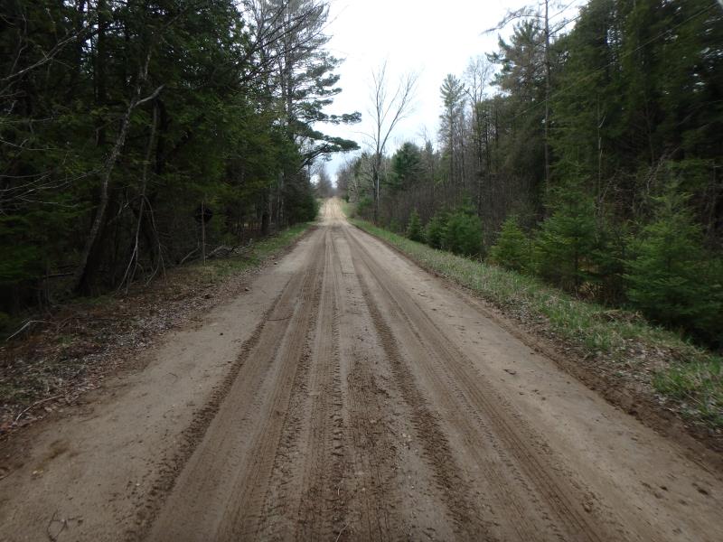
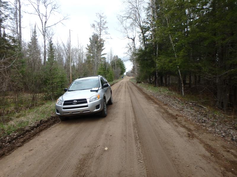
Lake Rd
Union Twp,
Grand Traverse County
Information collected by:
Site Location
GPS Coordinates: 44.604998
, -85.373484
T26N
R9W
Sec 35
Owned by Private
Fish Passability 0
Total Erosion: 0.0954 tons/year
Severity: Severe
Year Inventoried: 2020
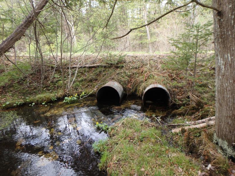
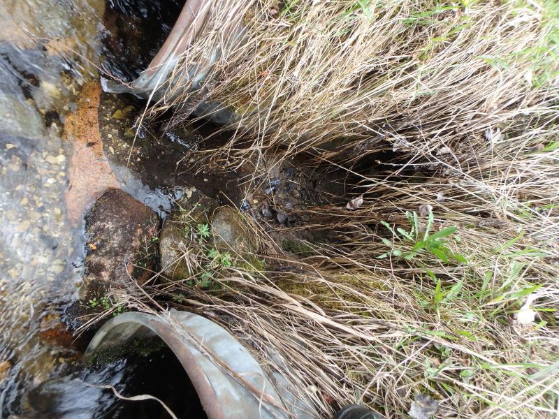
Inlet
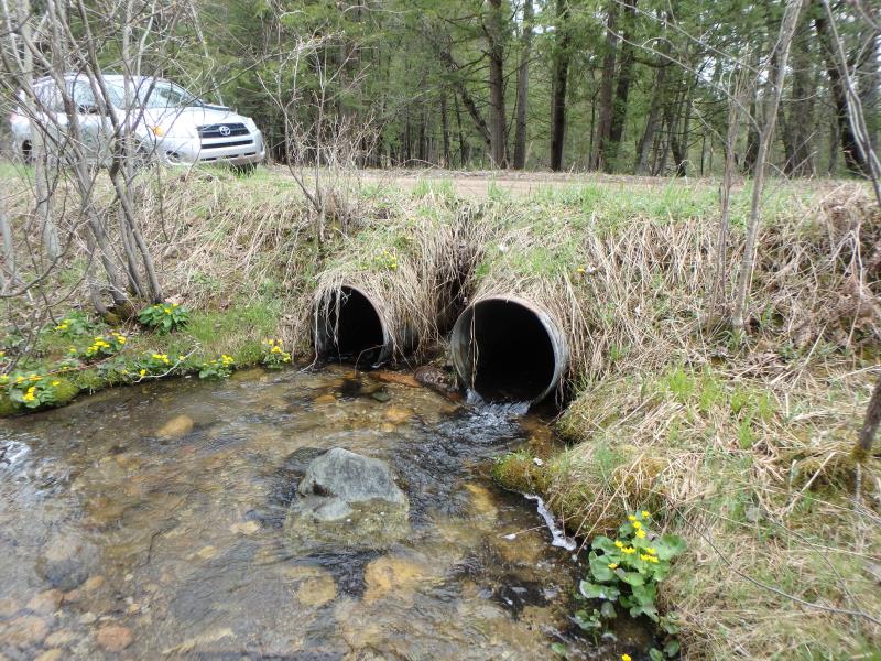
Outlet
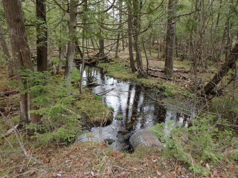
Upstream Conditions
Downstream Conditions
Road Approach - Left
Road Approach - Right
Erosion
Crossing Information
Type of Crossing: culvert(s)
Number of Structures: 2
Structure Shape: Round
Inlet Type: Projecting
Outlet Type: At Stream Grade
Structure Material: Metal
Structure Substrate: Rock
General Conditions: Fair
Multiple Culverts/Spans | ||||
Culvert/Span | Width | Length | Height | Material |
1 |
2 ft. |
30 ft. |
2 ft. |
Metal |
2 |
2 ft. |
30 ft. |
2 ft. |
Metal |
Structure Interior: corrugated
Dimensions of Structure: Length 30 ft.
, Width 2 ft.
, Height 2 ft.
Structure Inlet
Water Depth: 0.6 ft.
Embedded Depth of Structure: 0 ft.
Water Velocity*: 0.5 ft./sec.
Structure Outlet
Water Depth: 0.2 ft.
Embedded Depth of Structure: 0 ft.
Water Velocity*: 4.3 ft./sec.
*Water Velocities were measured 0.4 ft. below Surface
(with Meter)
Additional Comments
Water depth and velocity measurements recorded for culvert #1
Stream Information
Stream Flow: Less than Bankfull
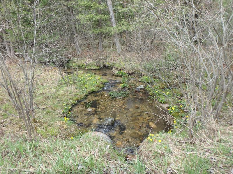
Riffle Information
Water Depth: 0.2 ft.
Bankfull Width: 10 ft.
Wetted Width: 7 ft.
Water Velocity: 0.6 ft./sec.
(Measured with Meter)
Dominant Substrate: Gravel
Road Information
Sand
County Road
Road Condition: Fair
Road Width at Culvert: 16 ft.
Location of Low Point: At Stream
Runoff Path: Roadway
Embankments
Upstream
Fill Depth: 2.2 ft.
Slope: 1:2
Downstream
Fill Depth: 1.8 ft.
Slope: Vertical
Approaches
Left Approach
Length: 150 ft.
Slope: Less Than 1%
Vegetation: Heavy
LS Factor: 0.05
Erosion: 0.0331 tons/year
Right Approach
Length: 100 ft.
Slope: Less Than 1%
Vegetation: Heavy
LS Factor: 0.05
Erosion: 0.022 tons/year
Erosion Information
Total Erosion at Crossing: 0.0954 tons/year
Extent of Erosion: Moderate
Notes: Undercutting between culverts. Could compromise road eventually
Location of Erosion | Erosion Dimensions | Eroded Material | Material Eroded | Total Erosion | ||
facing downstream | Length | Width | Depth | Reaching Stream? | (tons/year) | |
Right Downstream Embankment |
3 ft. |
1 ft. |
2 ft. |
yes |
Sandy Loam |
0.0403 |
Summary Information
Fish Passability 0
Erosion is an area of concern for this site.
A future visit to this site is recommended. Check state of erosion
�