Road Stream Crossing Site GTBAY_S720
Boardman River Watershed, S Branch Boardman River
ORV Trail off Shippy Rd
Boardman Twp,
Kalkaska County
Information collected by:
Site Location
GPS Coordinates: 44.66147
, -85.31294
T26N
R8W
Sec 07
Owned by State
Fish Passability 1
Total Erosion: 0.2656 tons/year
Severity: Minor
Year Inventoried: 2020
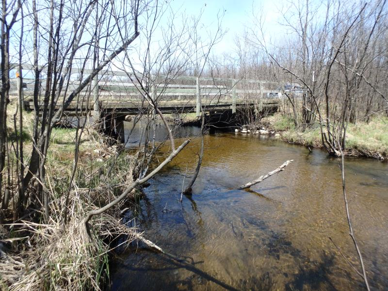
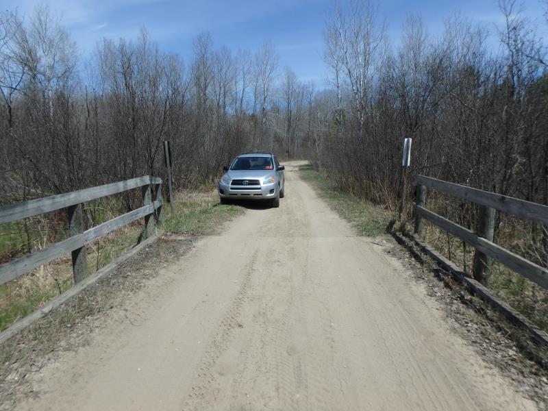
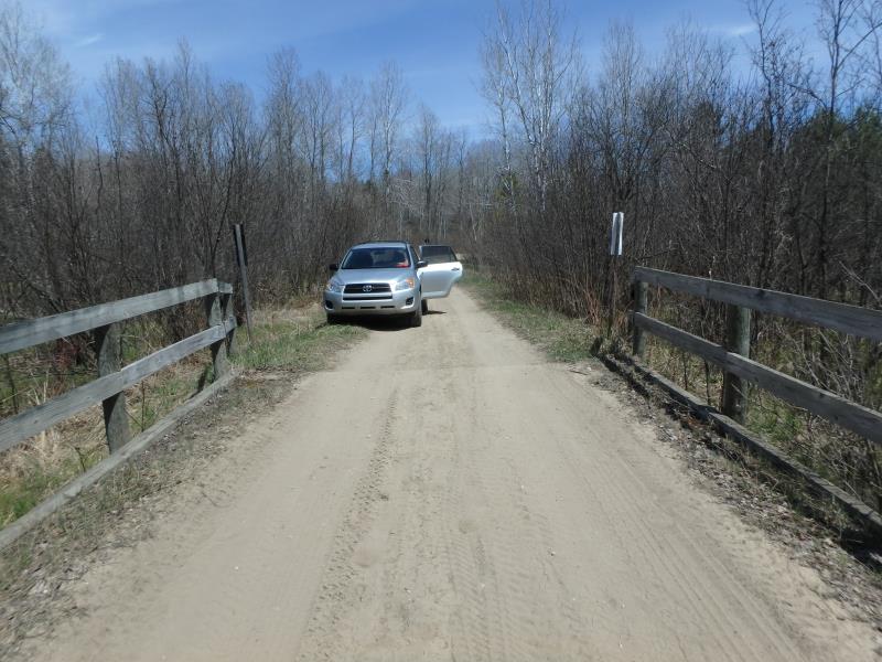
Inlet
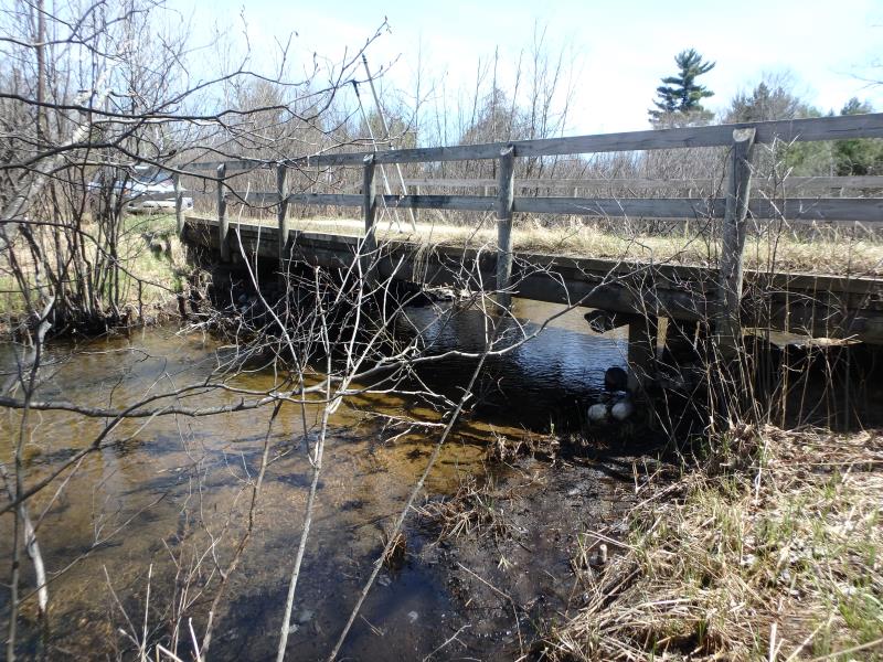
Outlet
Upstream Conditions
Downstream Conditions
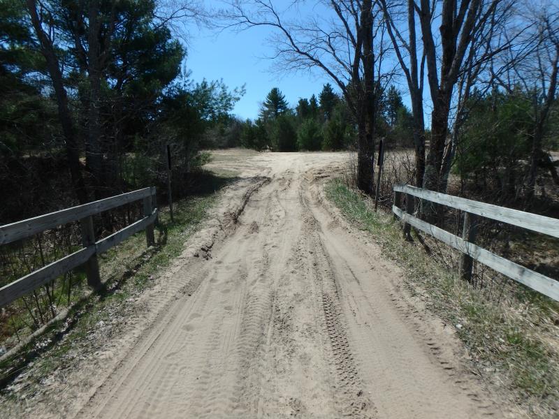
Road Approach - Left
Road Approach - Right
Road Approach - Right
Crossing Information
Type of Crossing: Bridge
Structure Shape: Open Bottom Square/Rectangle
Inlet Type: Other
Outlet Type: At Stream Grade
Structure Material: Wood
Structure Substrate: Sand
General Conditions: Fair
Structure Interior: smooth
Dimensions of Structure: Length 15 ft.
, Width 37 ft.
, Height 5.5 ft.
Structure Inlet
Water Depth: 1.3 ft.
Embedded Depth of Structure: 0 ft.
Water Velocity*: 2.1 ft./sec.
Structure Outlet
Water Depth: 1.2 ft.
Embedded Depth of Structure: 0 ft.
Water Velocity*: 2.3 ft./sec.
*Water Velocities were measured 0.8 ft. below Surface
(with Meter)
Additional Comments
Open bottom bridge, structure water velocities consistent with riffle velocity. Faster section, not a fish passage issue.
Stream Information
Stream Flow: Less than Bankfull
Riffle Information
Water Depth: 0.9 ft.
Bankfull Width: 34 ft.
Wetted Width: 27 ft.
Water Velocity: 1.8 ft./sec.
(Measured with Meter)
Dominant Substrate: Sand
Road Information
Sand
Other Road
Road Condition: Poor
Road Width at Culvert: 10 ft.
Location of Low Point: Other
Runoff Path: Ditch
Embankments
Upstream
Fill Depth: 0.2 ft.
Slope: Vertical
Downstream
Fill Depth: 0.2 ft.
Slope: Vertical
Approaches
Left Approach
Length: 100 ft.
Slope: 1% to 5%
Vegetation: Heavy
LS Factor: 0.38
Erosion: 0.1047 tons/year
Right Approach
Length: 50 ft.
Slope: Less Than 1%
Vegetation: Heavy
LS Factor: 0.05
Erosion: 0.0069 tons/year
Erosion Information
Total Erosion at Crossing: 0.2656 tons/year
Extent of Erosion: Moderate
Location of Erosion | Erosion Dimensions | Eroded Material | Material Eroded | Total Erosion | ||
facing downstream | Length | Width | Depth | Reaching Stream? | (tons/year) | |
Left Approach |
100 ft. |
10 ft. |
0.2 ft. |
yes |
Sand |
0.154 |
Summary Information
Fish Passability 1
�