Road Stream Crossing Site RIF_AR19
Rifle River Watershed, Fritz Creek
Fritz Rd
Clayton Twp,
Arenac County
Information collected by:
Site Location
GPS Coordinates: 44.087331
, -83.97742
T20N
R4E
Sec 34
Owned by Private
Fish Passability 1
Structure is NOT Perched
Total Erosion: 6.3145 tons/year
Severity: Restored
Year Inventoried: 2019
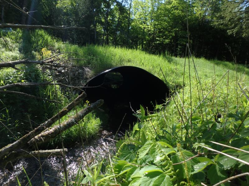
Inlet
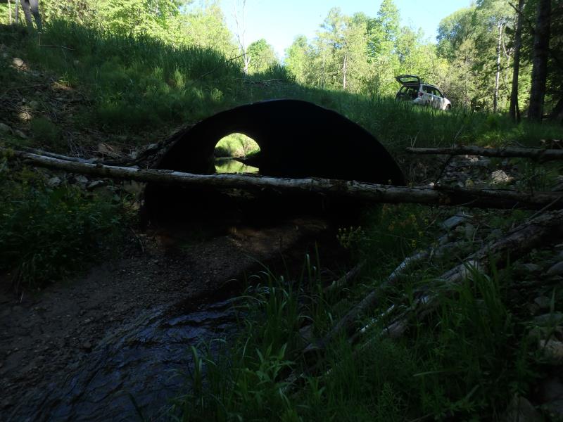
Outlet
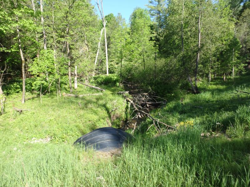
Upstream Conditions
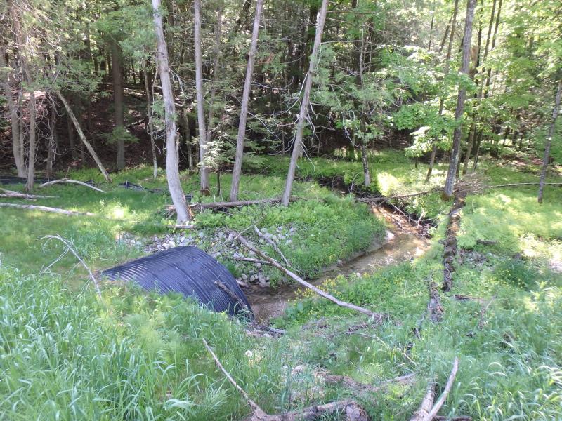
Downstream Conditions
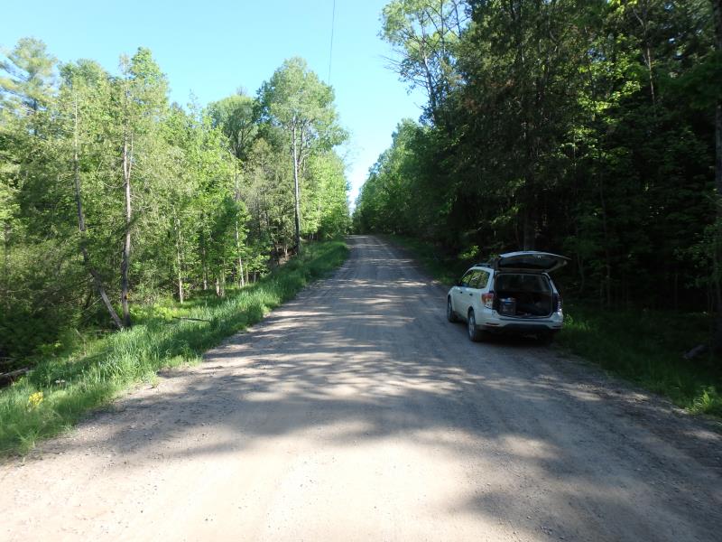
Road Approach - Left

Road Approach - Right
Crossing Information
Type of Crossing: culvert(s)
Number of Structures: 1
Structure Shape: Pipe Arch
Inlet Type: Projecting
Outlet Type: At Stream Grade
Structure Material: Metal
Structure Substrate: Mixture
General Conditions: New
Structure Interior: corrugated
Dimensions of Structure: Length 76 ft.
, Width 11 ft.
, Height 7.7 ft.
Structure is NOT Perched
Structure Inlet
Water Depth: 0.4 ft.
Embedded Depth of Structure: 0.1 ft.
Water Velocity*: 1 ft./sec.
Structure Outlet
Water Depth: 0.6 ft.
Embedded Depth of Structure: 1.1 ft.
Water Velocity*: 1.6 ft./sec.
*Water Velocities were measured 0.3 ft. below Surface
(with Meter)
Additional Comments
Restored in 2014 (new pipe culvert)
Stream Information
Stream Flow: Less than Bankfull
Scour Pool: Length 0 ft.
, Width 0 ft.
, Depth 0 ft.
Upstream Pond: Length 0 ft.
, Width 0 ft.
, Depth 0 ft.
Riffle Information
Water Depth: 0.4 ft.
Bankfull Width: 15.4 ft.
Wetted Width: 7.3 ft.
Water Velocity: 0.5 ft./sec.
(Measured with Meter)
Dominant Substrate: Clay
Road Information
Gravel
County Road
Road Condition: Good
Road Width at Culvert: 14 ft.
Location of Low Point: At Stream
Runoff Path: Ditch
Embankments
Upstream
Fill Depth: 2.8 ft.
Slope: More than 1:2
Downstream
Fill Depth: 3.3 ft.
Slope: More than 1:2
Approaches
Left Approach
Length: 426 ft.
Slope: 6% to 10%
Vegetation: Heavy
LS Factor: 1.557
Erosion: 2.5586 tons/year
Right Approach
Length: 570 ft.
Slope: 6% to 10%
Vegetation: Heavy
LS Factor: 1.709
Erosion: 3.7559 tons/year
Erosion Information
Total Erosion at Crossing: 6.3145 tons/year
Summary Information
Fish Passability 1
�