Road Stream Crossing Site PLT-I-16
Platte River Watershed, Brundage Creek
Stanley Rd
Inland Twp,
Benzie County
Information collected by:
Site Location
GPS Coordinates: 44.65219
, -85.91936
T26
R13
Sec 18
Owned by State
Structure is NOT Perched
Total Erosion: 0.3099 tons/year
Severity: Restored
Year Inventoried: 2021
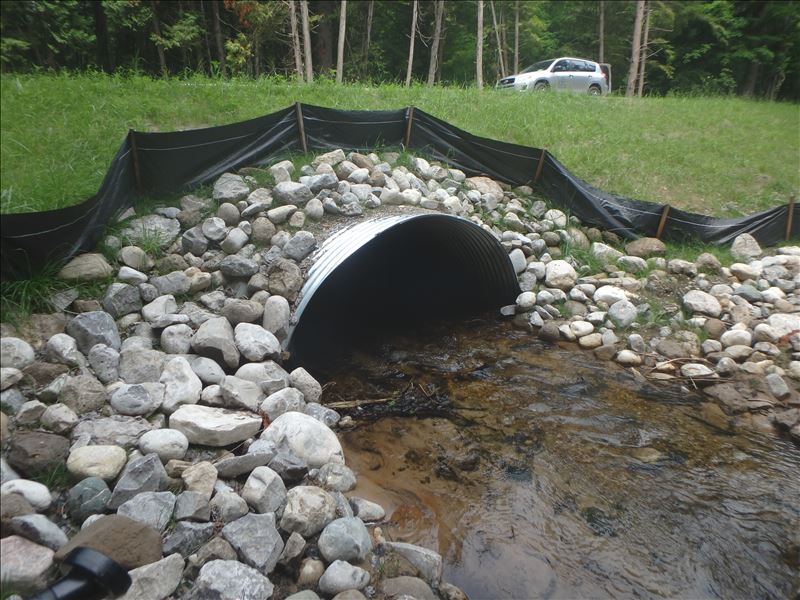
Inlet
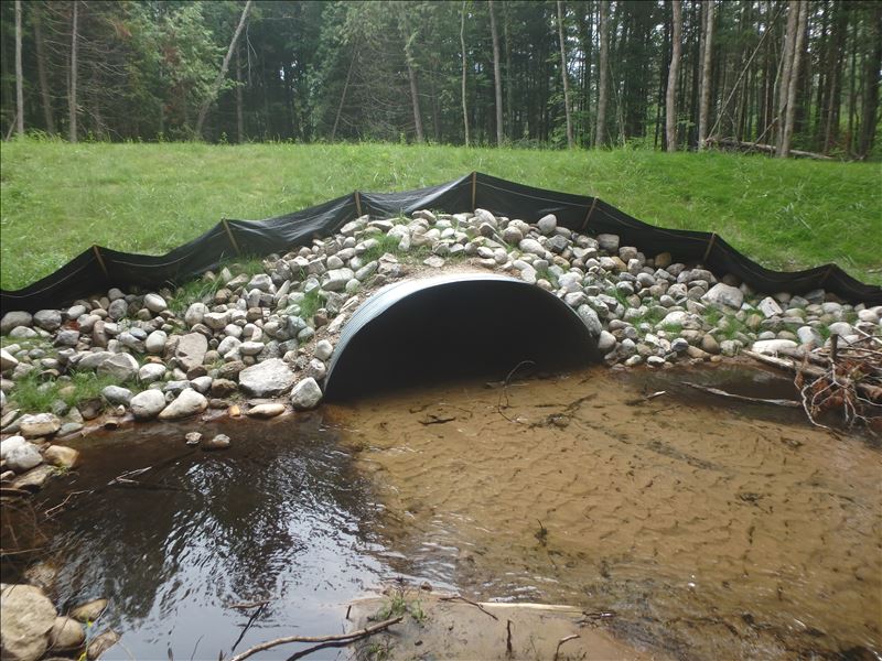
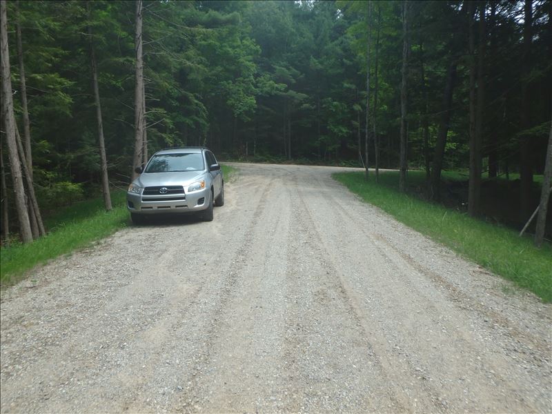
Outlet
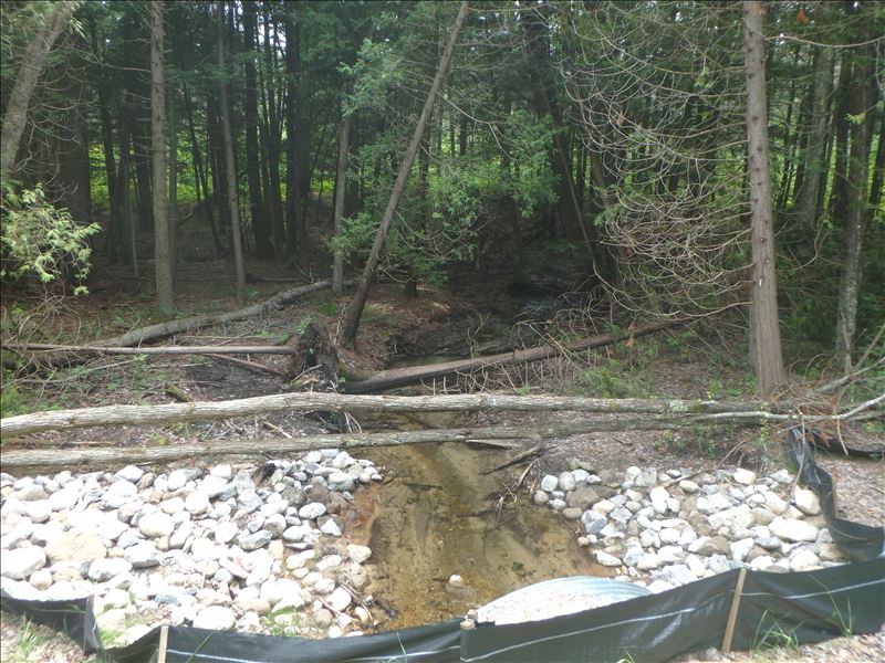
Upstream Conditions
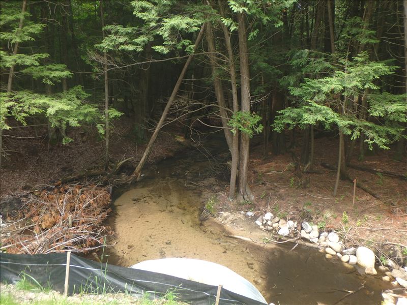
Downstream Conditions
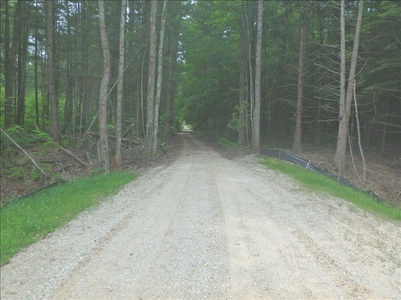
Road Approach - Left
Road Approach - Right
Crossing Information
Type of Crossing: culvert(s)
Structure Shape: Pipe Arch
Inlet Type: Projecting
Outlet Type: At Stream Grade
Structure Material: Metal
Structure Substrate: Mixture
General Conditions: New
Structure Interior: corrugated
Dimensions of Structure: Length 56 ft.
, Width 11.5 ft.
, Height 6 ft.
Structure is NOT Perched
Structure Inlet
Water Depth: 0.5 ft.
Embedded Depth of Structure: 2.2 ft.
Water Velocity*: 1 ft./sec.
Structure Outlet
Water Depth: 0.5 ft.
Embedded Depth of Structure: 1.7 ft.
Water Velocity*: 1 ft./sec.
*Water Velocities were measured 0.3 ft. below Surface
(with Meter)
Additional Comments
single culvert
Stream Information
Stream Flow: Less than 1/2 Bankfull
Riffle Information
Water Depth: 0.4 ft.
Bankfull Width: 13.6 ft.
Wetted Width: 12.7 ft.
Water Velocity: 1 ft./sec.
(Measured with Meter)
Dominant Substrate: Sand
Road Information
Gravel
County Road
Road Condition: Fair
Road Width at Culvert: 18 ft.
Location of Low Point: Other
Runoff Path: Ditch
Embankments
Upstream
Fill Depth: 5.2 ft.
Slope: More than 1:2
Downstream
Fill Depth: 6.2 ft.
Slope: 1:2
Approaches
Left Approach
Length: 50 ft.
Slope: Less Than 1%
Vegetation: Heavy
LS Factor: 0.05
Erosion: 0.0124 tons/year
Right Approach
Length: 150 ft.
Slope: 1% to 5%
Vegetation: Heavy
LS Factor: 0.4
Erosion: 0.2975 tons/year
Erosion Information
Total Erosion at Crossing: 0.3099 tons/year
Extent of Erosion: Stabilized
Summary Information
These non-native species were observerd at this site: Queen Anne's Lace
�