Road Stream Crossing Site CHAR_MA03
Lake Charlevoix Watershed, Loeb Creek
M-66
Marion Twp,
Charlevoix County
Information collected by:
Site Location
GPS Coordinates: 45.27994
, -85.23236
T33N
R08W
Sec 1
Owned by Private
Fish Passability 0.9
Structure is NOT Perched
Total Erosion: 2.5972 tons/year
Severity: Moderate
Year Inventoried: 2011
Site ID
Site ID
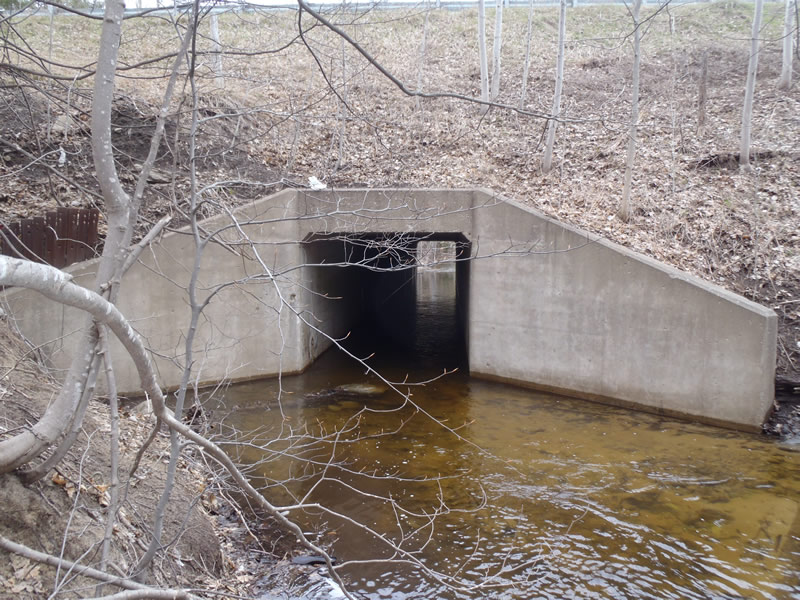
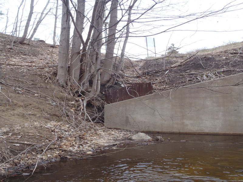
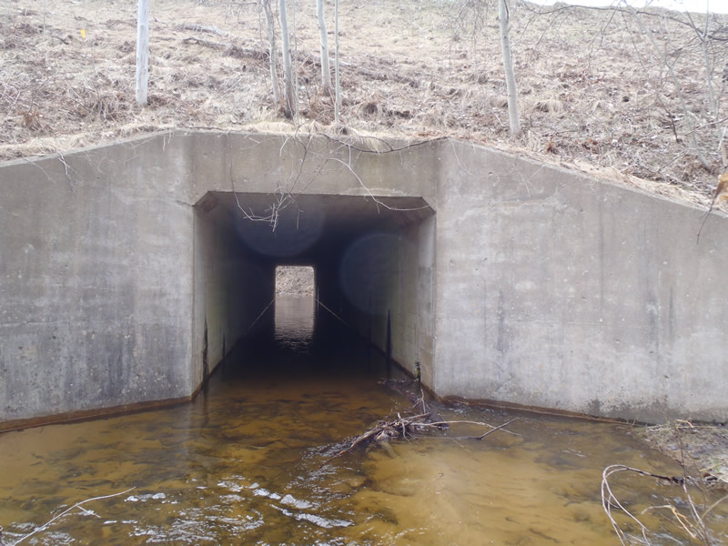
Inlet
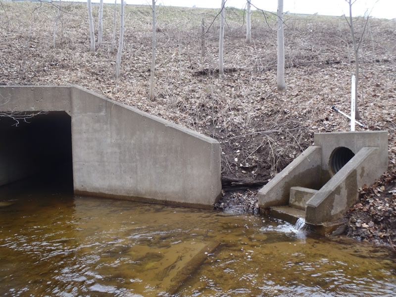
Outlet
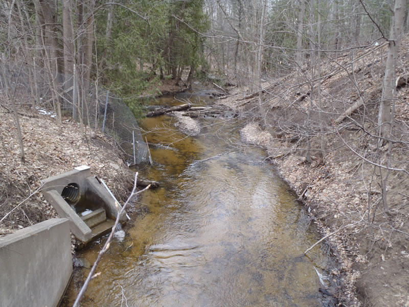
Upstream Conditions
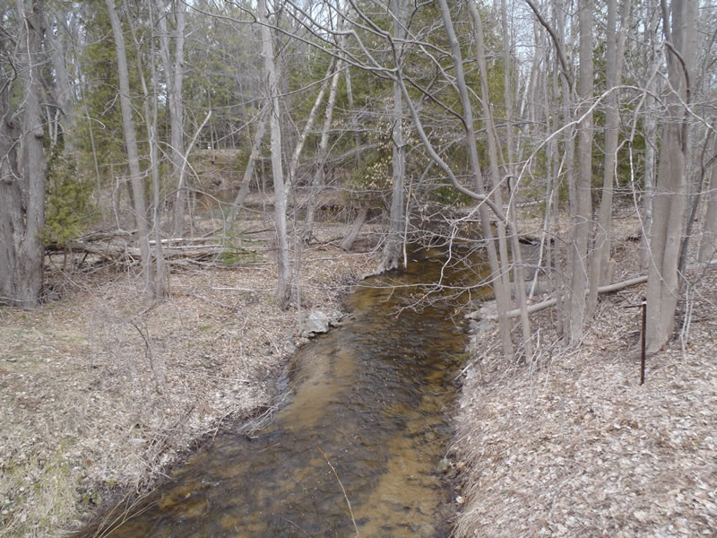
Downstream Conditions
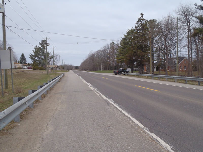
Road Approach - Left

Road Approach - Right
Crossing Information
Type of Crossing: culvert(s)
Number of Structures: 1
Structure Shape: Square/Rectangle
Inlet Type: Wingwall 30-70 Degree
Outlet Type: At Stream Grade
Structure Material: Concrete
Structure Substrate: Sand
General Conditions: Good
Structure Interior: smooth
Dimensions of Structure: Length 100 ft.
, Width 8 ft.
, Height 8 ft.
Structure is NOT Perched
Structure Inlet
Water Depth: 1.44 ft.
Embedded Depth of Structure: 0 ft.
Water Velocity*: 1.4 ft./sec.
Structure Outlet
Water Depth: 1.05 ft.
Embedded Depth of Structure: 0 ft.
Water Velocity*: 1.7 ft./sec.
*Water Velocities were measured 0.6 ft. below Surface
(with Meter)
Stream Information
Stream Flow: Less than Bankfull
Riffle Information
Water Depth: 1.1 ft.
Bankfull Width: 23 ft.
Wetted Width: 19 ft.
Water Velocity: 1.9 ft./sec.
(Measured with Meter)
Dominant Substrate: Gravel
Road Information
Paved
State Road
Road Condition: Good
Road Width at Culvert: 42 ft.
Location of Low Point: At Stream
Runoff Path: Ditch
Embankments
Upstream
Fill Depth: 17 ft.
Slope: 1:1
Downstream
Fill Depth: 17 ft.
Slope: 1:1
Approaches
Left Approach
Length: 405 ft.
Slope: Less Than 1%
Vegetation: Partial
LS Factor: 0.05
Erosion: 0.0283 tons/year
Right Approach
Length: 1000 ft.
Slope: 1% to 5%
Vegetation: Partial
LS Factor: 0.8
Erosion: 1.1107 tons/year
Erosion Information
Total Erosion at Crossing: 2.5972 tons/year
Extent of Erosion: Moderate
Notes: Vegetation could help to stabilze banks
Location of Erosion | Erosion Dimensions | Eroded Material | Material Eroded | Total Erosion | ||
facing downstream | Length | Width | Depth | Reaching Stream? | (tons/year) | |
Left Upstream Ditch |
69 ft. |
4 ft. |
3 ft. |
yes |
Sandy Loam |
1.391 |
Left Upstream Streambank |
10 ft. |
132 ft. |
1 ft. |
yes |
Sandy Loam |
0.0672 |
Summary Information
Fish Passability 0.9
Erosion is an area of concern for this site.
Erosion includes gully erosion
�