Road Stream Crossing Site CHAR_MA04
Lake Charlevoix Watershed, Loeb Creek
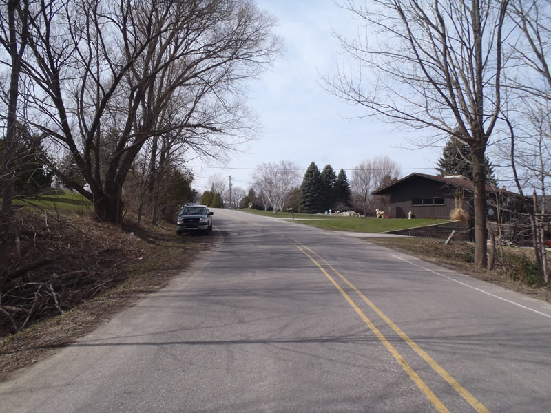
Novontny Rd
Marion Twp,
Charlevoix County
Information collected by:
Site Location
GPS Coordinates: 45.27251
, -85.24954
T33N
R08W
Sec 11
Owned by Private
Perch Height: 0.9 ft.
Total Erosion: 1.2766 tons/year
Severity: Moderate
Year Inventoried: 2011
Site ID
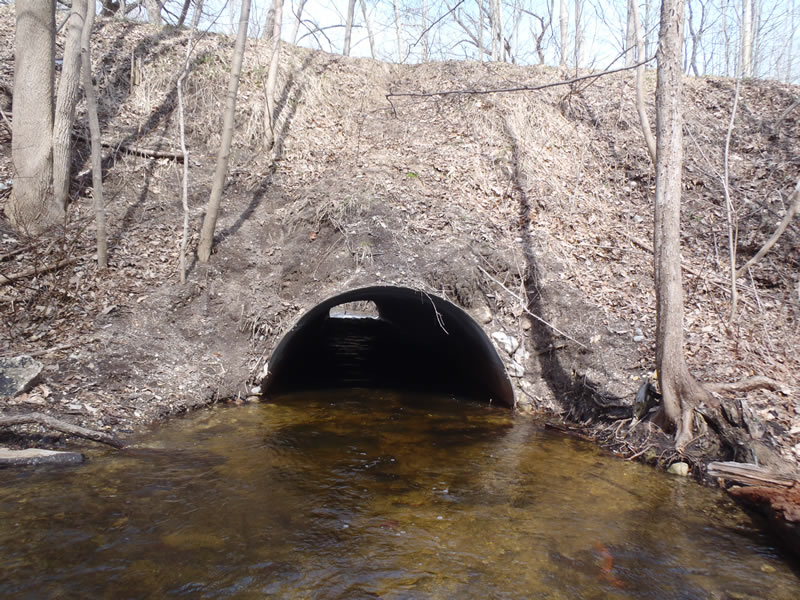
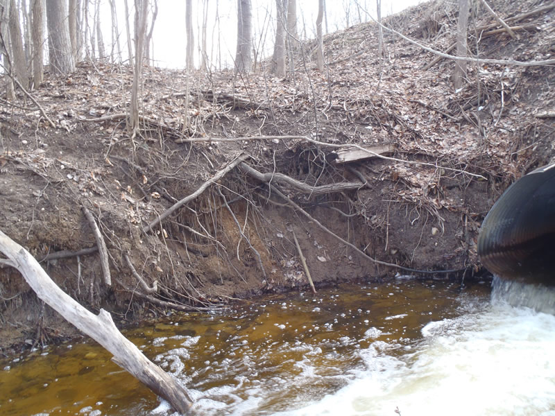
Inlet
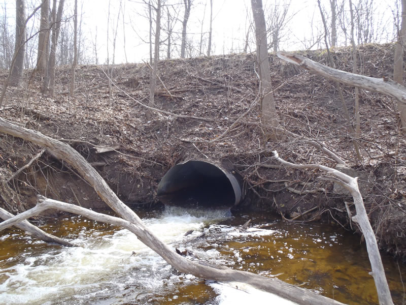
Outlet
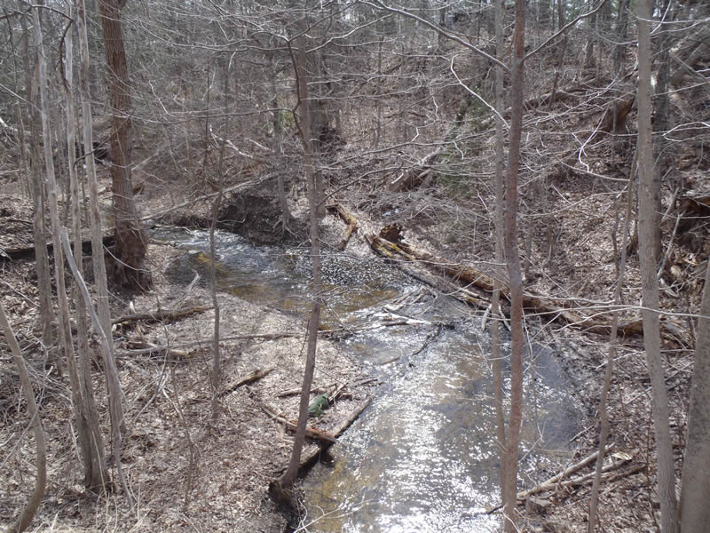
Upstream Conditions
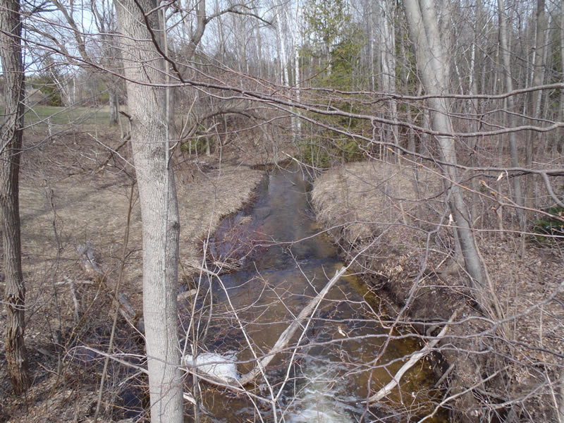
Downstream Conditions
Road Approach - Left
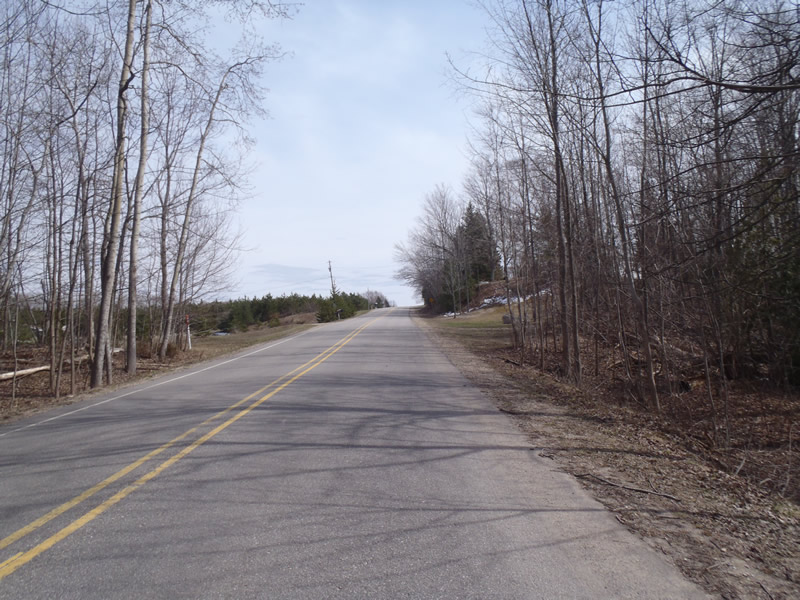
Road Approach - Right
Crossing Information
Type of Crossing: culvert(s)
Number of Structures: 1
Structure Shape: Pipe Arch
Inlet Type: Projecting
Outlet Type: Freefall into Pool
Structure Material: Metal
Structure Substrate: None
General Conditions: Fair
Structure Interior: corrugated
Dimensions of Structure: Length 90 ft.
, Width 5.8 ft.
, Height 3.8 ft.
Perch Height: 0.9 ft.
Structure Inlet
Water Depth: 0.95 ft.
Embedded Depth of Structure: 0 ft.
Water Velocity*: 2 ft./sec.
Structure Outlet
Water Depth: 0.4 ft.
Embedded Depth of Structure: 0 ft.
Water Velocity*: 6.6 ft./sec.
*Water Velocities were measured 0.3 ft. below Surface
(with Meter)
Stream Information
Stream Flow: Less than Bankfull
Scour Pool: Length 15 ft.
, Width 15 ft.
, Depth 2.5 ft.
Riffle Information
Water Depth: 0.75 ft.
Bankfull Width: 11.5 ft.
Wetted Width: 10.5 ft.
Water Velocity: 2.2 ft./sec.
(Measured with Meter)
Dominant Substrate: Gravel
Road Information
Paved
County Road
Road Condition: Good
Road Width at Culvert: 26 ft.
Location of Low Point: At Stream
Runoff Path: Ditch
Embankments
Upstream
Fill Depth: 11 ft.
Slope: Vertical
Downstream
Fill Depth: 11 ft.
Slope: Vertical
Approaches
Left Approach
Length: 429 ft.
Slope: 1% to 5%
Vegetation: Heavy
LS Factor: 0.486
Erosion: 0.1791 tons/year
Right Approach
Length: 690 ft.
Slope: 6% to 10%
Vegetation: Heavy
LS Factor: 1.817
Erosion: 1.0773 tons/year
Erosion Information
Total Erosion at Crossing: 1.2766 tons/year
Extent of Erosion: Moderate
Notes: Embankments and Streambanks need Vegetation and perched culvert has resulted in a scour pool
Location of Erosion | Erosion Dimensions | Eroded Material | Material Eroded | Total Erosion | ||
facing downstream | Length | Width | Depth | Reaching Stream? | (tons/year) | |
Right Downstream Streambank |
3 ft. |
25 ft. |
1 ft. |
yes |
Sandy Loam |
0.0202 |
Summary Information
Fish Passage is an area of concern for this site.
Perched and high velocities. Erosion is also a concern
�