Road Stream Crossing Site BEAR_BC097
Bear Creek Watershed, Tributary of Bear Creek
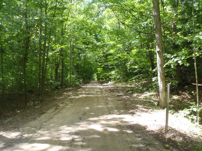
Griffin Rd
Brown Twp,
Manistee County
Information collected by:
Site Location
GPS Coordinates: 44.29829
, -86.06346
T22N
R15W
Sec 13
Owned by Private
Perch Height: 3 ft.
Total Erosion: 18.9614 tons/year
Severity: Severe
Year Inventoried: 2011
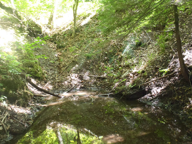
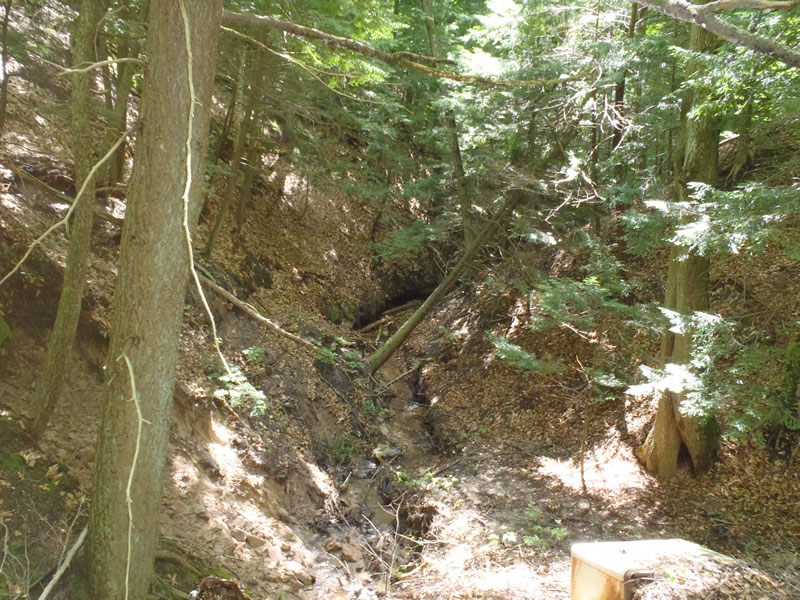
Inlet
Outlet
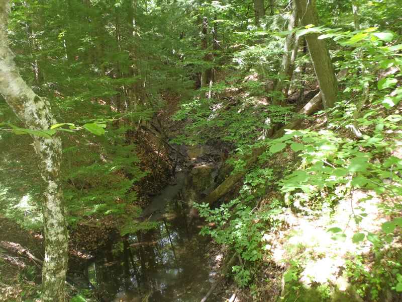
Upstream Conditions
Downstream Conditions
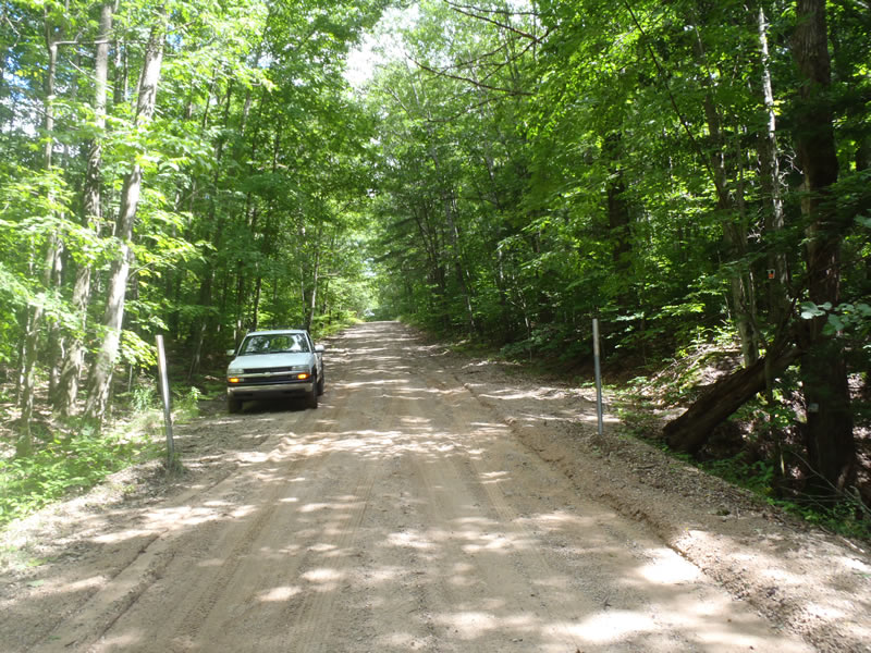
Road Approach - Left
Road Approach - Right
Crossing Information
Type of Crossing: culvert(s)
Number of Structures: 1
Structure Shape: Round
Inlet Type: Other
Outlet Type: Freefall into Pool
Structure Material: Metal
Structure Substrate: None
General Conditions: Poor
Structure Interior: corrugated
Structure is Rusted through
Dimensions of Structure: Length 70 ft.
, Width 3 ft.
, Height 3 ft.
Percentage Plugged:
Inlet: 76% to 100%
Outlet: 0%
In Pipe: 0%
Perch Height: 3 ft.
Structure Inlet
Water Depth: 0.6 ft.
Embedded Depth of Structure: 3 ft.
Water Velocity*: 0.1 ft./sec.
Structure Outlet
Water Depth: 0.1 ft.
Embedded Depth of Structure: 0 ft.
Water Velocity*: 3 ft./sec.
*Water Velocities were measured at the Surface
(with Meter)
Additional Comments
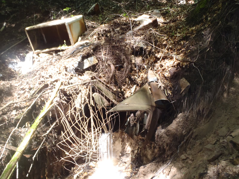
1) The exact inlet location could not be determined due to the amount of material deposited by embankment erosion 2) the downstream embankment is an old dump (scrap metal, appliances, etc) 3) Culvert dimensions are estimated because the inlet was buried and the outlet could not be reached safely with dumped materials present.
Stream Information
Stream Flow: Less than 1/2 Bankfull
Scour Pool: Length 5 ft.
, Width 3.5 ft.
, Depth 1.05 ft.
Upstream Pond: Length 25 ft.
, Width 12 ft.
, Depth 1 ft.
Riffle Information
Water Depth: 0.15 ft.
Bankfull Width: 6.3 ft.
Wetted Width: 3.1 ft.
Water Velocity: 1.4 ft./sec.
(Measured with Meter)
Dominant Substrate: Gravel
Road Information
Gravel
County Road
Road Condition: Poor
Road Width at Culvert: 17 ft.
Location of Low Point: At Stream
Runoff Path: Roadway
Embankments
Upstream
Fill Depth: 25 ft.
Slope: Vertical
Downstream
Fill Depth: 25 ft.
Slope: Vertical
Approaches
Left Approach
Length: 450 ft.
Slope: 1% to 5%
Vegetation: Partial
LS Factor: 2.219
Erosion: 5.051 tons/year
Right Approach
Length: 620 ft.
Slope: 1% to 5%
Vegetation: Partial
LS Factor: 2.772
Erosion: 9.9715 tons/year
Erosion Information
Total Erosion at Crossing: 18.9614 tons/year
Extent of Erosion: Very Severe
Erosion is occurring and corrective actions can be installed to address the problem.
Notes:
All stream-banks and embankments are eroding and road runoff is reaching stream. Left Downstream stream-bank erosion is a pure sand deposit with clumps of clay. It is highly erodible. The slightest disturbance created an extensive amount of erosion that directly reaches stream.
Location of Erosion | Erosion Dimensions | Eroded Material | Material Eroded | Total Erosion | ||
facing downstream | Length | Width | Depth | Reaching Stream? | (tons/year) | |
Left Upstream Streambank |
8 ft. |
12 ft. |
2 ft. |
yes |
Sandy Loam |
0.384 |
Right Upstream Streambank |
30 ft. |
4 ft. |
1.5 ft. |
yes |
Sandy Loam |
1.08 |
Left Downstream Streambank |
30 ft. |
20 ft. |
3 ft. |
yes |
Sand |
2.475 |
Summary Information
Erosion is an area of concern for this site.
Very severe erosion on all banks.
A future visit to this site is recommended.
Further assess the erosion.
�