Road Stream Crossing Site BEAR_BC059
Bear Creek Watershed, Tributary of Big Bear Creek
Milks Rd
Maple Grove Twp,
Manistee County
Information collected by:
Site Location
GPS Coordinates: 44.35616
, -86.04631
T23N
R14W
Sec 30
Owned by Private
Perch Height: 0.2 ft.
Total Erosion: 0.2494 tons/year
Severity: Severe
Year Inventoried: 2011
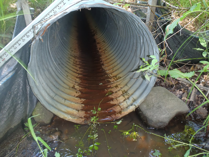
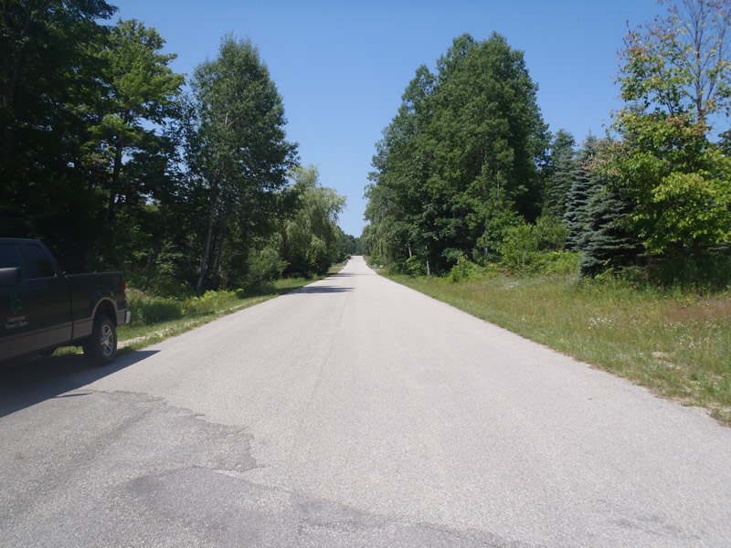
Inlet
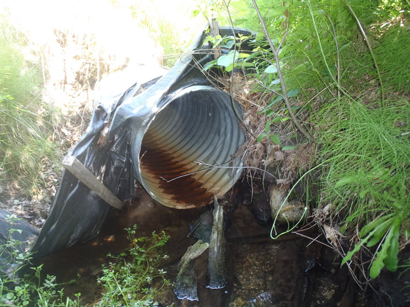
Outlet
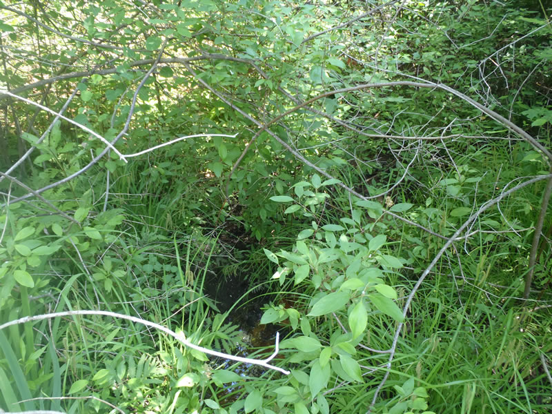
Upstream Conditions
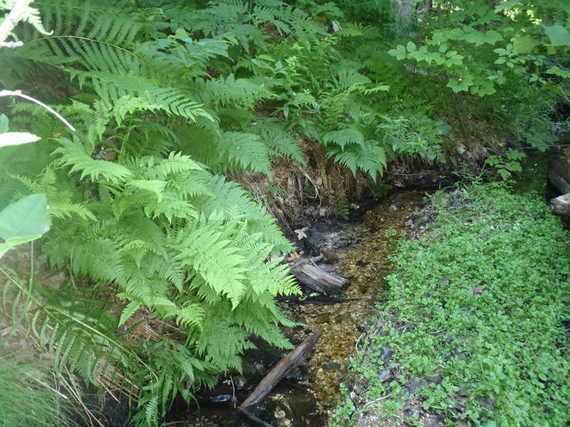
Downstream Conditions
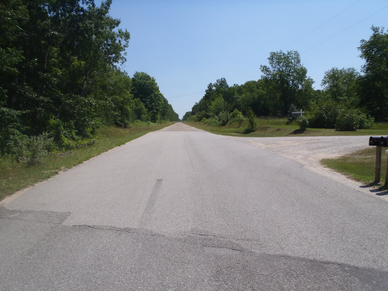
Road Approach - Left
Road Approach - Right
Crossing Information
Type of Crossing: culvert(s)
Number of Structures: 1
Structure Shape: Round
Inlet Type: Projecting
Outlet Type: Freefall into Pool
Structure Material: Metal
Structure Substrate: None
General Conditions: Good
Structure Interior: corrugated
Dimensions of Structure: Length 60 ft.
, Width 2 ft.
, Height 2 ft.
Perch Height: 0.2 ft.
Water Depth: 0 ft.
Embedded Depth of Structure: 0 ft.
Water Velocity*: 0 ft./sec.
Water Depth: 0 ft.
Embedded Depth of Structure: 0 ft.
Water Velocity*: 0 ft./sec.
*Water Velocities were measured at the Surface
(with Meter)
Additional Comments
1) The left approach is paved for the first 150 ft followed by gravel for the remaining approach 2) Intermittent stream that was not actively flowing at time of data collection but some water was still draining downstream. 3) Riffle information taken 25 ft downstream.
Stream Information
Stream Flow: Less than 1/2 Bankfull
Riffle Information
Water Depth: 0.04 ft.
Bankfull Width: 4 ft.
Wetted Width: 1.3 ft.
Water Velocity: 0.05 ft./sec.
(Measured with Meter)
Dominant Substrate: Gravel
Road Information
Paved
County Road
Road Condition: Fair
Road Width at Culvert: 30 ft.
Location of Low Point: Other
Runoff Path: Ditch
Embankments
Upstream
Fill Depth: 5.5 ft.
Slope: 1:1.5
Downstream
Fill Depth: 9 ft.
Slope: Vertical
Approaches
Left Approach
Length: 1000 ft.
Slope: Less Than 1%
Vegetation: Heavy
LS Factor: 0.05
Erosion: 0.0496 tons/year
Right Approach
Length: 100 ft.
Slope: Less Than 1%
Vegetation: Heavy
LS Factor: 0.05
Erosion: 0.005 tons/year
Erosion Information
Total Erosion at Crossing: 0.2494 tons/year
Extent of Erosion: Minor
Erosion is occurring and corrective actions can be installed to address the problem.
Location of Erosion | Erosion Dimensions | Eroded Material | Material Eroded | Total Erosion | ||
facing downstream | Length | Width | Depth | Reaching Stream? | (tons/year) | |
Right Downstream Embankment |
4 ft. |
1.5 ft. |
2 ft. |
yes |
Sandy Loam |
0.0538 |
Left Downstream Embankment |
8 ft. |
2 ft. |
2 ft. |
yes |
Sandy Loam |
0.1075 |
Right Downtream Ditch |
5 ft. |
4 ft. |
1 ft. |
yes |
Sandy Loam |
0.0336 |
Summary Information
Erosion is an area of concern for this site.
These non-native species were observerd at this site: Knapweed
�