Road Stream Crossing Site C09
Carp River Watershed, Carp River
North Country Trail
Wawatam Twp,
Emmet County
Information collected by:
GPS Coordinates: 45.72918057
, -84.82665002
T39N
R04W
Sec 32
Adjacent Land Owned by State
Severity: Moderate
Cost: $0.00
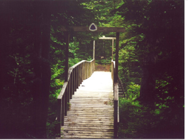
Site Location
Road Approach - Left
Crossing Information
Road Width at Culvert: 6 ft.
Road Surface: Sand
Maintenance: seasonal
Low Point: Other, either side
Existing Drainage Control? no
Any Failings? no
Type of Crossing: Bridge
Is this crossing constricted? no
Are there adjacent wetlands? yes
Comments: bridge span is adequate and banks area stable
Approaches
Left Approach
Length: 0 ft.
Slope: 0%
Vegetation: heavy
Right Approach
Length: 0 ft.
Slope: 0%
Vegetation: heavy
Culvert Information
Embankments
Upstream
Fill Depth: 0 ft.
Embankment Slope: vertical
Downstream
Fill Depth: 0 ft.
Embankment Slope: vertical
Stream Information
Upstream
Stream Width: 32 ft.
Stream Depth: 2 in.
Stream Current: slow
Stream Substrate: sand,gravel
Downstream
Stream Width: 32 ft.
Stream Depth: 2 in.
Stream Current: slow
Stream Substrate: sand,gravel
Erosion Information
Conditions
Is there Streambank erosion beside the crossing? no
Is there embankment erosion? no
Is there erosion at the culvert outlet? no
Is there erosion at the shoulder and/or ditch? no
Is there pooling at the outlet? no
Is there sand over the crossing? no
Other Conditions: none
Extent of Erosion: minor
Recommended Treatments
Action Recommended? yes
Add pavement? no
Add paved raised edge? no
Number of erosion control structures: 0
Number of sediment basins: 0
Number of diversion outlets: 0
Increase fill? no
Replace culvert(s)? no
Dimensions of replacement: 0
Extend culvert(s)? no
Lineal feet to extend: 0
Other Treatments: little impact from trail
Severity:Moderate
This page last updated on 2/9/2022.
�