Road Stream Crossing Site S435A
Boardman River Watershed, Kingsley Creek
Blair St
Crossing: Blair Street / Kingsley Creek
Paradise Twp,
Grand Traverse County
Information collected by:
GPS Coordinates: 44.58372
, -85.53909
T25N
R10W
Sec 8
Adjacent Land Owned by Private
Severity: Severe
Site Location
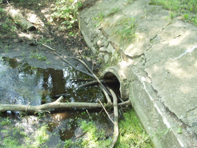
Inlet
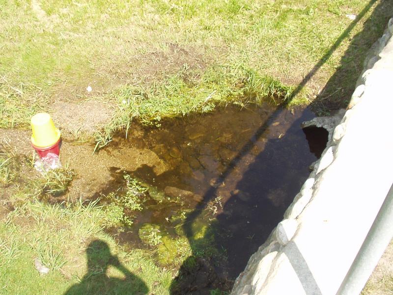
Outlet
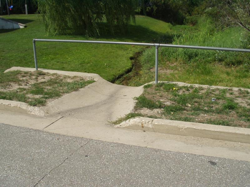
Road Approach - Left
Road Approach - Right
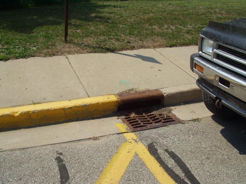
Crossing Information
Road Surface: Paved
Maintenance: year around
Existing Drainage Control? yes
Any Failings? yes
Type of Crossing: culvert(s)
(single culvert)
Is this crossing constricted? no
Are there adjacent wetlands? yes
Approaches
Left Approach
Slope: 0%
Vegetation: partial
Right Approach
Slope: 0%
Vegetation: partial
Culvert Information
Shape: round
Diameter: 2 ft diameter ft.
Material: concrete
Condition :fair
Flow: clear
Embankments
Upstream
Embankment Slope: >2:1 slope
Downstream
Embankment Slope: vertical
Stream Information
Upstream
Stream Width: 2 ft.
Stream Depth: 2 in.
Stream Current: slow
Stream Substrate: muck
Downstream
Stream Width: 2 ft.
Stream Depth: 2 in.
Stream Current: slow
Stream Substrate: sand,gravel
Erosion Information
Conditions
Is there Streambank erosion beside the crossing? yes
Is there embankment erosion? no
Is there erosion at the culvert outlet? yes
Is there erosion at the shoulder and/or ditch? no
Is there pooling at the outlet? yes
Is there sand over the crossing? no
Extent of Erosion: severe
Cause of Erosion: stormwater
Recommended Treatments
Action Recommended? yes
Add pavement? no
Add paved raised edge? no
Increase fill? no
Replace culvert(s)? no
Extend culvert(s)? no
Comments: Inlet embankment is concrete.
Stormwater from Blair Street pours into the creek from diversion outlet directly above culvert outlet. A pool is forming at the outlet because of the falling stormwater.
Stormwater from Elm Street pours out of
Stormwater from Blair Street pours into the creek from diversion outlet directly above culvert outlet. A pool is forming at the outlet because of the falling stormwater.
Stormwater from Elm Street pours out of
Severity:Severe
This page last updated on 2/9/2022.
�