Road Stream Crossing Site S886
Boardman River Watershed, Robbin's Creek
Private Trail
Garfield Twp,
Grand Traverse County
Information collected by:
GPS Coordinates: 44.69955
, -85.63285
T27N
R11W
Sec 34
Adjacent Land Owned by Private
Perch Height: 0.5 ft.
Severity: Severe
Site Location
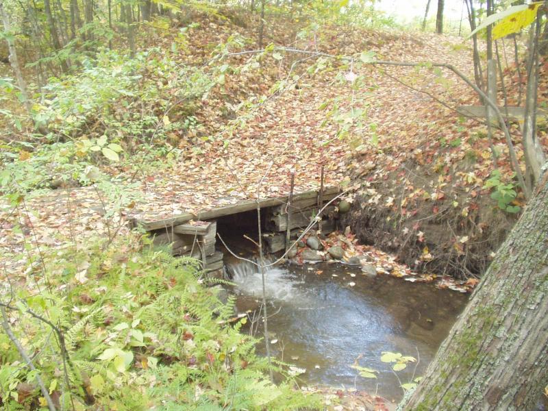
Inlet
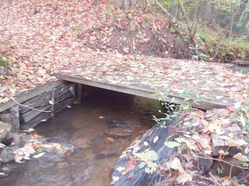
Outlet
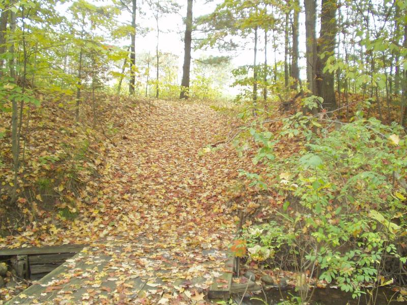
Road Approach - Left
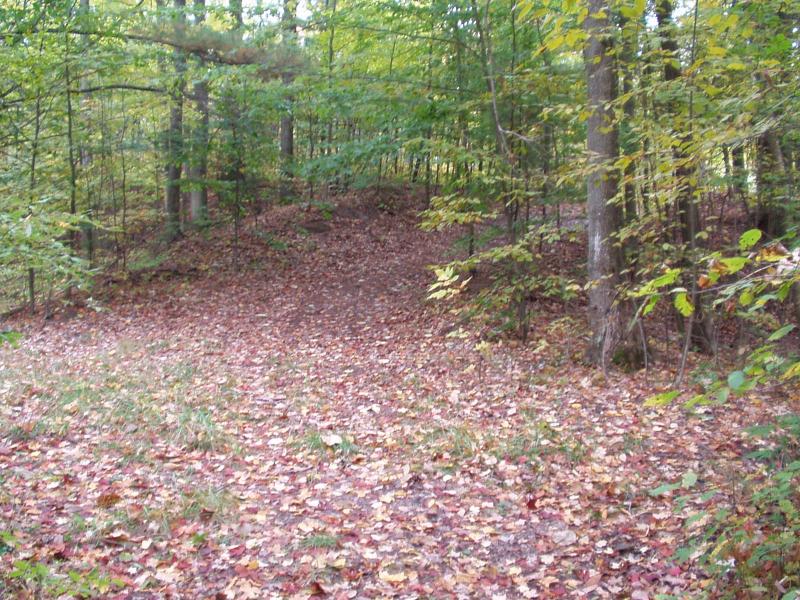
Road Approach - Right
Crossing Information
Road Width at Culvert: 6 ft.
Road Surface: Sand
Maintenance: seasonal
Low Point: At Stream
Existing Drainage Control? no
Any Failings? no
Type of Crossing: Bridge
Is this crossing constricted? yes
Are there adjacent wetlands? yes
Approaches
Left Approach
Slope: >10%
Vegetation: partial
Right Approach
Slope: 6-10%
Vegetation: partial
Culvert Information
Length: 6 ft.
Diameter: 6 ft wide, 2.5 ft tall ft.
Material: timber
Condition :fair
Flow: fish passage problem
Perch Height: 0.5 ft.
Embankments
Upstream
Embankment Slope: vertical
Downstream
Embankment Slope: vertical
Stream Information
Upstream
Stream Width: 5 ft.
Stream Depth: 6 in.
Stream Current: moderate
Stream Substrate: sand,gravel
Downstream
Stream Width: 10 ft.
Stream Depth: 24 in.
Stream Current: slow
Stream Substrate: sand,gravel
Erosion Information
Conditions
Is there Streambank erosion beside the crossing? yes
Is there embankment erosion? no
Is there erosion at the culvert outlet? no
Is there erosion at the shoulder and/or ditch? no
Is there pooling at the outlet? yes
Is there sand over the crossing? no
Extent of Erosion: severe
Cause of Erosion: dam / bridge structure
Recommended Treatments
Action Recommended? yes
Add pavement? no
Add paved raised edge? no
Increase fill? no
Replace culvert(s)? no
Extend culvert(s)? no
Other Treatments: See comments...
Comments: Railroad tie dam at outlet causes flooding and blocks fish passage.
Structure should be entirely removed unless the landowner wishes to keep it. In that case, the dam should come out and the bridge should be rebuilt.
Structure should be entirely removed unless the landowner wishes to keep it. In that case, the dam should come out and the bridge should be rebuilt.
Severity:Severe
This page last updated on 2/9/2022.
�