Stream Bank Erosion Site BGMN-085
Total Severity: Moderate
Total Points: 32
Information collected by:
Big Manistee River Watershed,
Dickson Twp,
Manistee County
GPS Coordinates: 44.30687
, -85.85094
T22N
R13W
Sec 14
Owned by Federal
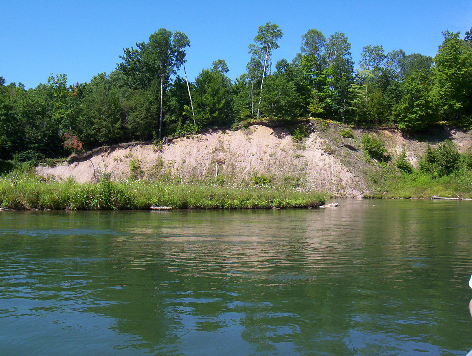
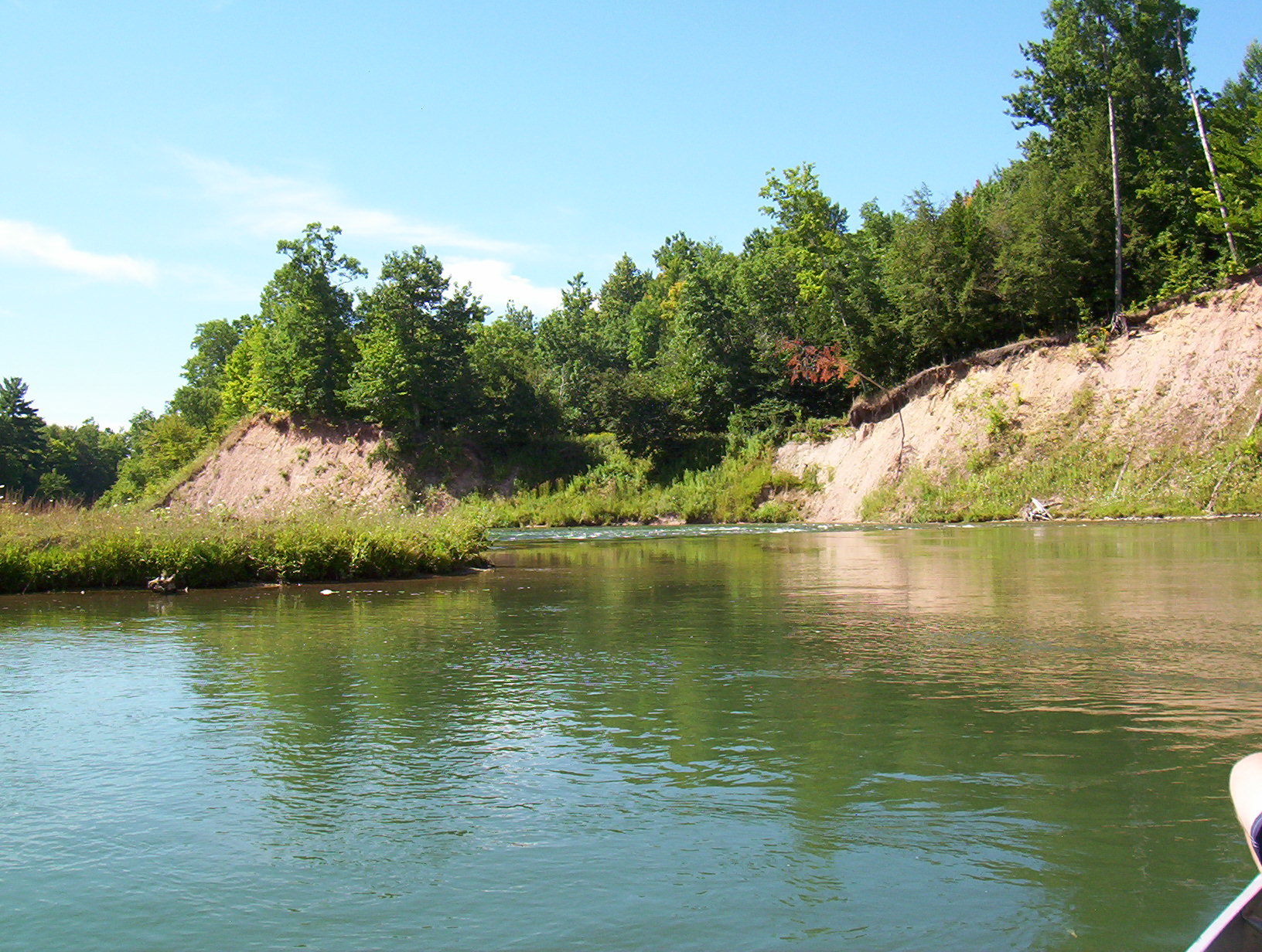
Bank Details
Which Bank? Right
Bank Aspect:E
Condition:Toe is stable; upper bank eroding
Erosion Trend:Increasing
Percent Veg. Cover: 10-50%
Bank Conditions
Stream Width:90 ft.
Stream Depth:3 ft.
Stream Current:Fast
Eroded Bank Length:280 ft.
Eroded Bank Height:50 ft.
Slope of Eroded Bank:3:1
Texture: Stratified
Cause(s) of Erosion
-Bend in river
-Bank seepage
Recommended Treatment(s)
-Bank revegetation
-Rock riprap
-Tree revetments
General Information
Total Points
32
�