Stream Bank Erosion Site MR-01
Total Severity: Moderate
Total Points: 34
Information collected by:
Maple River Watershed,
Maple River Twp,
Emmet County
GPS Coordinates: 45.52487
, -84.77395
T36N
R4W
Sec 10
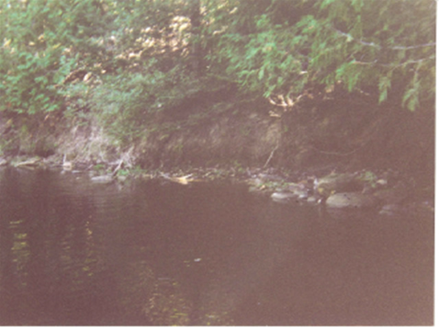
Bank Details
Which Bank? Right
Bank Aspect:N
Condition:Both toe and upper bank eroding
Erosion Trend:Increasing
Percent Veg. Cover: 50-100%
Bank Conditions
Stream Width:25 ft.
Stream Depth:1 ft.
Stream Current:Slow
Eroded Bank Length:70 ft.
Eroded Bank Height:12 ft.
Slope of Eroded Bank:1:1
Texture: Sand
Cause(s) of Erosion
-Bend in river
Other causes: steep embankment, deep hole
Recommended Treatment(s)
-Tree revetments
Other Treatments:or wait
General Information
cedar swamp downstream brown cabin and shed with orange roof but opposite side.
Total Points
34
�