Stream Bank Erosion Site MR-03
Total Severity: Moderate
Total Points: 30
Information collected by:
Maple River Watershed,
Maple River Twp,
Emmet County
GPS Coordinates: 45.51309
, -84.76587
T36N
R4W
Sec 14
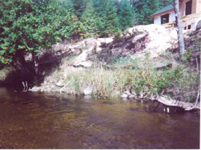
Bank Details
Which Bank? Left
Bank Aspect:SW
Condition:Toe is stable; upper bank eroding
Erosion Trend:Increasing
Percent Veg. Cover: 10-50%
Bank Conditions
Stream Width:20 ft.
Stream Depth:2 ft.
Stream Current:Fast
Eroded Bank Length:80 ft.
Eroded Bank Height:20 ft.
Slope of Eroded Bank:2:1
Texture: Sand
Cause(s) of Erosion
Other causes: development, excavation
Recommended Treatment(s)
-Bank revegetation
Other Treatments:revegetation on eupper slope or log terracing
General Information
large home
Total Points
30
�