Stream Bank Erosion Site MR-10
Total Severity: Minor
Total Points: 26
Information collected by:
Maple River Watershed,
Maple River Twp,
Emmet County
GPS Coordinates: 45.53954
, -84.78656
T36N
R4W
Sec 3
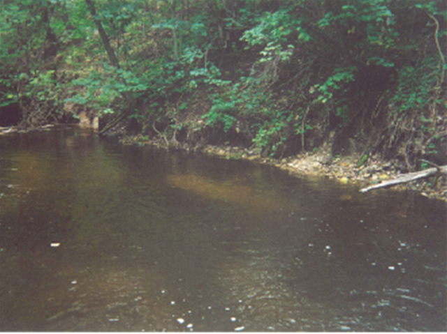
Bank Details
Which Bank? Right
Bank Aspect:XXX
Condition:Toe is undercutting
Erosion Trend:Increasing
Percent Veg. Cover: 50-100%
Bank Conditions
Stream Width:24 ft.
Stream Depth:1 ft.
Stream Current:Slow
Eroded Bank Length:100 ft.
Eroded Bank Height:4 ft.
Slope of Eroded Bank:1:1
Texture: Sand
Cause(s) of Erosion
-Bank seepage
Other causes: steep bank
Recommended Treatment(s)
-Tree revetments
Other Treatments:woody debris project
General Information
big cedar on left bank just after bebd, aspen upland on right
Total Points
26
�