Stream Bank Erosion Site MR-11
Total Severity: Moderate
Total Points: 33
Information collected by:
Maple River Watershed,
Maple River Twp,
Emmet County
GPS Coordinates: 45.54536
, -84.75396
T36N
R4W
Sec 2
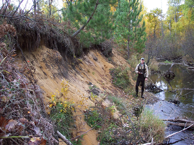
Bank Details
Which Bank? Left
Bank Aspect:NW
Condition:Both toe and upper bank eroding
Erosion Trend:Increasing
Percent Veg. Cover: 10-50%
Bank Conditions
Stream Width:15 ft.
Stream Depth:1 ft.
Stream Current:Slow
Eroded Bank Length:50 ft.
Eroded Bank Height:15 ft.
Slope of Eroded Bank:1:1
Texture: Sand
Cause(s) of Erosion
-Bend in river
Other causes: steep slope
Recommended Treatment(s)
-Bank revegetation
-Tree revetments
Other Treatments:log terracing
General Information
small 25 ft. white pines among aspen on top of bank
Total Points
33
�